


Deneye
-
Posts
164 -
Joined
-
Last visited
Posts posted by Deneye
-
-
I went with a set of Dayton Timberline MT's. So far, they have been great. We drove the Myra trail from Porters Lake to the airport without any trouble whatsoever (except for the branch that poked through the soft top, hence the duct tape
 ). Thanks for all the suggestions!
 Hey Missinnova...... you gotta lose those girly bumper ends! Example attached:
Do not judge lest ye be judged....All Jeeps are girly until they've been lifted. [
] -
ProComp MTs for me. They can take the abuse and keep on rolling. I prefer them over the BFGs because they have the lug siping.
Clicky Thing for tire info.
-
I'll have to head up there again some day. I imagine there are a few caches along the route. Thanks for the memory flashback.

Go for it! [
]There are about half a dozen caches at the south end between the Sasquatch Inn and Grace lake with a few more along the trail all the way up to Tipella. I've been meaning to do them myself but can never seem to find the time when I am out there...maybe this weekend i'll get to make a cache-specific trip...
-
Just a heads-up for anyone interested, the West Harrison Forest Service Road that heads north from Weaver Creek all the way up to Tipella at the north end of Harrison Lake...
They are actively logging once again as far up as Trio Creek (50 km marker) with quite a bit right at the roadside around the Mystery Creek turn-off (about 36 km marker). They have installed new km markers all the way up (to 50), the road is freshly graded and can be travelled with a car.
I stopped in at Hale Creek along the way and the forest service boys have been there...the place is cleaned up, the shelter is torn down and they have installed garbage bins, picnic tables and fire rings. The road down is 4 WD only. It's quite washed out and ripped up from the norm but with the work they've down down at the beach I'm sure they'll be fixing the road soonly. (or maybe not, come to think of it, since there *is* boat access here..Doh!)
West Harrison from Doctor's Point, north to Tipella is still rough in places but hasn't changed. Clear of snow and driveable. Sloquet hotsprings were as great as usual although they've started charging the camping fee earlier this year.
-
try switching the units over to metric and projecting in metres...
1 m = 3.281'
hth
-
Have him stick it to the side of the space station and then folks down here can photograph the station as it passes by. They then get to log it for "the farthest & fastest travelling geocoin ever!"
[
 ]
] -
The mothership of cache-mobiles..
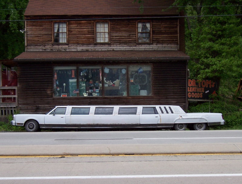
Man, is it me, or is that thing sagging in the middle?...lol
Nawww...It's the picture. The car is so long, you see, that they had to consider the curvature of the earth. So what you see in the photo is some Great Circle math being used to flatten out the horizon causing the car to appear warped...
(yeah, ok, so i'm a couple months behind....so what?
 )
) -
If you open a .gpx file in any text editing program, you will see exactly what you are getting....
-
yep. caused Safari to die on me when i clicked the black hole link...
-
Leave the DNF Log, it's part of your history. It can also be fun to go back once in a while to read those old DNF logs and wonder how you could have missed the cache.
You don't need to read your DNF log to experience those thoughts...
But I'd leave them in too..
-
I know the one's you're talking about. I didn't get to find them the last time I was there..Maybe it'll make a good campfire story

If we find them, are you interested in placing a cache nearby? I have a camo-painted 5-gallon pail kicking around with a few camping-themed goodies inside which I had planned on putting somewhere up by sunrise lake but instead could be planted up by the glyphs instead. (that is to say, if you already planned and created a cache, no problem, but the pail is still available
 )
) -
Barring a broken truck, I'll be there. Unfortunately my wife won't be able to make it but i'll have my 8 yr old boy with me and one of his friends.
Then there will be a muggle friend with his dog and probably a pasenger.
I figure we can be on the beach at 20 mile by about 1530-ish. Apparently friday is PD day at school which means we'll be able to leave earlier than first thought.
Saturday will see another vehicle arrive/catch-up with 2 bodies (half muggles) and a small dog with a possible second in behind. By the sound of it they'll be catching up somewhere around doctor's point.
Is there a waypoint for the petroglyphs handy that I could pass on to him?
I don't recall anymore what the trip is like up to Pemberton and back around through Whistler but i'm thinking it would probably be easier/faster to come back sunday that way, no? Seeing as how we're that far up the lake anyway...and hitting skookum too...otherwise it'd probably be 6+ hours coming back the way we went in...
Also, somewhere around 55km up Harrison west a bridge was washed out...just past Doctor's point...Bremerton creek i think. This was about a year ago now. Although there was a goat trail heading down towards the lake, i never gave it a try, but i've heard that you can use it to cross the creek and get back up to the road on the other side....Not sure if you know anything different or not but it'll be worth the trip just to get past that one

Depending on our timing, we may or may not stop at wood lake and/or hale creek.
Looking forward to this trip suddenly.
-
Any idea what time on saturday you might be leaving 20 mile bay and heading up to sloquet?
Before noon or is everyone the sleep-in & slow-moving-before-noon type?

I'm working on getting 3 more vehicles involved....
-
You'd probably have better luck downloading Internet.ZIP ....

-
Is there any way to get rid of all the pictures that are reposts? The quotations that duplicated pictures are making this thread three times more cumbersome than it has to be. At least in the future, not reposting pictures might help. I love this thread!!
Yep..just need to teach people how to edit their replies before posting...(IOW, delete the image tags)
-
Awesome!
That means you'll have camp all set up and dinner on the go by the time I arrive!

(I may or may not catch up with you at 20 mile bay....but i'll try)
-
Are you really leaving at midnight or is that supposed to mean noon on friday?
-
heh heh...all 3 replies at pretty much the same time with sodajerk coming in fastest...
-
MacGPS Pro is a great piece of software. It'll transfer waypoints and tracks between the unit and your Mac and can also use anything for a map with a little work (scans of restaurant placemats, photos of park trail maps etc etc...)
Depending on your hardware, USB, Serial or BlueTooth will work too.
Edited to add:
and GPSBabel does a decent job and changing .gpx geocache files into address book contact entries which can then be uploaded to and view from your iPod's Contacts list. Which gives you a cheap & simple form of paperless caching...
-
One of my favorites..."You can't get there from here."
In this case though, "It can't be done".
The North American plate would have shifted by a millimetre or 2 in the time period given, thereby causing a dislocation of the physical point on Earth and the virtual point of location (lat-lon) which means that even if the device could pick up the exact same virtual spot, it would be measuring the physical one differently, with the possibility that the original physical spot hadn't of change except by moving sideways.
Plus what the others above have said
-
I see nothing flaming about the topic and there's definately no name-calling in the OP.
Color me arrogant for adding this reply if you want.

-
I can't see the altimeter being useful for geocaching per se most of the time.
Sorry for the multiple posts...
Some days it's unfortunate that geocaching uses only 2 of the 3 dimensions we live in. I recently hunted a cache that was placed on the side of a hill. Due to reflecting signals, I wasn't getting very accurate location readings which was a pain because there was nearly a 50 metre elevation change between the upper & lower limits of location on this hillside. Knowing the elevation of the cache, even with a 5 metre EPE would have helped lessen all that over-exercising I did that day

I had to buy a box of donuts in order to build up my private reserves again...
(yes, I DNF'd it)
-
Personally, I like to know my elevation only occasionally as a curiosity and nothing more, so the altimeter isn't very important to me. As a matter of fact, I consider it a hassle because it needs calibrating all the time, and it's just something more to go wrong with the GPSr. And when used in a pressurized cabin on an airliner, it'll tell you that your altitude is only 5,000 feet when the plane is really at 41,000 feet.
I find it ironic what many people (not you in particular Neo Geo, but people in general) have to say about altimeters in GPSrs while at the same time thinking how cool it is to use their unit during an air flight....
One person's trash is another's treasure...
-
Deneye, do you have the Auto-calibrate turned on? If so its actually doing re-calibrates from the GPS altitude calculations regularly. I find that my Magellan give a pretty accurate reading, with +-5m as well, despite many books saying that it will be off by as much as 50m.
Anyway, as the Summit manual says, to be truly accurate you have to do the manual calibrate using very well known altitudes and pressures. I think that's likely one of those disclaimers so that people can't sue when the altitude is incorrectly calculated as it sometimes will be.
JDandDD
Yes. And if I really need the elevation measurements, about 10 minutes after aquiring satellites I'll calibrate the unit with the known value if possible. If I don't know the actual elevation, I'll sometimes set it to zero as a benchmark.

 ]
]


Calling all Off-Roaders!
in Canada
Posted · Edited by Deneye
As an aside, i just noticed today that my sipes (yep, correct spelling there RK ) are packed full of worn rubber. Good thing the rainy season is over or else I'd be out there picking my truck's toenails clean...one drawback of the softer rubber I find.
for a more agressive tread there are swampers & boggers but you'll be lucky to get a year's worth of pavement out of them.
Although I'm happy with and will probably stick with procomp for now, I'd say that generally, if you can easily fit your finger (or a knuckle) between lugs then you'll have a decent all 'round tire for anything you come across.
Have to agree with Renegade. It all depends on what you plan to be driving in/through/on/over. In my neck of the woods it is mostly loose gravel, sharp shale with the odd bit of granite, and some soupy mud.