

Klemmer
-
Posts
1553 -
Joined
-
Last visited
Everything posted by Klemmer
-
Thanks for the heads up, AZcachemeister. We keep some Boogey Boards and rafts handy in the garage. Also, both my Jeep and TeddyBearMama's car have those neat window-breaker hammers within arms reach of the driver at all times (true!) But after the Big One, you will have ocean front property, right? And then you can help NGS convert many Arizona vertical control marks to Tidal Benchmarks.
-
Hi Yinnies - Those ...smoke stacks and radio towers..." you saw are called "Intersection Stations", which you may know if you read the FAQ BDT linked above. They are positioned accurately, but most often provide some serious difficulty in using to check your GPS. There is no actual disc, it is just the "top" of the object (usually specified exactly on the datasheet). Only rarely could you access an antenna (or whatever) at ground level and walk under the center of it. I remember doing that once (an antenna on a golf course!) in hundreds of benchmark finds. Klemmer
-
Quick somewhat related story: When I was flying Aeromedical Evacuation for the USAF (C-9A Nightingale) in the 70's, one of our regular routes was from San Francisco (Travis AFB) to Seattle (McCord AFB). I had picked up a great tourist type write-up on Crater Lake, and on clear days we could get a clearance from ATC to do a circle around the lake, and I would read the blurb over the PA system for the patients / passengers. I had all the rim, lake & Wizard Island elevations, some history, etc. Had a lot of fun doing that for guys just back from 'Nam, and they sure seemed to enjoy it. One very clear day, just climbing out of 23,000 feet to ~33,000 feet, maybe 50 miles north of Travis AFB, I requested and received clearance for ".. your own navigation present position direct Mount Shasta, direct Crater Lake, direct Mount Rainier, direct McCord Air Force Base". And by gosh we flew it that way, with a few circles along the way! Yes, ATC was still following us by radar. With enough altitude, and the elevations of the peaks, it is just possible on a very clear day. Of course, this was long before GPS. For purists (and ATC controllers), I think they assumed we had Inertial Navigation (INS) or LORAN, which we didn't. They didn't ask. Very fun day. Didn't see the lookout tower, though. End Story Time....
-
Good day yesterday: Was at Disneyland, and found a new Disney Benchmark, that we (our nationwide group of 5) had not found before! Woo- Hoo!!! OK, I'm easily amused. There are not that many, and we like finding them. It's not listed yet as a Waymark, as it was too dark to get a good quality picture, but it will be. It's about 20 feet SE of the Candyland Canal Boats ride. Yes, Wintertime (on this forum) is one of our little group. And, for those of you who don't know: Disney California Adventure (DCA) Bencmarks Virtual Disneyland/DCA Waymarks Wintertime's Disney Benchmarks website
-
Wow. You guys are awesome! And did you notice there are now fancy electronic instruments to do the same thing now? Sometimes the old way is easier..... (or at least less expensive).
-
Your Best/Favorite Benchmarking pictures.
Klemmer replied to 2oldfarts (the rockhounders)'s topic in Benchmarking
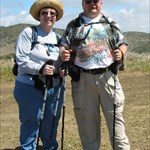
Visited the Buffalo NY area, where I grew up. Lots of relatives there yet. Just as I found OG1166 on the wingwall of a bridge over Ellicott Creek, I saw this guy down in the creek. Grabbed this quick shot, then as I tried to slowly line up the mark and the snapping turtle, he dove. Darn! He was good sized, about 24 inches nose to tip of tail. Also note he seems to have a chunk of shell missing. Ouch! Just 20 feet or so away, got a good shot of this Great Blue Heron: And another 20 feet or so away, found these Canadian Geese: Quite the wildlife benchmark! -
Agree. So both RM's and the Azimuth mark have been found. I wonder if the bolt is still there. Not much oxygen up at about 14,440. I would be dead.
-
Can you believe Arizona? 2 Oldfarts (and others) have been busy! We should try to get Arizona and SoCal all red! (OK, they ARE big counties)
-
Your Best/Favorite Benchmarking pictures.
Klemmer replied to 2oldfarts (the rockhounders)'s topic in Benchmarking
Another great hiking / benchmark hunting day. Found EV9281 on Mount Islip. Here's a few more wildflowers for Shirley: Blazing Star: First I've seen south of the Sierra Nevada. Really showy, unusually long stamens, and just across the road from the Dawson Saddle trailhead: Another pretty wildflower, but so far I haven't been able to identify it; And finally, a pair of members of the wild snapdragon family, possibly Lowbush Penstemon (although a bit out of it's described range): Sorry of you're not a wildflower lover, but I know Shirley likes them.... -
Went on a great hike this week end from Dawson Saddle to Mount Islip via Throop and Hawkins Peaks, then down to Little Jimmy Campground and back to Windy Gap. Good training. Here's a nice pic of EV9281 and the top of the old stone hut on Mount Islip: here's the rest of the remains of the stone hut: I suppose that the stone hut was used by the folks manning the fire lookout tower, which is gone now. The only thing some quick research turned up on the hut was that it was built around 1927, and used (as I guessed) by the fire tower crews.
-
From 10,834 ft San Jacinto to 11,500 ft San Gorgonio. Hope to be on top of San Gorgonio in August. Hope I can get the reverse photo of this!
-
Your Best/Favorite Benchmarking pictures.
Klemmer replied to 2oldfarts (the rockhounders)'s topic in Benchmarking
Had a great hike last weekend, up to San Jacinto Peak (10,834 feet), near Palm Springs, CA. I've been up there before (four time now), but FINALLY found the Azimuth Mark that belongs to the San Jacinto Triangulation Station. Looked for it before, but this time got it! It is quite a ways (trail distance) from the peak, and previously not well documented. Kudos to our forum member Rumpled for the first find and the coords! More info & pictures on my latest Geocaching log: DX5119 More pictures on our picture website HERE And, here's a couple flower pictures for Shirley: Very wide open Maripos Lily: California Corn Lily: -
Your Best/Favorite Benchmarking pictures.
Klemmer replied to 2oldfarts (the rockhounders)'s topic in Benchmarking
Looks like a Turkey Vulture to me. Lots of them around here in the mountains & wilderness-y areas. I was going to write something witty about the LA metro area needing a few more, but I better not...... -
Differences between a Benchmarker and a Geocacher
Klemmer replied to topflitejr1's topic in Benchmarking
A benchmark hunter is like a geocacher, but with the soul of an engineer. -
Your Best/Favorite Benchmarking pictures.
Klemmer replied to 2oldfarts (the rockhounders)'s topic in Benchmarking
Great picture, cjf! I propose that it is the first picture of a Bald Eagle in the same frame as a benchmark (OK, an intersection station). -
Your Best/Favorite Benchmarking pictures.
Klemmer replied to 2oldfarts (the rockhounders)'s topic in Benchmarking
Here's an interesting non-NGS Benchmark picture, from on top of Mt. Baden-Powell (9400 feet). At the top left of the picture is Edwards Air Force Base and Rogers Dry Lake, where many Space Shuttles and other test vehicles of all sorts have landed. And there is a great monument on top in memory of Lord Baden-Powell, founder of the Boy Scouts, which I was proud to be a member of (Life Rank) many years ago. Several groups of Scouts up there yesterday. Closeup of the plaque on one side: It is a serious hike to get there, from 6500 feet at parking, so almost 3000 feet elevation gain, in about 4 trail miles. It is known locally as a killer conditioning hike. The trail and views are great! One view from partway up: -
Would that make the one with the wires 'Pillar Light"?
-
Aha! here is the one at Silverwood Lake: And the top view: Looks a bit different than your description. As far as Waymarking goes, I have no doubt yours is an accurately located survey station of some sort, in someone's database (US Army Corps of Engineers, possibly). So, you could probably submit it in the US benchmarks category, IMO anyway.
-
There are at least 9 "first cousins" of your tribracks near the Hoover dam: There they are called a "THREE-SIDED CONCRETE PIER" by the US BUREAU OF RECLAMATION. This is the most commonly photographed one: GR1860. Each has a triangulation station mounted on it. I guess they had lots of concrete available for these at the Hoover Dam, huh? I have also seen piers similar to the one you describe at Silverwood Lake Dam, in the northeastern San Bernardino Mountains, also in SoCal. If I find the pictures I took, I'll post one. I have a feeling you will find similar piers (details differing) at many dams.
-
I've got one of the early PN-40's, about November last year. Not one problem with it, and I love it. Works great. Latest firmware & software are great improvements. Those that are knocking the PN-40 are / were either very unlucky, or - what? I dunno.... My hiking friends tend to drool a bit, with the hi-res aerial maps and USGS 25K Topos on it, all I want for $25 / year. Oh yeah, Delorme's support of MACS could be better; can't have it all.
-
jholly: That US Coast Guard system (DGPS) still exists, and is still being expanded around the country (depending on funds...). Other countries have established it also. Here is a two part article I wrote that has some info on it, although the article is 6 months or so old. Not sure what Andronicus has / had, but if it was truly a handheld DGPS receiver, he probably would have had to set in the USCG beacon frequency, so maybe not. You can (or could) buy separate portable DGPS beacon receivers, but now with WAAS, they are pretty much obsolete. WAAS is sometimes (somewhat mistakenly) referred to as DGPS (it does share some functional resemblance....). Klemmer
-
Your Best/Favorite Benchmarking pictures.
Klemmer replied to 2oldfarts (the rockhounders)'s topic in Benchmarking
Road? That was a ROAD? Picture of the alleged road taken from near (well below) the infamous FS1150 (VEX). I rest my case. -
aclakey If you are still watching this thread: I finally got around to updating from Topo USA ver 7 to ver 8. HUGE improvements for benchmark hunting. Now completely paperless benchmark hunting IN THE PN-40. If Topo USA ver 8 didn't come with your PN-40, Delorme has a 6 month free upgrade policy (well, you pay for shipping). Get it. The process: 1) Get the .dat file you want from NGS 2) Convert it to a .gpx file (BMGPX or BM2GPX) 3) Optional: Load it into GSAK 4) Optional: Filter it down to less than 1000 benchmarks, if necessary (radius, or whatever) 5) Import it into Topo USA 8 6) Check it out on the maps (even have benchmark icons) 7) Transfer to the PN-40 (up to 15,000 characters of the data sheet will be in the PN-40! Transfer is quick, under a minute for me for 500 benchmarks on my 3 year old PC. Awsome! Alternative: You can now bypass Topo USA, and use Delorme Cache Register is it very cool for geocaches, and for Benchmarks you can import the .gpx file, and send it to the PN-40. It is $9.95 from Delorme (download), and THERE IS ALSO A MAC VERSION (for you MAC'ers out there). Also awesome!
-
Hey FX: Hang in there! You'll get it turned around. You know I'm the other regular here with a Delorme PN-40, right? I think there might be a few more, also. Looking forward to Delorme's Cache Register. I have been able to load up all of most datasheets on the PN-40 using JaM4AR's little "hack" that uses Delorme's "Send to GPS" browser software. True, it only works for Firefox 3 browser (which I do anyway), and it is "get a cup of coffee" slow, but hey, it works! Of course, some improved formating wouldn't hurt . The only limit I've hit (PN-40SE w/ 8GB internal) is the 15,0000 character per "geocache" limit. I imagine the same 15,0000 character limit will apply with Cache Register. So,except for those really long datasheets, I've been "single unit" paperless benchmark hunting for a while. It's great! Now Delorme needs to come out with the update to allow multiple files of 1000 waypoints each (like my Magellam Meridian has had for years). Then it will be perfect for benchmark hunting (but it's close now). Klemmer
-
Your Best/Favorite Benchmarking pictures.
Klemmer replied to 2oldfarts (the rockhounders)'s topic in Benchmarking
OK, Klemmer's wildflower picture gallery ready for opening day. I wouldn't say every flower picture was taken while benchmark hunting, but certainly some were. And I would always have had at least one GPS with me, so that counts too, right? There are several sub-albums, so dig down a level, if you want. And of course there are many pages. Click on the photo for a larger version. Resolution has been reduced & more compression done for space & download. Just ask if you would like the full resolution version (4-5MB). Some ID's are still in process; assistance in ID appreciated. Most from Central to Southern California. -->> KLEMMER'S WILDFLOWERS