

jwahl
-
Posts
274 -
Joined
-
Last visited
Posts posted by jwahl
-
-
The mistake in the datasheet description I see is that it should be
ABOUT 125 YARDS SOUTHEAST OF THE
SOUTHEAST END OF THE NORTHWEST TANGENT OF CURVE instead of Northwest.
It isn't that easy to specifically identify the tangent point of the curve to much better than 35 feet or so.
The other calls then to the road and trail as well as to being on a large rock and using the topo coordinates should be okay.
If you use the 125 yards that moves it NW along the road from where the topo sheet puts it so you have a few hundred feet to search along.
-
I assume your calculator is using plane coordinates. Thus you could input UTM values, or State Plane Coordinate values. In either case those are on a projection and for a large figure grid angles are not equal to the geodetic angles you would get if you were actually on the point turning them.
The turned angles can be corrected to grid by means of computing a thing called the T-t correction, however an approximate calculation of the position would have to be made to compute the correction, followed by small changes in the angles.
Anyway using SPC coordinates for the GC1B0Q9 resection problem the solution using plane coordinates is within a few 1/100's of a foot of the correct solution. When considering that the angles are given to 0.00005 of a degree which amounts to 0.2 seconds the solution has inherent error of a few tenths of a foot anyway. Thus the error in using uncorrected grid is pretty small in this case.
- jlw
-
I am not from Las Cruces, but I can provide some clues. The GLO or General Land Office were surveyors for the Federal Government up until 1946 when they merged it's operations into what became the Bureau of Land Management. Between 1908 and 1946 the monuments they set were brass caps on 1, 2.5 or 3 inch iron posts. Usually the monument would be to mark a section or 1/4 section corner, but the GLO also surveyed Indian reservations, and all kinds of grants and claims. So what you found would likely be either a PLSS monument (PLSS stands for Public Land Survey System), or a corner of a grant. It should have marks on it which give it's designation.
Plotting the location on USGS quad source will probably give you a good idea. The actual survey records which describe the monument would be located at the BLM office in Santa Fe. Some of their records are being scanned and put on the internet, but the work is just beginning. There will be a plat which shows that parcels being surveyed and the bearings and distances of the lines, and there will be a set of field notes which describe the survey and each monument and how it was established, marked and referenced.
Some NM plats are on line here: http://www.glorecords.blm.gov and perform a survey search. You have to already know the approximate location by township and range which is probably 23S 1E of the NMPM.
Tell us the lat long and maybe we can help.
- jl wahl
-
This might be an example of a situation where one more investigative tool could help. That is determining the actual elevation of the candidate mark. I know that is beyond the capability of most on here, but it is still one critical element of information that can be added after all the history and on the ground investigations.
As an aside relating to an earlier post. The difference between the older '29 datum and the current datum can be computed with an NGS program called VERTCON. That may not be exact since it is an interpolated model. The best solution is usually to compare the two published elevations on a mark in the area.
- jlw
-
I would not expect it to be very common to have a Bearing Tree for a benchmark. Occasionally horizontal control stations have a marked tree.
Most often bearing trees are associated with property corners and in the west it was and is extremely common to have bearing trees on PLSS corners. (Section and 1/4 section corners.)
So I suspect what you found was a BLM or GLO section corner and possibly on a USFS boundary where they often set signs.
jlw
-
Your problem may have been made worse by a weak or poor configuration of satellites. That is the number and location. I think survey grade receivers have more capability to filter out multipath by only using the first signal received for example. However it wouldn't hurt to pass on the information such as 'Location suitable for Satellite observations. 'Large metal barn roof nearby may create multipath issues.' or 'iron bridge structure overhade may create multipath problems'. Those things in particularly if they are not obvious in the aerial coverage could save a surveyor some wasted time.
- jlw
-
There is a Scott Zelenak who posts over on rpls.com and is a surveyor who works for the NY Port Authority. - jlw
-
Here is another possibility farther west:
National Geodetic Survey, Retrieval Date = DECEMBER 2, 2008
CZ1849 ***********************************************************************
CZ1849 DESIGNATION - CWA 2
CZ1849 PID - CZ1849
CZ1849 STATE/COUNTY- AZ/PIMA
CZ1849 USGS QUAD - TUCSON (1992)
CZ1849
CZ1849 *CURRENT SURVEY CONTROL
CZ1849 ___________________________________________________________________
CZ1849* NAD 83(1992)- 32 08 41.14430(N) 110 57 09.48957(W) ADJUSTED
CZ1849* NAVD 88 - 776. (meters) 2546. (feet) SCALED
CZ1849 ___________________________________________________________________
CZ1849 LAPLACE CORR- 2.26 (seconds) DEFLEC99
CZ1849 GEOID HEIGHT- -29.36 (meters) GEOID03
CZ1849 HORZ ORDER - SECOND
Note that RM 3 is quite a ways away from the station. Based on a quick computation from the above station, the Azimuth mark which they are also calling RM3 seems to fall in a park between a couple of baseball or softball fields.
Does any of that fit? If not, it helps others help you if you give the position where you found the thing and the picture, etc. Also the whole discussion should probably move over to the benchmarking topic.
- jlw
-
I saw the term 'datum point' used in a diagram from the NGS bluebooking documentation. I have not seen it used widely in surveying, but it would seem to be a term NGS has used for some purposes.
- jlw
-
Leica Disto is I think a brand that is marketed to surveyors. Things you should look at besides range, are accuracy.
Also I am pretty sure, but not positive, that none of these gadgets will correct a slope measurement to a horizontal measurement, which is what most lines in surveys are reported in. So you would also need some kind of reasonably accurate clinometer and maybe an inexpensive scientific calculator to reduce the measured distance to horizontal..
There are a wide variety on ebay at any one given time. Reflective tape will probably help considerably and is a lot less expensive that a retro prism for hard shots.
- jlw
-
Isn't it interesting though that RM1 and RM2 are almost on line with two stations?
-
As a recently retired Cadastral Surveyor with the Bureau of Land Management with significant experience control surveying as well as licensed land surveyor in several states I will add my explanations to the list.
Until the last 15 years or so, property boundary surveying has been largely independent activity from control or geodetic surveying. There are also construction surveying and other specialties. The disciplines can overlap, but are different to such a degree that it is possible to have them be separate activities. Land Surveying as a profession may involve these and other disciplines.
The typical land surveyor probably is mostly involved with creating, describing and locating land boundaries (property surveying) as well as laying out things like buildings and other infrastructure on the ground so that they can be located and built where they are supposed to be (construction surveying). With the evolution of GPS as a surveying tool, and a geodetically based survey tool, the property survey has become much more related to using geodetic surveying and the geodetic network than it used to be say before 1990.
The term Cadastral as mentioned above is not a term that is commonly used in the U.S. but refers to property boundary surveying. To be specific the term ties it to property ownership and often taxation as the term was originally intended.
In the U.S. the term Cadastral has traditionally been used for the Federal Surveys that establish or restablish the Public Land Surveys. That was originally the General Land Office whose functions were combined into the Bureau of Land Management in 1946. This BLM use of the term is probably just an accident of history. Today you find many private as well as public land surveyors that are comfortable with the term and may use it to describe themselves in relation to property boundary surveying as opposed to construction work or other aspects of surveying.
Another example of a subdiscipline or specialty within land surveying, and most often a state government function is route or highway surveying that can involve power lines, pipelines, canals, etc.
I sense from your question a request for a deeper explanation of what the differences are between common boundary surveying and geodetic surveying. That would be difficult to convey in any very complete way in a few pages of text. Let me try to briefly review some historical context.
Individual ownership of land started to evolve in the 1400-1800 timeframe. Once private ownership of lands was possible, it became necessary for boundaries to be established, described or located to a larger degree than previously . Prior to that, boundaries existed for the state, king, or feudal owners lands, or for use purposes such as farming.
Let us look at colonial era. Lands in many of the colonies were granted by royal grants to individuals or groups as proprieters. These people could then convey lands to others, or cause towns to be created and lots conveyed. So it is that the large tracts of land that initially constituted the colonial grants were broken down into large estates, then smaller farms, towns, and so on to the current day. In general all these properties would have been surveyed. In the colonial era the primary instrumentation was the survey compass and the gunter's chain. Descriptions were written by a combination of what we call metes and bounds. Mete means measurement, and bounds describes physical features such as creeks, ridges, roads, etc. The lands were then conveyed, divided, conveyed again, etc. to the current day.
Remember that virtually every property in the country has been surveyed and it's corners monumented at some time in it's history. There are a few exceptions where the boundaries may be defined in records only having never been established on the ground. It is usually the case, though, that at some point as the land is sold or inherited over time that a survey of it is performed.
In the 18th and 19th century measured survey lines were most often described with bearings measured with a magnetic compass and distances measured with a surveying chain held level. By the end of the 19th century these methods were rapidly giving way to the use of the surveying transit and the steel tape for measurement. Distances measured with a tape may be have been performed by holding the tape level, or by determining the horizontal component of the tape on the slope with vertical angles measured byt the transit or a clinometer. During the 1970's this changed quickly with the advent of digital technology, the calculator, the electronic distance meter and digital theodolites and total stations.
A line on a boundary described as being 1000 feet long, means it is 1000 feet as would be measured horizontally and not up the incline of the land. Areas reported for land are similarly based on the horizontal equivalent of the boundaries.
States regulate land surveying in their state and issue licenses to surveyors based on experience, education and testing. Each state has a statute which defines land surveying, and most often the differentiating aspect in their definition is the establishment or location of property boundaries. Generally the county is the location where survey records are kept, but there are survey records in state agencies, federal agencies as well as in local surveying companies.
These individual surveys and monuments are less noticable to the public. Old surveys may have had corners marked by stones, mounds of stones, or by wood stakes, calls to trees and other things of a more temporary nature. Metal monuments were not commonly used until about 1900. Most local surveys are monumented with pipes, iron rods or sections of rebar today. These may not be marked in any way, however some states require a cap or other marking to identify the surveyor who set the monument.
Land boundaries are more a hierarchy of the chronology of how the lands were divided and land surveying often involves a lot of historical records research as well as finding evidence of previous survey lines and monuments on the ground.
You may live in an urban subdivision whose lots were laid out and surveyed in 1980 with electronic total station and computer generated coordinates, or in 1950 computed and drafted by hand and laid out with a transit and tape. That subdivision may have been cut out of part of a larger tract of agricultural land that was surveyed in the 1930's cut out of a larger tract of farm land. That farm may have been created in the 1880's surveyed with compass and chain, and so forth.
Outside of the original colonies there was a lot of land that was originally federal public domain. This began when colonial states relinquished their claims to western lands as part of forming the United States and the sale of those lands being to help support the central government. A system was set up to survey, describe and sell those lands in 1785 and it began in Ohio. These are the PLSS or so called rectangular surveys which consist of townships and sections. Land title in most of the non colonial states is based on them. There are a few states such as Kentucky and Tennessee which had so many state land claims in them that the rectangular system was never fully implemented, although there are township surveys in Tennessee. The public land states, besides the early midwest include the south from Alabama to the west, Florida, and of course everything to the west. These lands were surveyed and patented to individuals by the United States and almost all title derives from and is surveyed in relation to original surveys performed for that purpose.
Property boundaries in this country are not generally related to their absolute position on the ground, but relative to local features and monuments. As a practical matter, they were not usually tied into control surveys until more recently, say from about 1970 onward. Route and highway surveys were more often tied into control survey horizontal networks as a way to check them over large distances. In fact one of the early reasons for densification of the control network was to assist in such work.
Well I better quit there, since I have rambled on long enough, but hopefully provided some useful information in response to your question.
- jerry wahl
-
My best guess, is that someone did a survey and made up several monuments off site, hauled them up there to be set and someone made a mistake in which one they were setting. One needs to looks at where the proper corner appears to be to see if there is a similar type there.
Also you could check with the local government agencies to see if they have commissioned a survey or have a copy of it. In CA surveys are usually recorded and the surveyor's license number might be on the monument somewhere. You might be able to find a copy of the survey in the county courthouse.
- jlw
-
As a surveyor, given sparse control in that area, I would not hesitate to use it after verifying the RM for horizontal work, and rough vertical I could estimate the height of the cap above the bedrock and be good enough for many purposes.
I did work in the general area (Tuba city and East) in the 1980 era. Before GPS, this kind of thing would be a blessing to tie work into.
That probably means nothing in regards to the official definitions of desroyed, however.
- jlw
-
From Google and the topo maps it looks like it might be in a cemetery....
On second look, it looks like the fenced part of the cemetery is to the north. The objects in the road turn around the hilltop may be boulders.
- jlw
-
I would suspect that some stations in the older networks were not brought forward into later adjustments due to an evaluation of the quality of the measurements, or specific decisions based on the monumentation quality. Mostly the former. Many stations in the original North American Datum were not published in NAD27 and a significant number of stations in NAD27 were not included in NAD83.
Theoretically they all still have observations to them and station data, but it must have not been of sufficient quality to merit inclusion on the later work.
- jlw
Hi Shorelander--
Actually, this thread is just to demonstrate to you how much we need your assistance back here in God's Country. And you wouldn't have to fiddle with silly vaned-thingys that you have to disassemble to photograph (let alone occupy).

Yes, I think I get it that I myself can't supply "geodetic control," but the point in question was part of the great Triangulation of Massachusetts, and therefore, I assume, must somewhere have generated several notebooks of data linking it to others in the network. I believe this is "geodetic control" (actually, I believe that's its definition, even though I'm not sure
 ).
).But we shall see if I can find it, report it, and then await a reawakening....
-Paul
-
I do think that the description is confusing, but it seems clear from tower 5 that the position was 'traversed to'. What is unclear or unknown is how this point on the ground was determined and if it was monumented, there is nothing mentioned.
Besides the string intersection idea, if I were a surveying it and wanted to be sure I had a point directly under the tower, I would establish that point either with a zenith plumet (something any C&GS crew would have for plumbing towers), or by simply sighting the tower from a couple of nearby transit setups and dropping line down from the center of the tower to the ground and setting a point.
The first thought I had though was if there was something in the tower structure itself, that was visible and near the ground, such as some symmetry in the structure, cross braces, etc. Nothing is that apparent though from the photos.
Of course "Center of the base" does not necessarily imply directly below the top of the tower.
There not being any called for monument, it would be hard to assert having found it without qualification.
- jlw
-
My interpretation is somewhere on the top. Perhaps one end of the outcrop seems more like a base or low end of the outcrop, but the top is in the cross section. I would search all of the top surface area, particularly any and all horizontal areas.
-
There are two links that I am aware of for historic quads:
First:
and then
jlw
-
There are two sites for historic quads that I am aware of. I think they have the same maps though:
This was the original source:
- jlw
-
An eccentric could be a target or a light sighted from other stations. I would check out if the 'lookout tree' or items setup on the tree.
ECC 4704 is 19.180 meters or 62.92 feet away in a SW'ly direction from the station. The description says that the sation is 63 feet NE of the lookout tree.
That seems like a pretty close match. The other eccentric is very nearly the same direction and about 4 feet different in distance. That seems consistent with two objects possibly on the tree or on the platform on the tree, or on opposite sides of the tree.
- jlw
-
Good deal. So how does the location you had previous fit a distance pulled from RM2?
-
I think you should give Dave D. a nudge

- jlw
-
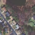
The location shown in your photo looks like about 6 feet or less from the curb stones, and if we were to believe in the positions shown in the plots earlier in this thread, it sure seems like it should be further SW by maybe 5 or so feet.
How well did you position fit the ties to the original structure.
Aerial photos are not perfect by any degree, but it makes me wonder.
- jlw
 ).
).
Question about Data Sheet Description
in Benchmarking
Posted · Edited by jwahl
A couple of other points about issues raised in some of the recent posts in this thread. First remember that the USGS 1:24K map product was compiled using the National Map Accuracy Standards which basically says that most features shown are within 1/50th of an inch at the given map scale. This comes out to about 40 feet in this case.
While digitizing points off of a quad may be better than that, it is a general indication of about how good the product was intended to be. Add to that paper base which changes size and so forth, you should not expect to be able to get coordinates from it to 5 feet accuracy for example.
The fact that we now have by virtue of scanned images of the maps, the ability to drill down and measure easily less than this does not change the inherent issue in the product itself, but makes it easier to forget about it than the days when you had to physically scale off the paper copy.
Most of the USGS maps were compiled using some projection based on a graticule in the NAD27 datum. However, unless you are using a paper map, many of the online systems as well as PC based mapping software allow for the map to be registered in NAD83 and in that case the coordinates you digitize are in NAD83 assuming that it was all done correctly. One way to check is to find one of the 2'30" tick marks on the face of the map and see what kind of coordinate you have for it.
The shifts between the datums are small in some areas, but signicantly large in many areas of the country.
- jlw