

earthshaker
-
Posts
101 -
Joined
-
Last visited
Everything posted by earthshaker
-
Yes I have posted a message on the Nebraskacache, to date two replies, is all I have, not a large interest in this operation, and I am a bit disappointed to be honest. I probably give up due to lack of interest, and just do my own thing.
-
Please show me yours! (GPS mount)
earthshaker replied to jsclifton's topic in GPS technology and devices
For my old reliable meridian I use a RamMount, the 4" riser bar and the permanent mount "disc", never had a problem. When I get a 60cs I will use a rammount that will work with what I already have. As far as posting go to photobucket.com and open an account (free) upload your pics to there and use the image tag, copy it and paste it on another forum within a message. like this Sorry it is the only pic I had handy, don't have one of my ram mount, just an example. -
Excuse me, I just sent an email to 1011 news about the other Nebraska and I included the panhandle, as a part of the Other Nebraska so there Actually I can relate to you. I feel everyone west of Broken Bow, should get together and start a new state called West Nebraska after all there is already West Virginia, and South Carolina we could put the capital in Ogallalla. At any rate the areas I am referring to are in Dawson and Lincoln County I got a call from a rep of the NGPC today, he was going to check with his people, in Lincoln and get some input. Then we will proceed. If I am reading you right, you probably wouldn't want to drive this far to pickup trash. Thanks for the reply, that gives two replies to the topic including my own reply.
-
Do Police and 911 dispatchers have GPS?
earthshaker replied to majormajor42's topic in GPS technology and devices
I have heard rumors here in Nebraska that some if not most rural (small town) public safety organizations use gps or have the ability to get the data, of course if the vehicles or the members don't have a gpsr, it wouldn't do much good, we would be back to the dispatchers giving the directions to the responders. I will look into this further and report back. It just sounds like a good idea to me! -
What amazing results on this post, so underwhelming, c'mon Nebraska Geocachers, show me some guts and initiative.
-
You can try here to check your declination, bear in mind the amount declination changes from year to year http://www.ngdc.noaa.gov/geomagmodels/Declination.jsp You can enter your coordinates (in decimal format) or enter your zip code in the box provided. Maybe not a real good idea, most houses use wooden floors and wooden floor joists, and nails (steel) to hold it all together, try a large flat surface such as a table that has been glued together, or a large cardboard box placed on the floor, about a foot above the floor should work better, watch out for staples. This reminds me of a story, when I got my first GPSr. a Magellan Sportrack, I started out wanting a good compass, don't remember why anymore, I exchanged the Sportrack for my Meridian about a week later, the Meridian had more bells and whistles. The compass I have is a army surplus unit I got about 20 years ago, it is scaled in mils, and degrees but the degrees are only graduated every 5 degrees so I don't use it much anymore. FYI there are 3200 mils in 360 degrees, yes my meridian will use mils also, not much use in the civilian world.
-
GPS accuracy and Google Earth
earthshaker replied to OpenTrackRacer's topic in GPS technology and devices
Just for fun today on the way to work I marked a recognizable spot near the highway, with my Merigreen, I just checked the mark with GE, the location I marked was within 5-10 feet from where I actually made the mark, How did I come up with the estimate of accuracy? I stopped next to a Historical marker and took a picture of it after marking the location from within my vehicle, I got out of the Jeep walked around the front, went to the passenger door leaned my backside on the passenger door and took the picture. Since my jeep is about 5 feet wide and my GPSr bracket is mounted on the center console on the passenger side, which by my estimation was about 7-8 feet from the marker. The accuracy was not too bad I would say, of course your mileage will vary. -
I am looking for some people interested in helping with Nebraska CITO activities, I went to a couple of WMAs (Wildlife Management Areas) in the west central part of the state this last weekend,, the first thing I saw in one area was a newly placed dead dog, or it appeared that way, I got a geocache and my wife got a bunch of ticks, we moved on to the next area about a mile away, first thing I saw was a huge pile of trash, litter box, paint roller tray and several other plastic items, as well as some biodegradables , and another dead dog body. The trash pile was at least 7 feet in diameter and a foot and a half high. I am fielding a request for some people to help in a major cleanup state wide, in other WMAs around the state. I have sent an email to the Nebraska Game and Parks Commission, and have so far not received a reply, but since I just sent it last night I am not worried ...yet. I would encourage other Nebraska Geocachers to do the same, go to http://www.ngpc.state.ne.us/admin/contact.asp Let them know that at least some of us care enough to offer to clean the WMAs up. Keep me advised of what is happening in your corner of the Nebraska concerning this project. Feel free to send me an email via this forum. Ryan in Gothenburg
-
Eartha I have sent an email to the Game and parks commission, waiting for a reply, I will post a message in the regional forum and see what happens.
-
Will move to PMs or email to spare everyone else - which would you prefer? email better
-
East Willow Island WMA, 40°51'45.43"N, 100° 2'5.34"W and West Cozad WMA. 40°51'16.73"N, 100° 0'49.60"W I am from Gothenburg, Dawson County, West Central Nebraska. Sunday I went to test somethings, and went to Blue Heron WMA, 40°54'58.84"N, 100°10'34.57"W, a good baseball pitcher could hit the local Pizza Hut from here across the interstate, here I found deer legs. A CITO would take a lot of man hours, and a few pickups, I would like to get something going on this problem but I will need lots of help.
-
Magellan GPS, what is the best...
earthshaker replied to Roadster's topic in GPS technology and devices
I have a Meridian gGPS, have the sd card capability, after reading and researching a bunch, I will go with either the Garmin GPSmap 60, or 60cs(x). My mom has an older Garmin GPS 76, that she was given. A couple of years ago we went to the same area together, I had a strong signal all the time, she on the other hand kept losing the signal, even under moderate tree cover, my Meridian has the quadrfilar helix antenna, the 76 has a patch like a lot of Garmin units. So to sum up, go with the GPSmap60 series, with the better antenna. -
My wife and I went out the yesterday to take some pictures in some WMAs (Wildlife Management Areas) here in Nebraska, as usual I took my GPSr along, to do some caches in the area in the first area, just after we crossed the bridge going into the area, we spotted a fairly recently placed dead dog, still mostly intact. Makes me wonder why these people (if I dare call them that) didn't just take the dog to a vet and have it put down instead of driving out of their way to do the deed. Then after a major tick attack (I am surprised they are out already) we went down to another area a couple of miles away, and saw this. And another dog body, not in as good as shape as the first (use your imagination here). By now I am getting real ticked off (mildly speaking). We took some pictures of the area and headed home. Both of these sites need some serious TLC, I am the only active Geocacher around here. The Game and Parks Commission doesn't have the funds to clean this kind of thing up, and the rest of the people don't care, or so it appears. I need some help to do the job, but I don't know how to go about it. any ideas would be appreciated.
-
Ok thanks I will try it today, hey that reminds me of a problem I have had, when I save tracks and waypoints on the card (a 32mB sandisk) and upload them, I have recently had a problem, the tracks transfer fine into GPS babel, no problem there. But it appears that the waypoints don't get saved on the card and of course then after running the data through GPS babel I don't have squat for waypoints. It used to work great. The com port data cable transfer works fine, but after a long trip it is incredibly slow. I went back and forth with Robert Lipe the other day, and he had no ideas what was going on. I was thinking bad card, so yesterday I ran a sd card utility on the card and did a complete format, and erased everything, I haven't tried the card yet anybody else had this problem?
-
Well I have an old Meridian gps that doesn't, appear to have the track frequency option, but I can tel you on a 100 mile trip there has been over 250 track points, fewer would be better, but since I can't change it I am not going to worry about it. I just downloaded ClaudeGPS2KML, will see how it works. Thanks for all the replies, there will be other questions I am sure. Ryan
-
Funny you should mention it, I just downloaded gpicsync, made a quick drive around town, took a few pics, voila! worked wonderfully, with one exception one image was in teh wrong place about a block away, but I fixed that in Google Earth, sweet app!
-
I have been playing with quakemap and my digital camera, here is my problem. Although I marked a waypoint and took a picture of the area, quakemap cannot relate the two to each other. Both the camera and my GPSr are set at the same time, within a few minutes anyway. Any ideas to make this work?
-
I am in the need to upgrade my trusty Merigreen. I was looking at some reviews on the Magellan Triton 400 hand held, looks good for the under $200 range, has sd card capability, and will work with National Geographic TOPO maps. Anybody have one of these units and willing to tell more about it?
-
GPSbabel now Microsoft GPS live
earthshaker replied to earthshaker's topic in GPS technology and devices
Yep yesterday April 1, Yes I wondered if it was a April fools joke, but I am still not sure. But this would explain why I haven't received a reply on my Meridian sd card issue I posted the other day on their email list yet. -
I just read an item on GPS Babel's site by Robert Lipe, that stated that GPSbabel got sold to Microsoft, and will reemerge as GPS live! I am not sure how to feel about this. What do the other users of this forum about this "deal"? here is a link http://www.gpsbabel.org/
-
on the ones I have looked at the sonar is optional. Iknow it is a wierd idea but what the heck
-
I have been looking around for a fixed mount GPSr to permantely mount in the GEOGEEP, I know this a bit strange, using a boat unit in a car but the biggest advantage I can see is the very large screen. I have seen units with non proprietary memory card capability but cannot find the units again (guess I should have saved the search) I would prefer the external antenna models. Does anyone here use a fixed mount unit? if so which one?
-
This is a signature block if you look at most of the posts you will see a wide variety of them, relax. Anyway I have never used my GPSR at night, but knowing about radio waves in theory the GPSr will work better, I agree with the post that stated due to dew, the signal may have been blocked. Vegetation of any kind can create problems with radio waves at higher frequencies in general, I am not sure where you are from, but try this if possible take your cellphone out to a tall corn field in the late season, you will find that unless a tower is nearby you will not have a decent signal. But on the other hand if you and a buddy go to the same cornfield at the same time of year as the cellphone example above, with say cb radio with one of you on each side of the cornfield you will be able to hear each other with little degradation of signal, of course that depends on the quality of the signal overall, since I did use cb radio as an example. Now for the technical overload part. The GRSr recieves at a frequency between 1200 and 1500 MHz, Cellphone 800-900MHz, FRS radio 460MHz, CB radio 27MHz. as a general rule lower frequencies penetrate vegation better. BTW did you get the FTF?
-
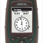
When you go shopping and looking at units, be sure you will be able to read the information on the screen, some units use an incredibly small screen hence small text and graphics, that is why I chose a Magellan Meridian over a Garmin Etrex.
-
I ran into a problem trying to insert things on a map, ended up using image editing software on a jpg of the map, anybody know of a free or at least cheap map editor that allows the user to input data on the actual map file? For example I need to place a 1300 foot circle on a map with concentric circles about every 160 feet going to the center. (a center pivot irrigation system) but no image editor that I know of will allow anything close to an accurate scaled, but I can do it in my cad program but it dosen't support the map files. any ideas?