

PFF
-
Posts
1197 -
Joined
-
Last visited
Everything posted by PFF
-
Some years ago, my wife was a secretary at Smith & Smith Surveyors, in Apex, NC. One afternoon, a crew returned from a job and staggered into the office. Their clothes were torn and they were covered in dirt. "What happened to you guys?" she asked. "We were on that big job out on Olive Chapel Road, and we had to cross over onto the adjoining farm," they replied. "So, what's unusual about that?" "It's an OSTRICH farm. First, we got chased by an ostrich, and then we were chased by the irate woman who owns the ostrich!"
-
Thanks, Patty! I just tried it and it works very well. This will be very handy, because I use coordinates to load my GPS units. Another interesting tool is found within the MORE tab. Click "Photos" and you will get a perspective which is a little different from "street view". For a sample, go to Laurinburg, NC and look for tiny squares at various places on the map. They are geographically correct--having been uploaded based upon GPS readings. Just east of downtown is a photo of a benchmark. Several others are waymarks. -Paul- P.S. The Laurinburg photos are very recent. (They were taken last Saturday!)
-
In discussions with Deb in 2009, she expressed a preference that there to be no cross-references to non-NGS websites. (At the time this came up, she was in the process of deleting a batch of previously-submitted reports.) I'll grant that reprocessing our photos to NGS spec's is labor-intensive. That's one reason I seldom do it. The other reason is that in the majority of cases, our updated written descriptions should be adequate. But, for those times when "a picture is worth a thousand words", the appropriate action appears to be submitting them to Deb. -PFF-
-
If you access this portion of the server using "www.geocaching.com/mark", it behaves exactly as it would if it were a stand-alone website. I don't see what would be gained by doing something like Waymarking.COM. And the fact that we have links here, and on Waymarking.com, to the "nearest" benchmark or geocache, demonstrates the interaction between different aspects of the hobby. Meanwhile, there are many geocaches located at or near benchmarks. Often, this results in a geocacher's first contact with a benchmark. Many of our avid benchmark hunters were introduced to survey markers by just such an experience. The only thing we're looking for, at present, is UPDATES! The data base here is ten years old. But as I understand it, that's not related to our sharing space on the server. Also keep in mind that there are many, many more geocachers than there are benchmark hunters. We benefit by having the expenses spread among all users. It doesn't seem fair for the smallest group of users to request a special favor, especially in view of the "little or no" benefit which would result. -Paul-
-
Hi, Bill, I'm thinking that I would not know to try pulling destroyed marks, if I did not know they once existed. The WW-2 work by pgrig is a great example of the value of having info on destroyed marks, and my search for 100-year-old survey markers is very similar. But unless someone knew (or suspected) that there might be a relevant data sheet, important clues would go undetected. I sometimes see a list of destroyed stations at the bottom of searches. However, without the data sheet in front of me, I don't know if they might possibly be useful. And it's labor-intensive to get the data sheet--with little chance of a payoff. Any work-around to this dilemma? -Paul-
-
[Original post snipped slightly for brevity. Emphasis added.]I agree. Leave it in the database, especially if the disk is near a historic object (or another survey marker--such as a meridian station, or a state-line granite pillar from 1898), or if it is a significant reference point in the descriptions of other stations. -PFF-
-
"This thread is like watching my parents try and use an e-mail program for the first time." One more hint, Mom. The ENTER key is the same thing as CARRIAGE RETURN. -PFF-
-
Wow! Easier to do than I expected. This image was created with MS Paint. I adjusted the size of the benchmark photo, and cropped it, using the photo editor in Microsoft Office (Professional). Then I opened the background photo in PAINT. To overlay the benchmark, I clicked IMAGE, ATRIBUTES, and PASTE FROM. To draw a straight line in PAINT, hold down the SHIFT key while moving the cursor. I probably will use this only occasionally, but for this station (FB2737), it seemed appropriate. By the way, the disk's position within the state outline is geographically correct.
-
Merry Christmas! Not only is Benchmark Hunting a great hobby, but the Forum is a wonderful place to hang out between search expeditions! -Paul-
-
Say, since today was the Winter Solstice, did anyone go out there at Noon to see if the Sun created a light beam along the axis of the monuments? A "Dagger of Light" in the right spot might be an indication that Winter is over the hump and the days will be getting longer. -Paul-
-
Try using 125 feet as the distance between telegraph poles. It's not exact, but it will get you in the ballpark. EZ1224 was described as being at the third pole west from a creek. Since the pole would have been up the bank from the creek bed, I measured from the end of a guard rail. I went 375 feet using my distance wheel, and recovered a mark nobody had seen for several decades. -Paul-
-
That's DE5174, set by NOAA. North Carolina also has commermorative markers. This is DI3832, near Clayton. Mount Mitchell (upload to NGS pending) In addition, North Carolina has an impressive "Center of Population" marker, and we have been promised that, somewhere in the state, a benchmark in the near future will be stamped GEOCAC. -Paul-
-
At this time, GC.com does not update its benchmark data base. The most recent update took place in the year 2000. Replacement monumenting varies by state. The North Carolina Geodetic Survey sets many new benchmarks every year. These make it into the NGS data base within two to four years, and they carry a unique PID series ("DG----"). The NC Dept of Transportation also sets new marks. Most of these are not included in the NGS data base. Although some new marks are set as replacements for marks which have been destroyed, I find that many are part of a current project. This could be advance work for a new lake, or a new highway. They might be associated with a new survey of a county or state boundary line (often done to resolve a dispute). You might also encounter "height modernization" projects which can include both new marks, as well as upgrades to older marks. Numerically, new marks only partially offset those which have been destroyed. Does this mean we will someday run out of benchmarks to hunt? No, because someone still has to visit the site and determine if a mark has been destroyed. But I often wonder if we will run out of easy benchmarks to hunt. -Paul-
-
Great advice. Then, if you find you enjoy benchmark hunting (and I predict you will), why not click the "nearest benchmark" link for every cache you're preparing to hunt? You will be amazed at how often there is a benchmark at, or very close to, a cache. Meanwhile, while searching the benchmark data sheets, if you see a dozen recovery notes for a station, click "nearest caches". There's probably a reason why a particular station is so "popular". The logs are another clue--especially if many of them say, "Stumbled across this benchmark while doing 'The Bear in His Den'." Combining these two aspects of the hobby will give you many opportunities to grab multiple targets at one location. -PFF-
-
That sounds like it will be fun! I like to start the New Year by benchmark hunting on the morning of January 1st. For a few hours, there are very few people stirring, and very little traffic. It's an ideal time to go after marks where I normally can't find a parking space--such as a downtown area or a college campus--or where there are too many curious onlookers. ("Is that man carrying a metal detector, or a rifle?") For the past two years, this annual event has been a team hunt. January 1, 2009, LJPARR and I started around 8AM on the normally-busy Blue Ridge Road, picking up marks at a bank, a hospital, and in front of several office buildings. Then we moved to a main road leading into downtown Raleigh, where we were the first recovery in 25 years for a half-dozen stations. The year before, WWFLVR and I teamed up to recover a dozen marks on, and around, the Duke University campus on the afternoon of December 31st, and we met again the following morning to visit numerous stations along Highway NC-98, which is the main route into Durham from Wake Forest. You are wondering: Can you do this and still party? Sure. When you hit the cold air on New Year's morning, your head clears up very quickly. Just remember to pack the car the evening before, so you don't go off in a fog and forget to pack something--like the data sheets. [Grin.] Or, there's a technique some folks use as they get older. A few days into the New Year, I asked a friend if he stayed up to watch the Ball drop in Times Square. "No," he said, "but I taped it." -PFF-
-
N 39 53.409, W 83 31.744 Amazing! Yesterday morning, I took a reading on the TopoMap (using GoogleEarth) and I came up with precisely the same number. I don't know if you and I are accurate, but we certainly are consistent. Since mjcongleton does not have a GPS unit, my suggestion is to measure south from the railroad tracks at multiple points, and then walk along the line this produces, using the earlier-suggested probe. -PFF-
-
Very unique. Thanks for sharing the photos. This was like erecting a witness post--except they used a reference mark disk. I like how they stamped "PLUG IS STATION" on the disk to prevent confusion. Bottom line: It allowed the survey party to make the station easier to find, while preserving it in its original setting. -Paul-
-
Those who watched the video all the way through have a lot of patience! I quit after their first attempted mark--and what a whimpy attempt it was. No probe. No metal detector. Just pull the grass away and if you don't see it, it's a not found? Did anyone notice if they ever, at some point in the video, explained how to find the data sheets? By the way, I think when they held up the board with benchmarks mounted on it (in one of the first scenes), they should have explained that these were disks which were "retired". The goal is not to go out collecting them! I can see the "geocaching-type" of log now: "Took KUDZU, left DEAD DOG.") Okay, so it's not an ideal video, but it's a start. Which brings us to pgrig's idea: How about using YouTube to show how to do it correctly? But rather than doing an entire hunt in a single video, we could begin with "Going on-line to identify your targets". Next is "Helpful Tools". Then, we could have a video which shows the arrival on the scene and the steps one takes. For our script writers (like ArtMan, for whom writing and production are areas of expertise), I recommend covering these points: *Find a safe parking place/approach. (Insert disclaimer about railroad tracks.) *Begin by looking at your compass and checking your surroundings. *Try to spot referenced objects. *If using a GPS unit, it can take you close to the indicated spot. (Insert disclaimer about Scaled Coordinates) Before writing off a mark as "Not Found", pause and think about the situation. A few tips: *If the description is more than a few years old, picture the scene as it might have appeared at the time of the last recovery, or when the mark was set. (Where was the road in 1972, and did it have this many lanes?) *Although the last note says the mark is "flush with the ground", probe a bit. Disks often get covered by grass or dirt. *If you are beside a paved road, look carefully along the edge. There might be a faded arrow pointing to the disk. *Take one more look at the references in the description. Buildings may have an addition or new siding. Utility poles get replaced--sometimes near the original, and sometimes not. The 16-inch tree may be gone, but can you see the stump? Finally, whether "found" or "not found", make some notes and take some photos which will help the next benchmark hunter. And then, off to the next target!! -Paul-
-
LOL. Driving on those copper-coated roads can be annoying. Not only are they slick in wet weather, but they attract lightning! -Paul-
-
Excellent responses. If any question remains about whether some entries are simply administrative notes, I think NE1365 will remove all doubt. -Paul-
-
Yep! Sounds like you're hooked! Congrats on finding those marks along the railway. Many disks which projected above ground have been destroyed by machinery. But I'm curious about something. What is it that takes the population of Kalamazoo, including new residents, into a certain downtown alley, where sometimes there are "lots of cops" around? [10/11/2009] -Paul- (Former owner of two Checker Marathons. built in Kalamazoo)
-
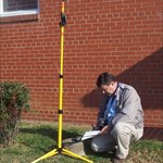
Your Best/Favorite Benchmarking pictures.
PFF replied to 2oldfarts (the rockhounders)'s topic in Benchmarking
An autumn day along Mt. Hebron Church Road in Nash County, NC. (AI5222 is recessed in the shoulder of the road.) -
N.C.G.S. "MUSTIAN" (DG6923) on Fire Tower Road, Franklin County, NC
-
Awesome! Remember, everyone.....order early for Christmas delivery. -Paul- The first 50 orders will receive a small packet of corn starch, absolutely FREE.
-
LOL! I see where you're coming from, John. The instruction book might be thicker than the stack of data sheets one is carrying. However, George's tips and techniques will be of considerable value to the following sub-groups within our hobby: *Those who submit updates to the NGS database; *Those "never-say-die" types who will not leave a site without finding EVERY reference mark. (If your spouse frequently has to call your cell phone to remind you to pack it in and come home at dark, you MAY be one of these.) If you fall into BOTH groups, you may need a laminated copy of George's Cookbook so you don't wear out the pages. While I'm having mine done, it probably won't be very expensive to make extra copies for a few others in the Forum. You can order from our special website, www.ThatDarnMarkHasToBeHereSomewhere.com My only recommendation, George, would be to define the "white powder" used to dust the monument for better photography. There are some folks here who came of age in the 60's, 70's, and 80's. But then, with Street Value being so high, perhaps it is unnecessary to suggest using common household substances (such as baby powder or corn starch), rather than that substance you are carrying for "medicinal" purposes. -Paul-