

PFF
-
Posts
1197 -
Joined
-
Last visited
Everything posted by PFF
-
Looks like it is back. Whew! My heart resumed beating...... [Grin]
-
I tried to use the Benchmark Viewer just now and the following message is displayed on the Select-a-State page. Any ideas? Warning: mysql_connect() [function.mysql-connect]: Access denied for user 'NGSUser'@'208.109.181.27' (using password: YES) in /home/content/d/e/s/deschmann/html/benchmarks/state_sel.php on line 5 Not connected : Access denied for user 'NGSUser'@'208.109.181.27' (using password: YES)
-
REI is running a sale with two versions of the 62 for $199. Looks like a good deal if you're shopping for a new unit.
-
Hi Nat, I just did a search for Raleigh NC (my local area) and everything displayed correctly. As someone mentioned earlier, make sure "display stations" is checked. Best regards, -Paul-
-
I'm in the process of downloading FindAControl (which seems to be taking FOREVER!). What other benchmark tools are people using on Android devices? I know Mike was working on an app, last year. If it is in the PlayStore, what is the name? -Paul-
-
Thanks to everyone for the suggestions. I'm running version 3.0. The next step will be to contact Malcom about the connection issues. -Paul-
-
Thanks, Mike. I've found the program to be very useful in planning a benchmark hunt. I like your idea, and I can see that the ultimate NGS experience would be to let DSworld guide me to a mark, and then I could enter the recovery report into the form at the time. So, is the former submission system still in play? Ii.e., a benchmark hunter goes to the NGS website and fillS out the form for Deb to review? I'm much more comfortable with that system. The only issue I had with it was that it took 60 days or more for entries to appear in the database.
-
After letting recovery reports pile up on the desk for nearly a year, I decided to submit them to NGS using DSworld. The first problem I encountered involved the program connecting to the NGS server. It takes up to five minutes for the "no internet connection" message to go away. Eventually, it is able to connect. (This happens on 3 different computers, all of which have been able to connect to other internet sites at the time.) I think the connection issue is related to my other problem: A few reports never get posted to the database. When I have finished a series of entries, I click EXIT on the entry form. A message appears that the reports are being uploaded. Often, I get a message that there is no internect connection, and sometimes it times out. When I've looked at the stations a few months later, some have been updated and some have not. I can't tell, at this point, if there is a pattern because in the beginning, I was not making notes about which stations were entered on a specific computer, or how many recovery reports a batch contained. (I'm watching this more closely, now.) Specific questions: (1) Is anyone else experiencing connection problems? I've noticed it sometimes takes a few tries to connect to NGS directly (not using DSworld). I have three computers, all running Windows. I keep them updatedm and one is only one year old, running Windows 7. The new computer uses Norton Security, and the other two rely on the Windows security package. (2) Is there a way to verify that an upload was successful--other than waiting a couple of months and then checking each station individually in the data base? -Paul-
-
A few of the meridians have PIDs, where we have posted photos: FY0295 AH2538 AI8586 AI8587 FX1380 FA0996
-
About five years ago, the North Carolina Geodetic Survey became curious to see how many of the State's meridan markers remained. A challenge went out to professional surveyors and other interested parties, including benchmark hunters. I found the first set in Mocksville, NC. One of the meridian stones was a reference mark for a modern triangulation station. Using that clue, I found the other stone about 100 feet away. Then, in Raeford, a reference on a USGS topo map hinted that the southern meridian could be found in a cemetery--having been relocated from the courthouse. A field trip proved that the reference was, indeed, the stone. The northern stone was found with the top broken off. One interesting hunt was in Burnsville, NC, where the stones were said to be in a cemetery on the south side of town. My wife and I made an exhaustive search, but found nothing. Then I consulted the original notes from the survey party and discovered the stone could not possibly be south of town because of the bearings to known landmarks. It had to be north of town. As we drove to a cafe for lunch, I spotted a directional sign to the "Historic Burnsville Cemetery". After lunch, we followed the signs and discovered the southern magnetic station. The northern station was not found. Meanwhile, professionals were finding meridians in their areas, including Asheville in Western NC, and some in the far eastern section of the state. One amusing find occured when the Register of Deeds in Lincolnton crawled under some bushes by the courthouse during her lunch hour and discovered the Lincoln County meridians. The search continued for a couple of years, with benchmark hunters making the majority of the finds. In Roxboro, the Person County stones were said to have been relocated from the courthouse to a large cemetery. It was too big and there were too few clues to go on, so I contacted a group of folks who make a hobby of inventoring headstones. They said, yes, they had seen two stones with USGS-NCGS on them. They went out and took GPS readings, which allowed me to visit the site and complete the documentation. We had a lot of great experiences. Some successes were the result of digging in courthouse records and doing other kinds of research. And some were just dumb luck--such as in Union County where the stones had been moved from the courthouse grounds, but no one remembered where they went. One day, a benchmark hunter was driving along a rural road and spotted the unique shape of a meridian stone in the front yard of a house. A check of the chain of title showed the property once was owned by the county surveyor. In Chapel Hill, a meridian was found by looking at the 1930 Sanborne Fire Map and plotting the bearings to old church steeples, as recorded by the orignal survey party. In a few cases, the stones still remained at the county courthouse--in Columbus NC, Taylorsville, Ruferfordton, and several others. When stones had been relocated, the most frequent place they ended up was in a cemetery, followed closely by the grounds of a county home. All of the monument pairs were approximately 100 feet apart, and those which had been moved had been repositioned in a true North-South line. Other than the Burnsville stones being north of town instead of south, I found only one other error. In Swain County, the descriptions were reversed; i.e., to find the northern monument in a cemetery, I had to use the headstone references for the southern monument, and vice versa. Sadly, about half of the stones in our 100 counties were never located--partly because after several years, some of us had put over a thousand miles on our cars and had spent as much time on the project as employers and spouses would allow. [Grin.] But it was a great experience, and NCGS was impressed by what a group of benchmark hunters with no professional surveying experience could do. It wasn't too long afterward that I got a call from Gary Thompson and Roger Barnes saying, "You know, there are some old 1885 monuments that we're looking for along the NC-VA state line......" -Paul-
-
Yes, I've also noticed the updating for corrections/additions. Also, NCGS sometimes files a recovery report from several years ago--which gets interesting if I have filed one for a more recent recovery. When they are changing the mark from SCALED to ADJUSTED coordinates, it is gratifying to see that my HH2 figures are pretty close. [Chuckle.] You'd think that waiting a few months for NGS to load updates shouldn't be a problem for me because the backlog at my State's geodetic survey is so great. -Paul- "Oh Lord, give me Patience.....and do it RIGHT NOW!"
-
"There were only 2 datasheets updated with new GEOCAC recovery logs. The most recent recovery added to the datasheets as of February 1 was dated December 18. The two datasheets were both for Shorbird -- recovery reports for AA8856 and KY0953 in Ohio." This seems to confirm my original post, and it is the same thing I see when checking North Carolina marks by Load Date. I have been searching one month at a time, but I have not seen any of my submissions appear for many months. Thanks for the tip about DSworld News. It appears that the emphasis has been on photo uploads rather than recovery reports. Maybe we need to dip into the treasury and send a Valentine card to Deb. Roses are red, Violets are blue. Empty the bucket And we'll love you! -Paul-
-
"....datasheets had been updated at least through January 2 of this year." Thanks. It had been so many months that I stopped checking. I had hoped to give Gary Thompson at NCGS a year-end report, but the data was not posted in time. We're in a high-growth area (over 100 persons moving into Wake County per DAY!), and construction is taking place everywhere. Even brand-new marks sometimes are destroyed within a few months. I've been making the rounds and filing reports, especially near new roads and subdivisions, but I got really discouraged during 2011 when I realized that the info was not getting to the End Users--professional surveyors. The other problem created by delayed updating is that all of our "benchmark" maps are stale. Whether you look at Scaredy Cat, GoogleEarth, or the NGS site, you don't know if you are going to be hunting a mark which already was reported as "found" or "destroyed" within the past year. With time and resources at a premium, volunteers (those who report to NGS) want to get the most "bang for the buck" by avoiding duplication. That said, here's my question about DSworld. Do reports go into the data base, or do they still land in Deb's bucket, awaiting review? I asked this in the previous DSworld thread, but nobody had an answer. Now that some folks have been using it for a while, what's the scoop? -Paul-
-
I fear it's the "handwriting on the wall". Geocaching.com keeps downgrading benchmark hunting--even though NGS gave the site a lot of recognition and praise, a few years ago. Meanwhile, NGS started stretching the upload intervals. We went from 30 days to 60 days, to 90 days, to what.....never? I used to feel we were performing a public service. Today, are we? If NGS does not post our finds to the national data base so they can be utilized by professional surveyors, why bother? The size of the photos on geocaching.com.......the broken link to the Forum (where we support each other and train newcomers)......moving the benchmark link to the bottom of the home page, in tiny print.....I think we can figure out where we rank with the site owners. Meanwhile, NGS says not to report recovery of a mark more than once per year. However, we have no way to know if a mark has been submitted by another user because the reports are stuck in the "bucket" for months at a time. Hunting benchmarks is still a cool hobby. But so is looking for cache's [edited by moderator] Five seconds to update, vs. five months or more for benchmarks. Which level of feedback will keep users interested and encourage new participation?
-
GoogleEarth coordinates should be accurate to within a few feet. As mentioned above, make sure you are using the same coordinate format. The best accuracy is achieved when using decimal degrees (DDD.DDDDDD) in GoogleEarth and in your GPS unit. (See "Settings" to change the GPS readout.) Zooming in increases the accuracy in GoogleEarth, as does putting the target in the center of the screen. I have been using GoogleEarth to load my GPS units for several years, with excellent success. It's not perfect, but I promise that it will do better than 21.5 miles. [Grin.] Coordinates from GoogleEarth are great for programming your auto GPS to a street address, or for taking you to the entrance to a cemetery, or finding an abandoned rail line. But this disclaimer: Use your GPS unit when setting a geocache. -Paul-
-
Good catch, folks!
-
Thanks for the reminder about DSWORLD. I've made a New Year's resolution to conquer the program. It's downloaded to my computer and unzipped. So far, it won't connect to the server (times out), but I have trouble reaching NGS with IE, anyway. It takes a couple of tries before I get connected. Meanwhile, I assume a submission via DSWorld still goes in Deb's bucket for review. Even though I have not been able to connect to the website, it is interesting to read the Help screens. I picked up a few tips from the Submit a Recovery screen--one of which I highlighted. (See below.} I notice that the sample report uses the convention of starting with the most distant object and working down to the closest. -Paul-
-
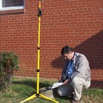
From the NGS home page. Dark red highlighting added to some text for emphasis. Edited to remove naming convention for new stations (no PID). Purpose This document clarifies how passive mark photos (Bluebooking and Benchmark Recovery) are to be formatted and validated, given the configuration of the current National Geodetic Survey Integrated Database (NGSIDB) loading software. User requirements, software, loading procedures, and outreach should support the goals outlined below. Note: This document does not intend to supersede any contract requirements or preclude future improvements to the loading process, nor does it address the submission of photos of CORS stations or the use of photos in the newly developed OPUS-Projects software. Why store photos? Photos are optional, valuable addenda to survey control, capturing mark identification and setting condition and quality information useful for data processing, mark recovery, and appraisal for future use. Resolution and format: Photos should have a resolution no larger than 1024 x 768 pixels; photos that are too large will be automatically resized upon upload to the NGSIDB. Orientation (landscape vs portrait) and extents are unimportant, but the photo should be rotated to open in a heads-up view. The .JPG format is preferred, but not required as all images are converted to .JPG format upon uploading into NGSIDB. Content: As photos will be available to the public, the subject matter shall be in good taste and professional in nature. Photos of questionable quality or content, including possible privacy or copyright concerns, or distracting detail (personnel, company logos, etc.) will be rejected during a pre-load review by NGS. Requirements: Photos are optional. However, should a user wish to submit them, then NGS encourages (but does not require) that each mark have a minimum of 3 photos, consisting of a close up, eye level and horizontal type. These are described below. The submitted photos must follow the naming convention laid out later in this document or they will not be loaded. Photo types: CLOSE-UP - A photo taken directly above the survey mark, approximately 18 inches away from the disk. Remove any equipment, dirt, debris, water, or snow to show a clear image of the complete mark. Avoid shadow lines crossing the disk. If there is a logo cap, the logo cap should be open to show the datum point. The intent of this photo is to clearly show the mark, its condition, and all stamping on the mark or logo cap so that it is clearly legible. EYE-LEVEL - A photo taken directly above the survey mark from eye level to show the monument and cover an area about 1 meter in radius, all around the mark. Remove any equipment, dirt, debris, water, or snow from the mark to clearly show the disk and the setting. If it has a logo cap, the logo cap should be open to show the datum point. The intent of this photo is to show the general condition of the mark and the immediate surrounding area, especially any condition that would be a threat to the stability or permanency of the mark. HORIZONTAL - A daylight photo oriented horizontally, with the tripod or a target highlighting the mark location, and with reference objects, significant obstructions, or possible multi-path sources in view. Remember to record the direction the photo is facing. File names Provide each photo as an individual digital file, using the file name to identify the content. The general format for file names is PID- DESIGNATION- TYPE- DATE.jpg PID is the NGS ID for the mark, if any, e.g., AB1234. For new marks without PIDs, leave this blank and begin the file name with the designation. DESIGNATION is the official name for the mark, up to 25 characters. TYPE Use -1- for close-up, -2- for eye-level, and -3DIR- for horizontal photos, with DIR indicating the direction the photo is facing, e.g., 3ENE for east-northeastward-looking. NOTE: a direction is required for horizontal photos due to the current configuration of the NGSIDB DATE is the date photographed, in YYYYMMDD format. Use dashes "-"to separate the above fields. Spaces are not permitted in the file name. Use an underscore "_" in lieu of spaces within fields. These separators are required to minimize UNIX file handling problems. Examples of photos taken on 31 January 2006: Existing Marks (with PID) 'AB1234-SMITH_RM_2-1-20060131.jpg' is a close-up photo of NGS mark AB1234 'AB1234-SMITH_RM_2-2-20060131.jpg' is an eye-level photo 'AB1234-SMITH_RM_2-3N-20060131.jpg' is a horizon photo looking north 'AB1234-SMITH_RM_2-3SW-20060131.jpg' is a horizon photo looking southwest 'AB1234-SMITH_RM_2-3ENE-20060131.jpg' is a horizon photo looking east-northeast <a name="Captioning">Captioning Captioning is optional, but if done, must conform to the following convention. Note that the PID is after the designation, spaces are used instead of underscores and commas are used to separate the data items instead of dashes. Examples of photos taken on 31 January 2006: Existing Marks (with PID) 'SMITH RM 2, AB1234, 1, 20060131' is a close-up photo of NGS mark AB1234 'SMITH RM 2, AB1234, 2, 20060131' is an eye-level photo 'SMITH RM 2, AB1234, 3N, 20060131' is a horizon photo looking north 'SMITH RM 2, AB1234, 3SW, 20060131' is a horizon photo looking southwest 'SMITH RM 2, AB1234, 3ENE, 20060131' is a horizon photo looking east-northeast ---To place or replace a caption using WinDesc or DSWorld while in the photo editor, click 'EDIT>LABEL>STANDARD' from the main menu or press 'CTRL L'. ---Press 'CTRL S' to save the changes and exit. Website Owner: National Geodetic Survey / Last modified by Burt Smith Dec 16 2011
-
Confirming: Deb's address is working okay. I received an e-mail from Deb today, in which she mentioned receiving an earlier message from me. So, it looks like everything is the same as it has been in the past. AZC probably is typing too fast for his old keyboard to handle, and it scrambles the address. [Grin.] -Paul-
-
Interesting. i sent her a message about three weeks ago, and it did not bounce. -Paul-
-
Read the logs before you invest too much time looking for a specific cache. Also check the dynamic map (satellite view). You may find things like this:* GC33NPK. Coordinates have been revised or alternate coordinates have been suggested. (Original position was off by 350 feet.) GC31Q6P. Coordinates which SHOULD be revised. (Look at the dynamic map's satellite view. We don't hide caches here.) GC11JFN. Not found by experienced searchers during the past year. (You probably won't find it, either.) These examples also show the value of a DNF log--especially if you made a sincere effort to find the cache. Your log may be the first indication that something is wrong. *I don't wish to imply that these are "bad" C.O.'s. In the case of the first two, coordinate error can happen to anyone because of signal reflection, reading the tiny GPS screen wrong, or making a typo. For the last one, it could be a case of someone suddenly busy with work or family, or illness, or a hundred other things which can prevent checking on caches.
-
I agree with the previous replies. Also, if you have a photo which will entice others to visit a cache, add it to your log. Consider including captions. Descriptions can make the photos more interesting. Examples: GC173VH GC1B3JR -Paul-
-
"Is there a number for this challenge?" Opps! I was having so much fun writing the post that I probably made it too realistic. LukeTrocity: I was thinking of doing the same thing. But if you go, be careful because NJ is in Irene's path. Of course, you could take shelter in the Ice Cave (which is one of the neatest cache destinations that I've run across).
-
I decided to remove the original post. It looked too much like a REAL geocaching Challenge. But for those of you who DO go "hurri-chaching", your finds ought to count double. [Grin} Please be careful, and stay alert to changing weather and road conditions!
-
Now your family knows what to get you for Christmas! Regarding your 60cs......For me, recharageable batteries are more practical than a 12-volt power cord. And the best batteries I've found are the SANYO "eneloop" series. These have a very low "internal discharge" rate, meaning that if you want to grab the GPS on short notice and hit the road, the charge from last week (or even two weeks ago) will give you hours of use. I started with a package which included two batteries and a charger (SEC-MDR02TG3U). Over several years, I've built my inventory to eight batteries because I have an AA-sized flashlight and my digital camera also uses the AA size for power. For your purposes, the two battery set should work fine. Having a spare set is not a bad idea. Or, in an emergency, you can stop at any store and purchase two conventional AA batteries. Just be sure to use the "eneloop" charger with "eneloop" batteries. By the way, I'm a "paper" guy, like you. I go on very targeted hunts, rather than driving around and letting my GPS alert me to a nearby cache. It's a personal preference thing. For me, it avoids being distracted by my hobby when I should be working or running an errand for my spouse. Also, I always review recent logs before searching for a cache. If several experienced cachers have not found it, I may not give it priority--or I'll know to put it off until I have plenty of time to spend hunting.