

bobandrobin
-
Posts
127 -
Joined
-
Last visited
Posts posted by bobandrobin
-
-
Oh Yeah. That will do. Thanks!
-
A while back someone posted a link that when clicked on opened a page on Google Earth and showed their route. I believe there was a sliding scale on the bottom of the page that displayed distance and altitude as the route progressed.
We are trying to find something like this to download hikes that we would like to save/share. We have a Garmin 550 and Delorme pn40. Any help is appreciated. Thanks!
-
So...what's a 'chick tract'?
-
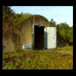
Here in Florida most state parks Charge admission, we pay $60 each annually for a State Parks Pass. This is a bargain for us, we spend all of our free time outdoors and frequent state parks and you won't hear me complain about it. However if the Parks dept. started charging to place a cache I would opt out. Just not right in my opinion and downright greedy. My presence and tax dollars are funding the park.
Last weekend we hiked through a Water Management Area and found two caches destroyed by a controlled burn. This poses the question what degree of consideration would the CO expect from the agency if he/she had paid to place the caches there. If the agency charges for the placement, knows the location and type of cache wouldn't it be reasonable to expect them to protect it during maintenance? We have seen caches destroyed by logging, trail clearing and remodeling inside state parks here. Seems there should be some liability with charging for placement.
I'm getting off a bit here but something to consider.
-
-
just go directly to the averaging tool and create a new waypoint there. let it do its thing until the bar reaches 100% and hit the save button. that's pretty much it. if you want to rename the waypoint afterwards, you can do it through the waypoint manager.
the additional averaging towards an already existing waypoint is useful if you want to take multiple readings over several days. it's gonna get more accurate over time, but so far all my single reading averaged waypoints have been accurate enough for all purposes.
Thank you for the usefull info both of you provided.
to dfx:
i have done this, gone directly to averaging and marked the spot after the 100% bar was visible and i left it a little bit more. When i returned back to check the spot, i noticed that the accuracy was not so good. I repositioned the waypoint and then it was more accurate.
Do you have any logical explanation for that, or it may happen some times?
Thank you in advance

If I may...
Don't expect the gps to bring you back to the exact spot you marked. You may get lucky and have that result but don't expect pinpoint accuracy. A 30' radius is an acceptable margin of error on a good day.
-
GC7AF, Da Dog Yaks, on the Juniper Run. It's been adopted by Clan Riffster - there are a couple of other nice caches on the Juniper run as well.
If you don't have a canoe or kayak, they are available for rent in the Juniper campground. Very reasonable.
I highly recommend doing this paddle.
GC13TCF The "Blatantly Obvious" Night Cache is in the eastern Ocala National Forest, not far from Deland
Thanks for the recommendations! We had planned to do "Da Dog Yaks" but the day before we did a canoe trip around Hontoon Island which was more than we expected- 'bout 10 miles! We took things a little on the easy side at Juniper. Very beautiful area and we had a great time!
-
I suppose the shipping is relative to your location. My 550 had to be returned to garmin after an update failure and then again when the replacement unit had issues. Both times Zagg stepped up and made good on their warranty. Two replacements in about three weeks and the shipping was only $3 each time.
The product is as good as any, lifetime replacement and reasonable cost. I have nothing but good things to say about them.
-
Will you be available for the Florida Finder's Fest?
Unfortunately no, we will be in the area the following week. Does sound like quite the event though.
-
Hello, We're traveling to the Deland area in a few days and will be visiting Blue Springs, Hontoon Island and Juniper Springs. Does anyone have a favorite or memorable cache experience in the area? Night caches?
Thanks for your input.
-
Keep an eye on Craigslist.
-
I was one of 'em. It doesn't work for me either. All I can think of is possibly it should locate your isp address and convert it to gps coordinates? Just guessing here.
Maybe one of the fringes for the elusive platinum membership?
-
Ironically it says log only has room enough for initials!!

Looks like a fuse coming outta that thing. Quick... gimme the phone!!
-
Same here, plenty of pictures with no issues. I did read the camera operates poorly with low batteries, have you tried a fresh set?
-
Not sure about the "go" unit, but until someone who is comes along... My Expedition C used a data card and I took cache info from Groundspeak as pocket queries, converted them with GSAK and loaded them onto the card, then uploaded the info to the unit after inserting the card. Perhaps with the cables you can skip the card but more than likely the files will still need to be converted for the Lowrance to recognize them.
Try a forum search for "ifindergo" Several old threads out there.
-
If you shop around the price difference is around $60- $80 between the 450 and 550. Right now the 550 is $420 at Amazon. So you're talking about a waterproof camera that geo-tags for $80 or less. Not bad in my book. The camera is always at ready and it eliminates another battery eating device in your pack.
I will admit the camera is limited but for the money I consider it a good buy for the average user like myself.
I left the pics large to emphasize my point.
-
I've been doing this with Base Camp and Birdseye imagery from Garmin. Very slow process, you actually feel your hair growing. I'll be watching your thread hoping for an alternative, good luck.
-
I just ordered this last week. I've read a lot of good reviews about it. Found a 24 oz. spray bottle for under $20 inc. shipping at Amazon. I think REI carries it too.
-
I no longer have the Endura or use for these maps. These are micro SD cards.
Turn by turn...$75.00
Advanced southeast...$50.00
BUMP
-
BTW, I have the turn by turn maps for the Endura listed in the garage sale. Been there a while, I'll deal.
-
Well since you asked....
My Safari was my last Lowrance. I was very excited to upgrade from my I finder Expedition C, and for a week or two I could get by the issues of the clunky slow screen (I didn't know better.) Then other issues like the unit shutting down while loading PQ's and caching started to worry me But Lowrance promised a fix for these issues and I was as patient as my 30 day return window allowed. There were some other problems, scrolling through the touch screen was like winding a spring, and now and then it would "unwind" and take you back to where you started, and the issue of shutting down when close to a waypoint.
To the best of my knowledge folks are still waiting for that promised upgrade.
I decided to take my vendors advice and try the Oregon. Best decision I've made in a long time, I've had my 550 for about three months and Garmin has released 3 or 4 (?) upgrades in that time.
On a positive note, Endura Expert is very helpful, and an asset to the forum!
-
Working great for us, download was smooth. Thank You!
-
Welcome FF,
I can't help you much but someone will be along soon who can. I had a Lowrance I Finder Ex. C as a starting unit and was able to transfer some of the cache information from GC..com to to the unit via GSAK and a macro. Downloaded the info to the data card then to unit. Good Luck!
-
Does anyone else with this has the same problem?
I am not sure if my unit has become defective or if its caused by the latest beta, but my unit shuts down what looks like randomly but from experimentation by shaking the unit.
When the unit is on if I shake it alot it will shut off.
It also shuts down when the unit is on and I press the power button to change the brightness and stuff.
It doesnt do it all the time.
Batteries are fresh so it should not be a problem with the batteries (nimh).
Anyone else with similar problems before I contact Garmin?
Maybe, kinda....I have a 550T w/3.71 and one day the unit shut down for no apparent reason. When I powered it back up the battery charge indicated no charge, I could have sworn the batteries were fresh. These were the nimh ones that came with the unit. I haven't used these batteries since and the problem hasn't resurfaced. I figured bad batteries and forgot about it till reading your post.
Saint Johns River Water Management District
in South and Southeast
Posted
I was kicking around looking at some local areas and noticed this. I think it's new, I've never noticed it before. It doesn't appear to include all the counties with SJRWMD properties in them, but maybe it's a work in progress. You can apply for permission or find a cache within the park.
I thought it was cool. Last link on right of page.