

RossOlson
-
Posts
70 -
Joined
-
Last visited
Never
Everything posted by RossOlson
-
quote:Originally posted by 95yj:I wish all outdoor recreationalists had that attitude! The true environmentalist gives something back to the environment, not just sit around and complain about what others do to it!!! Dennis "The Menace" Mitchell I have to agree with "Only in a YJ", other than the fact he has square headlights. We are top of the food chain and should have the freedom to travel on public lands but with that freedom comes responsibilities. I don't do much geocaching anymore because the places I like to spend time are the forest, mostly federal, and unfortunately it is illegal to geocache there so I stopped. I still off-road, hunt, fish and camp where it is legal. There are those that feel that they should have the right to do what they want and have no since of right and wrong. If you want to maintain your freedoms you have to take responsibility for your actions or someone else will!!!! Ross
-
Truth or myth about ammo boxes, DEA said no more boxes.
RossOlson replied to Sissy-n-CR's topic in General geocaching topics
quote:Originally posted by Cache Canucks:...but I always did wonder why it was that when you shoot on a military range, they always had you pick up and turn in your spent brass so that it could be re-cycled (to keep your spent brass is actually an offense); and yet, when it came to the metal boxes that the ammo was packed in, they were always 'up for grabs' to anyone who wanted them. http://canflag.ptbcanadian.com/images/animated/provii/ontario1.gif I am in the Army and have run a few ammo points. We used to be able to take the ammo cans if we wanted. The last two or three years we have had to start accounting for them. It sucks. Ammo cans are great storage containers. It may becuase they are army can resale the containers to surpluse or as scrap metal and recover some of their costs. The army has gotten into recycling. [This message was edited by RossOlson on February 16, 2003 at 11:13 AM.] [This message was edited by RossOlson on February 16, 2003 at 11:15 AM.] -
I am interested. What areas are you placing the caches? Ross
-
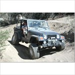
I have driven hummers for a while and I would pick an xterra over a hummer. An xterra would probably be a good choice for geocahing if you weren't into tuffer trails. They could probably handle most trails most people would encounter. If the trial gets too rough, go jeep.
-
Changing tire size will change the accuaracy of you speedo. What about when you drive slower or faster. Wouldn't a tire become taller and skinnier the faster it spins? Could this change the accuracy of speedo at different speeds.
-
quote:Originally posted by targetdrone:They are GREAT, if you didn't pay for them. I don't think they are quite worth what Garmin wants to charge for them. They have saved my but way out in a park after dark by showing the foot trails that I would have NEVER known were there with just the basemap. "I can't find the longitude for the North Pole" Thanks for the reply. I wasn't sure if they should any trails. I have heard they aren't that great of topos but I am more interested in trails.
-
quote:Originally posted by Olar: I can spot that landmark on the map at 0° true. Conversely if I wanted to navigate to a landmark shown on the map at 0° true then I would _add_ the 13° west declination to get the magnetic compass bearing required to find the landmark in the field. Cheers, Olar "Today really is Yesterday's Tomorrow" You do not spot anything on a map at 0deg true, it would be 0deg grid if you are plotting it on a map. If you are using a map you don't want to correct for true north and magnetic you want to correct for grid north and magnetic. Look at the chart, declanation diagram, that you posted and you will see the diff norths. True North, Polar, is marked as T.N. on the declantion diagram you posted and is different than Grid North. Check on your gps, I have a legend, and it should somewhere under settings you will be able to find away to correct for the different norths. The legend says true, grid, magentic, and user. You use this to compenstate. If you head out with compass and use the wrong north to correct form you will end up at the wrong place. Trust me on this, use your gps to see it, look at you declanation diagram you posted earlier or do a search and you will understand the diff. An easy way to see this is with a flat map that covers a large area, a protactor and a glope. Draw two lines straght north from opposite sides of the map, that will be grid north. Find those same to places on a globe and draw a straight line from each to the North pole, that will we true north. On the globe draw a straight line frome each plce to magnetic north, hudson bay area, that will be magnetic. Take you protractor and measure all three anlges. That is the difference between the norths. The terms are not interchangeable. [This message was edited by RossOlson on December 24, 2002 at 09:51 AM.]
-
I did a search and got mixed reviews. How up to date are the topos with federal forestry trails? Another question, how do tell the difference between contour lines, trails, roads etc. Does the screen show them in different shades or dashes? I understand they aren't the best topos on the market but they are the only ones that I can down load in to my legend. Are they worth while as opposed to carry paper topos with you. I will be using them mostly for off-roading. TIA, Ross
-
I am sorry for taking this discusion off-course. The original question was about coverting to a true north reading. I just wanted to make sure WDP was cleaf that there were different "Norths". As far as using UTM if you can play battle ship you can figure it out. Reading a map was not the question.
-
quote:Originally posted by Poindexter:RossOlson wrote: "Take a flat map of the country" In what projection? There really is no north pole on a mercator projection and if your talking about a conformal projection, then what do you mean by drawing a line "straight up"? I use true north many times to physically orient my topo maps to compare features on the map with what I see around me. As for your other question, yes, the variation changes slowly but not as slowly as you may think. The topo map of the area where I live was last updated in 1979 and shows a magnetic variation of 8°30' and today it is 11°8' It currently changes about 4'/year. You should never use the variation from USGS topo's as many of them are quite outdated. Also, grid variation on these topo's can be as much as 2° near the edge of a zone while the grid line at the center of a zone is the same as true north. Poindexter Again, I think we are confusing terms. WDP is dealing with maps for astronmy. I am not familar with these maps so maybe true north is important, but on a topo you work with grid north, the map, and magnetic north, the compass. On a topo I don't undertand why you would concern yourself with true north. If your topos are 2deg diff form one side to the next your maps must be large and that would be something to keep in mind. If trying to navigate with different maps and equipment it is important to understand the diff norths, otherwise it is not important.
-
Hopefully this chart helps. I deal with this almost on a day to day basis. It is only important if you plot your points on a map and than use a gps or a compass to navigate with. If you plug you point into the same gps that you will navigate with it doesn't matter what you use for a north.
-
quote:Originally posted by Poindexter:Declination is the angle between true north and magnetic north and changes annualy due to the constant movement of the magnetic north pole, which is not located in the Hudson Bay. Declination has nothing to do with the differences between a "flat" map and a globe. Grid declination is the angle between grid north and true north. Whichever north you use is a personal preference and not related to using a "flat" map versus a globe. Sorry, but your just adding to the confusion. Poindexter Another question? If magnetic north changes annually what day do we set our compasses? I am sure it slowly changes over long long periods of time just like everything else but nothing we have to adjust for annually. [This message was edited by RossOlson on December 23, 2002 at 08:18 AM.]
-
Take a flat map of the country and draw a line straight up from Los Angles and one straight up from New York, that would represent map/grid north. These lines would stay parallel. If you draw a line from LA to the north Pole and one from NY the lines won't be parallel, this would be true north/polar. If you take a measurement with you compass you will get magnetic north and if you were to draw lines from LA to the reading you got from the compass after you corrected for declanation the lines whoud meat at magnetic north, hudson bay. The declanation correction is how you compensate for this. You don't use polar (true north) you don't have anyway to measure it. How could true north even come into play? I think the confusion is in the labeling of true north vs grid/map north. I have been taught trained in differnet terms. As W.F.F. pointed out one error in his exapmles I believe that there using true north as Map/Grid north is another error. I understand true norht to be polar and Map/Grid north on a flat map. The important thing tounderstand is your declanation angle is how you use your compass and map together. [This message was edited by RossOlson on December 23, 2002 at 08:51 AM.]
-
There are three norths, true north(north pole), magnetic north(hudson bay) and map/grid north. Declination is how you compensate for using a flat map in a round world. Declantion is the adjustment you make between map/grid north vs. magnetic north. Don't spend to much time thinking about True north unless you use a globe to navigate.
-
Garmin is pretty good about fixing those kind of things. They reglued my Vista for free and sent it back air. Thanks for the response. I emailed them yesterday, hopefully they will take care of it. Ross
-
I lost a button on the rubber band around my legend. I am waiting for a email back form garmin but I thought I would try here for any other sugestions. TIA, Ross
-
When I was stationed in KY and AL chiggers were a problem. I ate a couple of match heads everyother day, when I was in the field, and I never had a problem. I was told the sulfur made you un appealing to chiggers and ticks. I don't know if that is true or not and I will probably end up with cancer. In all the time I spent in the woods, weeks at a time, I maybe had 3 ticks and a couple chigger bites.
-
quote:Originally posted by georgeandmary: quote:Originally posted by RossOlson:Georgeandmary, You registered in Feb 2002, just over a 7 months ago and you have over 700 posts. I think you post just to post. You keep saying the samething over and over. Ross Ross I reviewed your previous posts and I wonder if you were actually referring to yourself. The majority of your posts refer to the environmental impact of geocaching. {I feel their is very little impact on geocahing and it should be allowed to continue, we just have to follow the law. It is part of being in a society} Since you have only found 6 caches I wonder if your sole purpose on these pages is to preach{I am in the Army and have spent time deployed, ever since 9/11 training has stepped up.I haven't had that much free time. I plan on doing more durning the fall.} I also find it interesting that you think that if someone steps off a trail they will cause permanent, {my concern is the way we are precieved} but that it is fine to drive a jeep off road {I drive on trail open to off-roading, puplic and private and pay all the required fees}. There seems to be a slight flaw in your logic. {if you have questions of this sort email privately, lets not waste the forums space, Ross_Olson@hotmail.com} I really hope that if you decide to change careers and get into land management that you will be more open minded about geocaching{I am open mined to all the puplic using puplic land, ane want to see more areas opened. Just be responsible}. I have found it to be an enjoyable family activity{I am happy, more children need stronger families. If you are involving your family that is a good thing.} My had enjoyed backpacking and hiking before discovering geocaching and found that it just added a little thrill to the outing. {i also do it along with other hobbies and find it enjoyable} I also do not understand your need to list the names of the organizations that you belong to.{did you go to either one of those links? If you are an outdoors person you will find them interesting.} This is a quote from George: "I've also hosted 2 GeoEents and attended a 3rd. That's where I actually get to gether with other cachers, IN PERSON. Geoevents are a way of strengthening the geocaching community. What exactly have you done? george" I was answereing his question, He is the one that brought it up. it only bolsters my idea on your reason for being here. {what do think my reason for geing here is? Email privately if you want} But since you feel it has some significance I will tell you that I have a degree in Geology and that I have actually worked in the environmental field. {Again it was george that brought it up. I am assuming he is aware of your background, you don't need to share it with me, i don't mind but Its not important} Mary Remember: Half the people you meet are below average. http://img.Groundspeak.com/track/5867_200.gif
-
quote:Originally posted by georgeandmary: quote:Originally posted by RossOlson:Georgeandmary, You registered in Feb 2002, just over a 7 months ago and you have over 700 posts. I think you post just to post. You keep saying the samething over and over. Ross Ross I reviewed your previous posts and I wonder if you were actually referring to yourself. The majority of your posts refer to the environmental impact of geocaching. {I feel their is very little impact on geocahing and it should be allowed to continue, we just have to follow the law. It is part of being in a society} Since you have only found 6 caches I wonder if your sole purpose on these pages is to preach{I am in the Army and have spent time deployed, ever since 9/11 training has stepped up.I haven't had that much free time. I plan on doing more durning the fall.} I also find it interesting that you think that if someone steps off a trail they will cause permanent, {my concern is the way we are precieved} but that it is fine to drive a jeep off road {I drive on trail open to off-roading, puplic and private and pay all the required fees}. There seems to be a slight flaw in your logic. {if you have questions of this sort email privately, lets not waste the forums space, Ross_Olson@hotmail.com}:confused: I really hope that if you decide to change careers and get into land management that you will be more open minded about geocaching{I am open mined to all the puplic using puplic land, ane want to see more areas opened. Just be responsible}. I have found it to be an enjoyable family activity{I am happy, more children need stronger families. If you are involving your family that is a good thing.} My had enjoyed backpacking and hiking before discovering geocaching and found that it just added a little thrill to the outing. {i also do it along with other hobbies and find it enjoyable} I also do not understand your need to list the names of the organizations that you belong to.{did you go to either one of those links? If you are an outdoors person you will find them interesting.} This is a quote from George: "I've also hosted 2 GeoEents and attended a 3rd. That's where I actually get to gether with other cachers, IN PERSON. Geoevents are a way of strengthening the geocaching community. What exactly have you done? george" I was answereing his question, He is the one that brought it up. it only bolsters my idea on your reason for being here. {what do think my reason for geing here is? Email privately if you want} But since you feel it has some significance I will tell you that I have a degree in Geology and that I have actually worked in the environmental field. {Again it was george that brought it up. I am assuming he is aware of your background, you don't need to share it with me, i don't mind but Its not important} Mary Remember: Half the people you meet are below average. http://img.Groundspeak.com/track/5867_200.gif
-
Gerogeanmary, I want to finish an MA in environmental studies. If I don not continue in the Army I would like to work the Dept of Forestry, BLM, or Dept of Fish and Game. I am very concerned with the outdoor sportsman, including geocacher, future and plan on doing what I can to protect it. I am als a memeber of the Blue Ribon Coalition. They are large group that protects Puplic Land Use. Their link is http://www.sharetrails.org/. I parctice and want to make people aware of the concept of Tread Lightly. This another good organization. http://www.treadlightly.org I practice pack in and trash out, also cache in and trash out. Ross
-
Numbers Mean Nothing or This Is Not a Competition
RossOlson replied to mikemtn's topic in General geocaching topics
quote:Originally posted by Jamie Z:Rather amusing, since when I saw the title of this thread, I considered posting a link to the PaterQuest thread. No.. numbers don't really matter. But you know what matters? I spent six days on the road seeking out every cache I could get my hands on during daylight hours. I spent time in the downtowns of big cities (well, one city), I nearly got my truck stuck on a forest road, miles from nowhere, I had to go through a military checkpoint, I got questioned by the cops once, I met RPecot, Cachercarry, and Pater47 himself. dadgum right I'll be proud when I get a chance to log 'em all and my name sits atop the list of Mississippi caches, but nothing will ever beat the experience I had standing out in the middle of the woods in pouring rain looking for a cache placed by Pater47 with the owner standing right next to me, laughing. Soaked head to toe, Pater relished every second that I couldn't find his cache. It's not the numbers that matter, but it's the numbers that drove me. Mike... you gonna challenge the Mississippi lead? On second thought, lets continue this discussion on the PaterQuest thread. Jamie That a good answer. Different things motivate different people. -
Georgeandmary, You registered in Feb 2002, just over a 7 months ago and you have over 700 posts. I think you post just to post. You keep saying the samething over and over. Ross
-
quote:Originally posted by georgeandmary: quote:Originally posted by Mudfrog:I think its a different ballgame now and if you "take the risk" and get caught with GPS in hand, then theres a good chance that GeoCaching would be supsected! Sure its a small thing this one time, but these small things sure are gonna add up. Have a gps in your hand does not equate with geocaching. And their is no way to PROVE it. Remember: Half the people you meet are below average. http://img.Groundspeak.com/track/5867_200.gif So what you are saying is that if you can get away with go ahead and do. Right or wrong doesn't matter. Ross
-
quote:Originally posted by georgeandmary: quote:Originally posted by RossOlson:georgeandmandy, Its not the authorities that are the concern, it people like Sen. Boxer and her supporters. Ross How are you going to connect someone in a closed area to geocaching. [They said they did it.] Barbara Boxer is too busy raising money to be worried about someone who got a ticket in a closed area. [she doesn't care about tickets, just closing areas] People get fined every day. How many people in the LA area are getting caught without their 'outdoor passes'.[????] Do you think they'll ban hiking because of it? [i haven't read anything about hiking, the impact of mountain biking, and horseback riding has been mentioned] No, they'll just collect the fines and go on with it. Now, if their is a cache in a closed area, then request that it be archived, [the area is temporaily closed] bet get off the guys case who was a little ballsy and took the risk. [i am responding to your post] If he gets caught then he'll pay the price but you are blowing this WAY out of proportion.[i feel strongly about this] george Remember: Half the people you meet are below average. http://img.Groundspeak.com/track/5867_200.gif
-
quote:Originally posted by Alan2:You know Ross I understand your concern about cache seekers "breaking the rules" but we are all human. I myself have hidden a bunch of caches breaking the rules because I have never asked permission first. I once removed a cache from a National Recreation Area (NRA) in all places Brooklyn! I found out you weren't suppose too and called the land manager aferwards. He asked me to remove it. I notice the one cache you hid is in Land Between The Lakes. As a designated MNational Recreation Area under the management of the USDA Forest Service, I'm not sure you can hide caches there either. Did you ask permission first? Or did you break the rules? There's been a number of forums on just this issue. Most people probably on the order of 80% or more never ask permission or rarely. I guess my point is before we all get too holy and start pointing fingers at everyone, we do the right thing first ourselves and trust others will do that too. Sort of following by good example if you know what I mean. Just my opinion. Alan I talked to the people working in one of the outdoor centers and the rangers at Turkey Bay (OHV area inside Land Between the Lakes), they didn't know what I was talking about and didn't care. There only concern was that I didn't drive off the trails. I did check the cache regulary and removed it when I moved from the area. I feel if the lands are open we should be able to use them and I wish more areas were open to us. If it is not posted to stay out that is different it is easy for somebdoy to make a mistake, these areas are cleary posted, and they knew it, that is the difference. Ross