

alain4s
-
Posts
65 -
Joined
-
Last visited
Posts posted by alain4s
-
-
On Android, there are two types of app-specific files : persistent files, and another location for storing cache data.
If the geocaching app uses cache files instead of persistent files, it would be consistent with this bug becauseAndroid sometimes deletes cache files on its own.https://developer.android.com/training/data-storage/app-specific
And the solution for the programmers is to change the lines of code that looks like
File.createTempFile(filename, null, context.getCacheDir());
File cacheFile = new File(context.getCacheDir(), filename);
with
File file = new File(context.getFilesDir(), filename); -
On 3/22/2020 at 7:13 AM, @rthur said:
Still no news from Groundspeak on this issue...

I've contacted HQ. They emailed me back :QuoteThank you for contacting Geocaching HQ. We are aware of the fact that some Android users are experiencing a souvenir notification when there is in fact no new souvenir. We apologize for the inconvenience and hope to get this issue resolved soon.
-
.png) 2
2
-
 1
1
-
-
2 hours ago, alain4s said:
So far, it seems to work.
Unfortunately, despite the reinstall, it reappeared when I checked a couple hours later.-
2
-
-
Yep, it's back.
 I made sure none of the 3 possibilities I evoked in my December 10th post were in effect. I had no other choice but to uninstalled and reinstall to make sure everything is fully resetted.
So far, it seems to work.
Version 8.17.1, Android 8.1.0, Samsung SM-J327W.-
1
-
-
I wouldn't be surprised if the problem occurs when :
-
The download of the souvenirs images was interrupted or was never initiated.
In that case, the notification would stay on all the time. -
A "clean up" software (like CCleaner) periodically frees up disk space by deleting the app's cache.
In that case, the notification would reappear a few hours or minutes later. -
The yellow dot is mistaken for a souvenir notification when, in fact, it signals an incoming message.
In that case, the notification would stay on until the user reads all his messages.
-
The download of the souvenirs images was interrupted or was never initiated.
-
I am happy to report the bug was squashed with Version 8.7.1 on Android 8.1.0
Good job. Thanks.-
2
-
-
Already fixed. Back to normal.
Thank you, whoever repaired this. -
This morning I noticed that, on maps, the mystery cache icon, a blue circle with a with question mark, has been replaced by the Trinidad & Tobago flag. Occurs on all mystery caches.
https://www.geocaching.com/map/images/mapicons/8.png


-
I received the latest update on my phone yesterday. Still not solved on version 8.5.1 on Android 8.1.0.
-
Free Library Box
with a container embed in the roof or behind the post.
The ones I've found where all enjoyable and kids friendly. They are often looked after by a local association that you can easily contact and/or join.

-
1
-
-
https://www.geocaching.com/about/glossary.aspx
BOCP - Base of Concrete Post LWF - Log will Follow BOP - Base of Post MTT - Multi-Trunked Tree BOT - Base of Tree NA - Needs Archiving BYOP - Bring your Own Pencil/Pen NM - Needs Maintenance C&D - Cache and Dash P&G - Park & Grab (US) CITO - Cache In Trash Out PAF - Phone a Friend CO - Cache Owner PMO - Premium Member Only COTD - Cache of the Day PQ - Pocket Query DNF - Did Not Find QEF - Quick Easy Find EO - Event Organiser RAF - Replaced as Found EOW - End of Wall RHS - Right Hand Side FTF - First to Find SL - Signed Logbook GC - Geocoin STF - Second to Find GPSr - GPS Receiver TB - Travel Bug GZ - Ground Zero (Cache Coordinates) TFTC - Thanks for the Cache ICP - Ivy Covered Post TFTE - Thanks for the Event ICT - Ivy Covered Tree TFTH - Thanks for the Hide/Hunt/Hike LHS - Left Hand Side TN - Took Nothing (from the Cache) LN - Left Nothing (in the Cache) TNLN - Took Nothing Left Nothing LOFTS - Logged Only For The Smiley TNLNSL - Took Nothing Left Nothing, Signed Log LTF - Log to Follow TTT - Triple Trunked Tree Less Common Geocaching Acronyms
AMIAT - Another Micro in a Tree OFTN - One for the Numbers AWP - Additional Waypoint OPS - Obvious Pile of Sticks/Stones CRAP - Cache Retrieved as Planned SBA - Should be Archived DISCO - Disguised Container (Scotland) SOOP - Something Out of Place FIGS - Found in Good Shape TAF - Text a Friend MKH - Magnetic Key Holder TOTT - Tools of the Trade MKS - Magnetic Key Safe UPR - Unnatural Pile of Rocks NiAH - Needle in a Haystack XNSL - Exchanged Nothing, Signed Log -
3
-
-
-
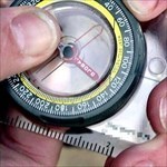
A benchmark is a point where exact elevation is known and is marked with a brass or aluminum plate. It is marked BM on the map with the elevation numbers given in feet. Benchmarks are useful to help determine contour lines.
-
1
-
-
Official U.S. government information about the Global Positioning System (GPS)
https://www.gps.gov/systems/gps/performance/accuracy/#how-accurateQuoteHow accurate is GPS?
It depends. GPS satellites broadcast their signals in space with a certain accuracy, but what you receive depends on additional factors, including satellite geometry, signal blockage, atmospheric conditions, and receiver design features/quality.
For example, GPS-enabled smartphones are typically accurate to within a 4.9 m (16 ft.) radius under open sky. However, their accuracy worsens near buildings, bridges, and trees.
-
1
-
-
Quote
Authorities need your help to solve the biggest jewel heist in history!
The heist at the Teague-Ulmer Museum remains the biggest jewel theft in history and one of the great unsolved mysteries of the museum world. Many theories have surfaced as to where the stolen jewels have been hidden, but after many years investigators have still not retrieved them. New evidence has recently revealed itself and the authorities need your help to find the stolen jewels.
From July 11 to August 11, collect clues to track down the missing jewels. Once you have found all of the jewels, uncover the combination changed by the thieves to return them safely to the vault!
?
-
2
-
-
A1smallfry, you have found 100 caches in Madisson county and another hundred in St-Louis. In Maddison alone, you have still 600 more geocaches to find. There are more than 10.000 geocaches in Illinois you haven't found. If you keep finding geocaches at the same rate as you did the last two years, It will take you at least 100 years to find all the geocaches in your state.
You seem to have almost exclusively tried to find basic traditional caches. No premium caches. No mystery caches. No events.-
2
-
-
Both the black and red paragraphs don't make me fear for my safety, I don't feel insulted and I don't feel I am in any fashion not welcomed to go visit any of those earthcaches, learn and have fun. Neither is the equivalent of an insult ("You're a F&%& M?&*&?") nor of a threat ("I will harm you if..."). Now, realising she used too strong words, terratin admits she feels being asked a photographic proof in bold text is only an annoyance. That's all.
I understand that some cache owners feel the need to write their instructions in big bold red letters because some geocachers simply don't pay attention to the specific requirements of out of the ordinary geocaches otherwise. I see often the (unnecessary, in my opinion) reminder "Bring your own pen" in many descriptions. I see also "The geocache is not located at the published coordinates; you need to solve the puzzle first..." in big bold red letter in the descriptions of many mystery geocaches. I think all those reminders are unnecessary because I consider that if I decided to participate in a game, it's my responsibility as a player to learn the rules of the game first. But, that said, I don't consider those reminders rude or unwelcoming. They don't spoil my fun.-
2
-
-
I see nothing rude or threatening to being required to prove I actually went to the location and met the requirements of an earthcache. I don't take offense nor I feel I am being promised to be assaulted in any fashion. I think you exaggerating.
-
4
-
-
I never "replace" full logs. Instead, I send a photograph of all the signatures to the CO and add a new temporary sheet of paper to make the geocache last until the CO does their own maintenance. If there is no space for even a minuscule temporary log then I just send the photograph.
In my region, truly full logs are very rare. Most geocachers, here, let the CO know the log will need replacement soon.-
1
-
-
-
I too have a Samsung Galaxy J3. It works perfectly fine with the official Geocaching app version 7.11.0. Not crashed even once.
Current Android version for Samsung J3 is 8.1.0. So you might want to update your phone.
Also check if you have enough memory to run the app.-
2
-
-
On https://project-gc.com you can search for archived and disabled geocaches.
-
1
-
-
On 3/23/2019 at 12:46 PM, Sulky team said:
How can I put a banner on my page?
This thread was ―12 years ago ! ― about the Yaesu FT-50 VHF/UHF radio.
For questions about posting images on your profile page, read https://www.geocaching.com/help/index.php?pg=kb.chapter&id=29&pgid=113
And, if you still have questions, try asking on https://forums.geocaching.com/GC/index.php?/forum/138-how-do-i/ -
La plupart des logiciels de navigation ainsi que les appareils GPSr possèdent déjà cette fonction. SI vous utilisez l'un d'entre eux, vous n'avez pas besoin d'un logiciel supplémentaire comme FizziCalc pour effectuer ce calcul.
Quant à FizzyCalc, rien de plus simple:- Cliquez sur l'onglet « Projection »
- Entrez les coordonnées du point de départ dans le champs « Point »
- Entrez la distance de projection dans le champs « Distance »
- Choisir l'unité de mesure que vous avez utilisé à l'étape 3 dans le menu déroulant « Distance Units »
- Entrez la direction de projection dans le champs « Bearing »
- Cliquez sur le bouton « Go » pour obtenir le résultat
-
1

.png)


NASA’s Mars Rover Perseverance is trackable via Geocaching! (TB5EFXK)
in Trackables
Posted
Exactly. Sheloc (Scanning Habitable Environments with Raman & Luminescence for Organics & Chemicals) will be deployed and used when the rover will reach some interesting samples to scan for signs of bygone life. I doubt it will be soon. The rover needs to be fully charged and tested, the big antenna deployed, the high bandwidth link established, a list of nearby regions of interest prioritized, the most effective route planned, the rover moved to the first sample, etc. Remember that the top speed of the rover is 152 meters per hour.
The previous rover, Mars Curiosity, landed on Mars August 5, 2012. It's test first drive was, on Aug. 22, 2012, almost 3 weeks later, going forward about 4.5 meters. I am not sure but I think it took more than a month to reach the first region of interest.