


Gr8Scot
-
Posts
181 -
Joined
-
Last visited
Posts posted by Gr8Scot
-
-
I've been asked the following question by a fellow cacher. I've no idea and can't find and answers in GS help or on the forums. Anyone have any ideas?
"Any ideas on this error, I get it whenever I try and read the GS forums? I get the error on both my pc's, frustrating as I can see thread topics but cant read any content."
-
I'm still waiting for TB's from our good friends SawaSawa, Gr8Scot and Hesamati to be logged in to the Event Cache of the 5th Dec. I believe there may be one on the way from TinyTigger as well. Travel well all TB's from the Western Cape!
Our TB's tags were posted from Gauteng on Friday 26th, so I hope that they get to us by next Sunday! Not very confident, as something posted last Friday via the same service still hasn't got here.
 What happens if they don't make it in time for the start at the event? Can we start late?
 -
Another question: once I buy my GPS device, will I still have to buy maps to load onto it? That's the impression I'm getting from the review I've read.
You don't HAVE to buy maps. Depending on where you live, the free Open StreetMap may be all you'll ever need. In Cape Town I don't use anything else and it's more up to date than the commercially available products. And the mountain trails are way better

You can download the whole of SA & Lesotho with a Mapsource installer (the program you use to transfer the files to your Garmin) from here: Free worldwide routeable maps for Garmin
If you want to see the coverage in your area, go to www.osm.org and just move the map to your area of interest and zoom in.
I have the Oregon and swear by it. If you can pick one up 2nd hand for a good price, I'd do it. Who needs another voice in the car telling you where to go anyway?
-
Looks like we might have a bot trolling logs through the caches - Serl - he has done quite a few amazing caches in a very short time.
I see he was at Drinks with Orange as well. It must have been him that got everyone else's order

-
I imagine that many others involved in Geocaching use this combination of software and may have noticed the following since they upgraded to AVG Free 2011.
1. Freezing of Outlook while downloading Gmail
2. Email sent in plain text (such as topic subscription notifications from this forum) suddenly appearing in tiny font that has been changed to html
These problems have been caused by the upgrade to AVG Free 2011 and are acknowledged as such on their forum. Until a fix is provided, the following work-around from their forum seems to fix the problem:
Open AVG user interface
Double click E-Mail Scanner
Click "Tools/Advanced settings"
Click "E-Mail Scanner" in LHS window
Untick the block for "Scan inside archives" (This is causing Outlook to freeze)
Click "Certification" under "E-Mail Scanner" in LHS window
Untick "Certify incoming e-mail" (This removes the "No virus found in this message" message that's causing the tiny font)
The above seems to fix the problem but still scans new mail for viruses (even though you don't get the message at the bottom of the e-mail).
Please use the above at your own risk.
-
Hi g.i.s.
Royal Ascot is mine.... I remember a log about a horse that ran by without a rider, and the cacher commentating something funny about it... Can't remember anything about pelicans though... Rest assured I haven't deleted a log yet...
Henzz you could possibly search your Inbox archive for the log.
-
Last I heard SaGeoshop's stock of TB's is arriving on the 20th of November.
-
Thought I had I spare TB tag which you could have had, but can't seem to find it - sorry.
Thanks. I ordered some from SaGeoShop. Stock arriving on 20 November, so I should get them in time.
Looking forward to the event!
-
OKAY!!
The Manor House at Meerendal is officially booked for breakfast at 9am on Sunday 5th December.
Would this Event qualify as a starting point for the 2011 TB Race?
Would be great if it could be.
Cool, any objection if I turn up in MTB gear? (No laughing at the legs allowed)

I'd vote YES for using the event for the 2011 TB Race. Just hope I can get some tags in time.
-
FINE WINE 3: A Season to Celebrate
4th or 5th December.
I'd tend towards the Manor House option. I don't see the need to pay Meerendal for the function venue as it's not a spectacular area in any event. Also, having an a la carte breakfast works better for kids. I don't think that the room size restriction will be a problem - you never really get to speak to everyone anyway.
-
Now there's an "out of the box" thinking of tecnology... But how close do you need to be before the GPS "see" the chirp? If it's only 2-3 meter's, then it's not going to help that much.?
The reviewer stated that he got a signal at 20-30 feet (so 6-10m) if in clear sight but only at 5 feet (1.7m) on the other side of a tree. Probably good enough to tell you which room in the house to search

Further reading seems to indicate that it would be no use for my idea though, as it only transmits the co-ordinates previously pre-programmed into it. So unless you knew WHERE you were going to loose your keys.....
Maybe an idea for some inventor to pick up on though? Or Garmin could include some sort of signal strength meter in the software.
-
There's a Chirp "hands-on" review available.
It seems that Groundspeak was caught unawares by Garmin's release of the Chirp and a couple of cachers have reported that their local Reviewers have refused to publish new cache listings based around a Chirp citing "commercial" infringement of the guidelines.
I just wonder if it would be any good to attach to one's keyring so that they could be found if lost around the house. Or any other item for that matter. In my opinion, THAT would be a useful device.
-
Here's something new from Garmin. It's an electronic homing beacon called the "Chirp" that can be placed as cache (or in an existing cache) to give a electronic hint as to where a cache is. Size is about 33x22mm and battery life is about a year. It'll work with the Oregon, Dakota & GPSMap62 and has about a 3m range.
Direct price conversion is around the R 160 mark.
What thoughts on this working in SA?
http://garmin.blogs.com/my_weblog/2010/10/...nnectivity.html
-
Seems things are moving along with this project. There is a civil aviation workshop being held on 26th & 27th of October at Emperor's Palace to explain and discuss how it would impact the aviation industry.
Attendance is free if anyone is interested. Details here.
-
Have you tried running a Pocket Query with the "Dogs Allowed" attribute selected as a search criterion?
Your question raised a good point and made me go back and check that I had used the dog friendly attribute on my caches where dogs were welcome (I had, fortunately). Perhaps this could serve as a reminder to other cache owners to check. So easy to forget if you don't have a Thunder yourself.
-
On the end of a shoelace.
Don't tell me you watch too much Disney Channel as well?? I don't think I'll ever forget that after watching Phineas & Ferb's A-G-L-E-T song over and over.
Over to you CnC
-
Ok - caught a little unawares by getting that right!
Here's a quickie.
Where would you find an aiglet?
-
I seem to recall it was designed by South Africa's official Herald, but I don't remember his name. I think he was called in after a national competition to design a new flag produced no acceptable results.
-
In World War 2 - there was an operation that had relevance to South Africa called "Operation Ironclad" - what was this operations objective?
Did it have anything to do with an attack on a railway line that the Germans were building between Swakopmund & Windhoek in what was then SWA?
-
I've now completed Silvermine East, so all the tracks I currently have have been added to the OSM map.
To take a look at what's included, go here
I've created two Garmin .img files of the area from the Cape Town Harbour to Clovelly and west of the Blue Route. This includes the whole of the TMNP as well as all roads, etc. One is routeable (1Mb) and the other (.5Mb) isn't. These can be uploaded directly to the newer Garmin GPS's. There is also a Mapsource installer for older Garmins for the routeable version. I hope to soon be able to create the maps for other makes as well.
The files are downloadable from the links below:
Please send me ANY feedback, especially if you find something wrong

-
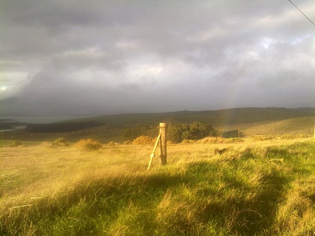
I took this with the cell phone camera at Take a View in a patch of sunlight on an otherwise grey day. Somehow the poor quality of the photo seemed to add to the atmosphere.
-
The update has been causing my Oregon to shut down. It must have happened at least 20 times this weekend.
Which model do you have? Many reports of problems with the x50 update, but none with the x00 series that I've seen or read about. Can you describe when the shutdowns occur or is it just at random?
-
Picked up this interesting piece of news on another forum that is of relevance to to SA Geocaching community:
For those that don't know, EGNOS is the European equivalent of the American WAAS system that assists ground-based GPS receivers in improving their accuracy by sending a correction signal to the GPSr to take account of atmospheric interference, etc.
There is more detailed information in the ESESA (EGNOS Service Extension to SA) newsletter here.
At last we may be able to join the Northern Hemisphere in being able to see under WHICH rock a cache is hidden!

-
If you look at the Table Mountain Parks brochure handed out at Silvermine they talk about Silvermine West (the dam side) and Silvermine East (the waterfall side) checked Slingsby and he does not label - maybe this should be standardized?
You are correct. The above should read Silvermine West.
 What happens if they don't make it in time for the start at the event? Can we start late?


Help needed - can't read forum threads
in South Africa
Posted
Thanks MnCo