


TFTC
-
Posts
847 -
Joined
-
Last visited
Posts posted by TFTC
-
-
For anyone planning a night hike, the next few nights should be interesting.
-
Hopefully your neighbors are more tolerant than his!I am thinking about getting a new 4WD for my Geocaching Adventures. What do you think about this guy? I don't think I could ever get stuck.... and if I came to a boulder that was too big to climb, I could just move it.


-
I bet the hike up was a bear though!Changing subject a little...After you climb a mountain to find a cache - here's a quick and cool(!) way to get down. Several videos on YouTube but this one is of better quality. http://www.biertijd.com/mediaplayer/?itemid=4262

-
I'm going to try out the Garmin XT software once I can find it - I think that might give us the best of both worlds on the phone. I've run into too many problems with the dependency on the data connection using Google Maps and Live Search. There have been times when I'd be driving for 5 minutes while it's waiting to load a map. So having the maps onboard would be a plus - maybe at some point Garmin will use the data connection to get newer POI's than are on the card. The downside is that there is only 750MB free on the card for your own files.Took my TILT on its first road trip. I'll start off by saying that without paying for software its just no comparison to having a dedicated navigational GPS on the dash. Also, I wonder, about wear and tear on the phone as I'm always pressing buttons changing screens on the Garmin. I hate to wear out my new PHONE in the first week. -
July of 2005
<snip>
That one needed a slight enhancement....


-
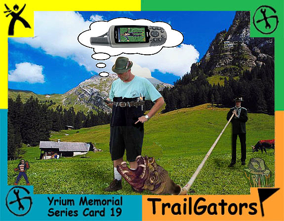
It looks like they are all doing a splendid impersonation of the rock in front of them!I vote for this to go in the calendar (it always cracks me up) - maybe end-page!!!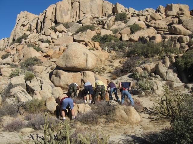
Double-honk if you can name the cachers!
-
Just realized that I was using version 1.2 and it's up to 2.0 (no longer a beta?) now - so I'll at least try the current version!One nice thing with the new BETA of google maps is that your location stays centered on the screen (even if you don't have GPS built in). If no GPS it uses tower triangularization for your location I thought it would auto-update!
  Thanks for getting me to check!
-
I just found two caches today with my Tilt - well, one and a half.
I used Cachemate for PPC - it also has a navigation compass like BeeLineGPS (I have that too), but I find it easier to manage waypoints in Cachemate (in fact, I couldn't figure out how to mass delete them in BeeLineGPS).
It seems you do have to keep moving, like a GPSr without a compass, when caching with a Tilt.
I was having trouble with the second cache, so I broke out my 60cs, and it didn't do any better so something was interfering with the GPS signals in that spot. Finally found it though!
While I think the GPSr is a much better cache-finding experience, the Tilt will do just fine when I don't have the GPSr on me (which is most of the time). I'm waiting for the Garmin X software for car navigation - not happy with Google Maps (which involves too many screen clicks whenever you lose the data connection or stray off course) or Live Search (which actually locks up occasionally, requiring a soft reset) at the moment.
Love the Tilt though - best phone I've had so far (previous was Treo 650).
-
Ah, Qualcomm MSM7200 gpsOne. It doesn't look like the various SiRF tools will be much help then!I should have read RumJungle's post more carefully.The Tilt DOESN'T use a SiRF Star III GPS receiver. There are many applications for changing the static navigation with this model.
Tilt uses a Qualcomm GPS.
-
Hello all,
The Tilt uses the SiRF Star III GPS receiver. It has a mode called static navigation where the GPS is ether tuned for vehicle navigation or pedestrian navigation.
See this article for more information on static navigation.
yes, the problem is so far nobody has found (AFAIK) a way of switching between the 2 navigation modes with this GPS model.
In the BeeLineGPS application (made by VisualGPS mentioned a few posts ago), there is a checkbox for Static Navigation in the Tools - GPS - Manufacturer Specific - SiRF Setup screen. It's unchecked on my Tilt. Dunno whether it properly detects or actually sets the setting, but there it is.
-
Thanks! I'd found this one, but I like the google one better. Though overlapping the 2003 fires is informative - almost lets us predict where the next round might be.
Here ya go TFTC.
Hey, TG - where'd you find that fire map?Here is what the fire map shows: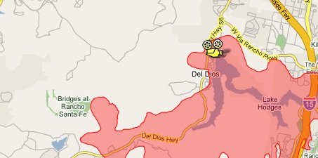
-
Hey, TG - where'd you find that fire map?Here is what the fire map shows: -
Maybe .. but you can choose between Photo and GPS Photo - it's not like you don't have to make an effort to tag the photo.
Privacy reasons. Suppose you take a geotagged photo in your backyard during an event. Party, wedding, barbecue, whatever. You post the photo on Flickr to share with folks who couldn't make the event. You just told the whole Internet where you live, since the lat and long will be in the Exif tags and on display. Yes, you can hide Exif location data. But I'm presenting the worse-case-scenario of a person not being savvy enough to turn off the geotagging function on the phone or suppress the Exif location tags when posting the photo online. The phone's manufacturer is playing it safe to avoid liability if a stalker took fancy to someone in the photo and decided to pay a visit.By the way, thru a registry hack, I enabled the geotagging feature of the Tilt's camera. One of the photo options now is GPS Photo, which puts the coordinates into the EXIF data. Somehow that seems like it has some potential, though I haven't used it much yet. Not sure why they disabled it by default.
-
By the way, thru a registry hack, I enabled the geotagging feature of the Tilt's camera. One of the photo options now is GPS Photo, which puts the coordinates into the EXIF data. Somehow that seems like it has some potential, though I haven't used it much yet. Not sure why they disabled it by default.
-
I have it and tried to find a few caches with it (with my 60cs as backup) - seemed to work ok using cachemate ppc. I used Microsoft Live and Google Maps for driving, but it did lose the data signal a few times (very annoying with Google Maps as a dialog pops up you have to hit OK on). I'm thinking the Garmin X software might be the solution for driving, but it doesn't look like it has a geocaching mode. The way I see it, it gives me the opportunity to try for caches if I happen not to have my 60cs. And if it makes the find a little more challenging, so be it!If I use it while I'm driving (with TomTom) seems to be working fine.However, if I use it while I walk, sometimes the position doesn't update even if you walk for 30 seconds. After that, you get a new position. Then it works for a few minutes and I stop getting new positions.
I have tried in different places (no tree cover) and with different programs and I got the same problem.
Anybody had a similar problem?
Thanks
-
That's what we did - called our answering machine every few hours! Good thing we didn't go with voice mail!Spotted this quote in an article about the fires. Interesting concept if you have an answering machine in the house - presuming the phone lines are still alive in the area."I called my home and my answering machine still works, so that's how I know we're OK," said Rancho Bernardo resident Fuli Du, who packed his belongings Wednesday preparing to leave Qualcomm.
-
No sign of this on the Encinitas web site!Sorry to say this, but parts of Encinitas and Carlsbad are now under voluntary evacuation. -
We're back home - phew.
Forget our house! Let's just hope they can protect our caches!Just got home from work in Encinitas and there is a mandatory evaction from Olivehain, so hope TFTC place is going to be ok. The fire is just west of the Bridges country club.We're ok - keeping our fingers crossed for our house! We evac'd to a house in La Costa where we we were living when we had to evac from the fires there a few years back. Seems like a ritual price we have to pay for all the great things we enjoy by living here.
-
The mountains south of San Marcos are on fire. They are evacuating the area around CSUSM and San Elijo Hills!
Fires near the Escondido Mall.
Fires in Guajito heading west which will take it toward us if it never stops. Hope it stops.
Have you found a place to get up-to-date info? That San Marcos one is too close to us for comfort.
I'm looking at signonsandiego.com from the UT. People are posting under the articles.
There's also a new news blog here:
That's where I've been looking too - just not being updated frequently enough! I want a Google Earth live feed!

-
The mountains south of San Marcos are on fire. They are evacuating the area around CSUSM and San Elijo Hills!
Fires near the Escondido Mall.
Fires in Guajito heading west which will take it toward us if it never stops. Hope it stops.
Have you found a place to get up-to-date info? That San Marcos one is too close to us for comfort.
-
The only thing I've seen is that you can search for a business and point to a kml file online and it will show the 1st 9 waypoints in the file. I sure hope someone comes up with a way to combine geocaching with the google maps app soon!I use the google maps software on my Treo 680 quite a bit, very handy software.Is there any plug ins / software that can turn the mobile google maps into showing caches on it like the geocaching.com google maps option does on the cache info pages? Or like the plug in for Google earth that shows all caches on a page view?
-
That's really bizarre - I can't imagine your caches are being targetted specifically. Have you had any go missing once you've replaced them? You might consider making them member-only caches for a while so you can see who is checking them out.In recent months an unusual amount of our 'in the country' caches have gone missing and with help from our caching friends we have been getting them replaced . But it is still going on.
-
Hehe, watch out you top 50ers!


 I thought it would auto-update!
Has anybody used AT&T Tilt (Kaiser) pda for Geocaching?
in GPS technology and devices
Posted