

Kohavis
-
Posts
397 -
Joined
-
Last visited
Everything posted by Kohavis
-
A good idea. I don't bring gloves, but I should ..... This was near a cache close to home. It's the open end of a railing:
-
Probably to discourage cache raiding. I've read some disturbing and semi-organized attempts in various blogs on the net that encourage people to go out and destroy caches for the sick, twisted fun of it. Requiring them to register records their IP address at least. If push came to shove, someone could view the server logs and identify which registered user viewed which cache just prior to its being destroyed. I'm not sure what could be done about it at that point, but it adds a layer of inconvenience for the would-be raider.
-
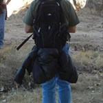
It's easy to get carried away with stuff you load into your geocaching backpack. It's a lot like packing for a trip - most people overpack. I've read some descriptions that defy all reason Some pack blankets, emergency food, even a cook stove with pots and pans That's fine for an overnight campout or that 5-star hide on top of Everest, but get real. You'll never need it for a typical caching outing. Here's what I bring. 99% of the time it's enough, and since I usually walk 5 or 6 miles on a typical hunt, it's light: Water (cooler weather -one 22 oz. bottle, warm weather - two bottles) GPSr Cell phone w/camera Reading glasses Spare logbooks and pencil stubs Spare zip-lock bags in various sizes Notebook Several pens First Aid kit "Tool" kit containing black Sharpie, Swiss Army knife, double-sticky tape, string, magnetic telescoping wand, dental floss, 2 spare fresh AA batteries, sm. spool of wire. Small swag bag Anything more than that is excess baggage for me. The backpack weighs about 5 pounds - easy to carry on long geocaching "death marches"
-
Point at them, wink, smile, and then start rubbing yourself suggestively. They will either move away quickly, or approach you looking interested. Unfortunately, I've never had any females do the latter, only the former Seriously, the "pretend to be taking pics" has served me well. Occasionally I pretend my GPSr is a cell phone. But the one that always works is a combination of pretending to take pics, then scribbling something on a piece of paper. People quickly lose interest when they see that
-
FRS is limited to 0.5 watts and GMRS is limited to 50 watts. However, typically portable GMRS handhelds operate with 1 to 3 watts, but the "power output" is subjective. There are some fine, more expensive GMRS portables that are in the 25 - 30W range, but they're NOT cheap! For an inexpensive radio, you have the two most common options: FRS or GMRS. Both operate in the freq. range around 460 MHz UHF. FRS is cheap, no license is required, and the range is decent for a family picnic or for a car communicating with a fifth wheel it's towing behind it. Outdoor person-to-person max. range is up to about a mile depending on the terrain. Out in an open area, it'll be a mile. In a suburban neighborhood it'll be about 300 yards or so, depending on the radio and terrain. In the woods, maybe half that. GMRS is just as cheap these days because almost all of the radios are hybrid FRS/GMRS. How they managed to get that allowed is baffling, since one radio service requires a license and the other doesn't. I guess the manufacturers have some serious clout with the FCC. GMRS will cost you $85 for a family license, good for 5 years. Range will be up to 2 or 2.5 miles in a suburban setting depending on the radio and terrain, with a highly rated bubble-pack radio. A poorer choice radio, maybe half that, tops. Power specs all depend on where the power is measured - input to final amplifier stage, output to antenna, effective radiated power (ERP), etc. As you pointed out, the power specs are meaningless because if mated to a poorly designed antenna, it's all moot. A radio with a well designed antenna and 1 watt output to the antenna will perform absolute rings around a radio with 5 watts output to the antenna and a crappy antenna. It's all about wavelength and how accurately the antenna is matched to the frequency (1/4 wave, 1/8 wave, something in between ...center loaded, base-loaded, etc.), VSWR (voltage standing wave ratio), dielectric constant, impedance, RF opacity of the cosmetic covering, how good is the effective ground plane?, etc. All interacting and affecting how well that radio works. In this world of mass-produced bubble-pack merchandise, most cheaper FRS and GMRS radios have been made to a general formula that hits the middle of their production variances. Rarely a radio is perfectly matched to the antenna. The vendors are interested in making a tone of them, and selling them as fast as possible. That's why the insanely exaggerated range claims. They're counting on you NOT doing your homework before buying it. You have to move into the pricier enthusiast area of the hobby to get better radios and well-tuned attached or external antennas. Check the web for GMRS websites, usergroups, forums, blogs, etc. Here's a good list of output "power" of several GMRS/FRS radios: http://www.twowayradioforum.com/forum/show...amp;postcount=1 What's far more important is the reviews of the various models in real-world situations. Check out the site. From what I've been able to gather, the Cobra LI-7200 has the best real world range of all radios reviewed and an insanely long battery life. Among the cheap "bubble pack" GMRS radios, it's as good as it gets. http://www.twowayradioforum.com/forum/showthread.php?t=311 Forget the advertised ranges. The sales people pull those out of the air (or other, more unseemly places). As someone already pointed out, those are line of sight from two mountaintops and have no real world meaning. In fact, the LI-7200 is advertised as being a "27 mile" radio, but recently I read a review where someone tested it out on two mountaintops and actually got 32 miles range. The Midland GXT-950 is also a very highly-rated unit, with a range slightly lower than the LI-7200, but slightly more rugged. Read the product reviews at twowayradioforums.com for details. The license fee for GMRS is insane, and geared toward the earlier days (pre bubble-pack) when a good handheld would set you back $300. The total damages for a license is currently $85. That covers your whole family for 5 years, but it's still $85 - or 3-years membership here Considering that the above-mentioned top-rated Cobra LI-7200 can be had for $61/free shipping - that includes TWO radios, two 1500 mAH Li-Ion battery packs, an AC adapter and a desktop dual charging cradle, it's no wonder that people are skipping getting a license. It costs more than the gear! The result: There are millions of GMRS radios out there, and currently only 80,000 licensed operators. You do the math. The FCC has placed a higher priority on post-9/11 homeland security issues and just doesn't go after the individual operating without a license unless he's really asking for trouble, like a pattern of malicious behavior. You're far more likely to be turned in by another licensed operator "dropping a dime on you" than by the FCC itself. And even then, they must locate you, since you're not using a call sign. I'm not advocating operating without a license. I'm saying that there is a move underway to get the license requirement for GMRS dropped, ala the older Citizen's Band service which used to require licensing. If you buy a hybrid FRS/GMRS radio and wanted to remain perfectly legal, you could always limit your usage to channels 1 - 14, which are either FRS/GMRS shared or FRS-only channels, and set your power output to "low" on the shared ones. The radio should automatically limit the power on the FRS-only channels. Then wait and see what happens with the GMRS licensing issue. There are two other options besides FRS or GMRS, namely MURS (Multi Use Radio Service) and FHSS (Frequency Hopping Spread Spectrum)/eXRS. Neither requires a license. MURS uses the 151 MHz VHF band, and FHSS uses the 900 MHz UHF band. MURS is generally assigned to things like remote gate operation and wireless intercoms, but it is legal to operate two-way radios and is "licensed by rule" instead of by individual. MURS has a power limit of 2 watts. The lower frequency means it will fare better outdoors in the woods, but not quite as good inside a mall. The downside is that the radio gear is pricey. I don't have any real-world range info for MURS, but it's probably similar to GMRS. FHSS/eXR uses the 900 MHz ISM band (Industrial, scientific and medical). Wireless LANs, cordless phones and microwave ovens use various "ISM" bands. For the 900 MHz band I'm not sure what the power limit is, because it's subjective, and dependent on duty cycle, but typical two-way radios operate with a radiated antenna power of 1 watt. FHSS has the advantage of being only marginally more pricey than GMRS ($90/pair versus about $60), and has almost absolute privacy due to the frequency hopping nature. Range is as good as many GMRS units, but not quite as good as the top-rated ones. It's person to person outdoor range is about half that of the highest-rated GMRS unit, the Cobra LI-7200. Here's the range of the Tri-Square TSX300, a highly-rated FHSS/eXR unit: Not bad for a license-free radio. The downside is that at 900 MHz, range drops off dramatically with tree cover and hills/valleys. The higher the frequency, the more "line of sight" a radio becomes. Whew! I think I'm done. I hope this information helps someone who is trying to pick a good walkie
-
Don't forget to check the hide location for ownership before you actually hide something. Keeping a few caches in your backpack for impulsive hides is fine, but you have no way of knowing if it's private property or federal land that doesn't allow placing caches unless it's something obvious, like an Open Spaces or Conservancy District area with signage. Research your hides ahead of time. It will prevent having to go back out and re-hide it. Use Google Maps here at Geocaching.com using the maps, satellite and terrain views. Also use Google Earth and Google Street View if hiding an urban cache. For a long hike hide, check the Bureau of Land Management (or the equivalent in your country) and make sure the property is public land.
-
When I started geocaching I used to leave FTF prizes, usually a set of stereo earphones, a USB-to-mini USB cable, a jeweler's screwdriver set, $3 in cash, microcache magnets, etc. But I found that the local FTF hounds don't care about that stuff and some even leave it. And the ones who did take it never commented in the logs, so I assumed they weren't overly impressed. So I stopped leaving a prize. Their prize is logging another FTF.
-
I don't think this has been mentioned yet, but you can really do everyone a favor if you use waypoint averaging when hiding a new cache, if your GPSr has that capability. Most do. Take about 100 readings while standing as close to the cache as possible and let the unit average them. It only takes a couple of minutes. You can watch the error margin drop as it takes more readings. The folks who log the finds will appreciate it and usually comment on how accurate the coordinates were
-
You're absolutely right. For the way we think, and what we want to get out of geocaching. But for some it's all about the numbers. They'll feel disappointed if they don't find 40 or 50 in a day. And for them, that's what they want out of geocaching. More power to 'em That's the beauty of geocaching - you can make it whatever you want
-
The Venture HC is an excellent geocaching unit. You can send caches directly to it from the website, or you can upload bulk waypoints and POIs via other apps like GSAK, Easy GPS, etc. Although the unit specs on the Garmin site says you can't upload Custom POIs (useful for paperless caching), you can. They did a unit software update a while back that enables that function using Garmin's POI Loader. "Geocache ready" is another way of saying that it has special icons for found and unfound caches, automatically adds your found caches to the calendar, and has a feature where you can go on to the next nearest cache directly from the waypoint navigation screen. I'm happy with mine and have no plans to upgrade to a fancier unit. It has everything I need. I was sold on the sensitivity and accuracy of the high sensitivity receiver not long ago when I threw it in my pocket and walked around a mall store for awhile. Even being inside a steel structure it recorded every step. Impressive! The only thing that might be an issue for some is the lack of a card reader. In my case I don't care because the internal memory is plenty for two-state car trip maps, and all of my caching so far has been done in my state. I think you'll be happy with it.
-
I haven't tried it in a couple days. It seems to be working now ....<crosses fingers>
-
I forgot to mention I'm using beta 5.0 too. I guess there's a reason it's a beta release
-
Paperless Caching with eTrex Venture HC and Summit HC
Kohavis replied to Kohavis's topic in GPS technology and devices
Thanks for the assist, IBcrashen. Another thing you can't do with a POI on the GPS is delete it. But POI Loader has that option on this screen: -
The vital information given here is already available on this forum, but it involves a fair amount of searching and web surfing. I've assembled it here as a convenience for other geocaching.com members. This is mostly for the new members just starting out and wanting to make the most of their first GPS units. Many of you veterans have already upgraded to more elaborate units that have more advanced paperless caching built in. By paperless caching, I mean BASIC paperless caching. The more expensive models allow you to store the entire cache page in some cases. I'm talking here about adding your own notes for when you're out on the trail and are tired of dragging along pages of printouts. It can be done using the Custom Point Of Interest (POI) feature. Several of the eTrex line are listed as not supporting Custom POIs in their specs. The two models listed don't, and neither do the newer basic "H" models like the Legend H. I don't know if they will at a later date, so I'll limit this to the two models in the topic title. Usually the units that have Micro SD card readers have had the Custom POI feature since the unit's release. But a lesser known fact is that the Venture HC and Summit HC have had that feature enabled after release via a software update. The Venture HC and Summit HC are often dismissed out-of-hand as being unsuitable for paperless caching. The purpose of this post is to show how to use these units for some very basic paperless duties.: The reason that feature doesn't show up in the Find menu is because you don't have Custom POIs loaded. Once you upload them to the unit, the feature will appear on the menu. You can create custom POIs very easily. My favorite app to do this is Mapsource, which comes with the GPSr unit. Easy GPS also can do this, but it severely limits your text character count in the comments field. In Mapsource, open your current database. Save before you do anything else. Using the Waypoint Tool, click an area near the cache you want to add comments for. Fill in the name and your notes in the "Comments" text area. Keep it brief or it will be truncated later: Repeat for each cache you want to make a note for. Delete your other waypoints, tracks and routes. DON'T save it or you'll lose them - you have a copy of your DB on the HD. Go to the file menu and "Save As" a .gpx file. Pick a name for it. Close Mapsource WITHOUT saving.(You can also save this version with a different name ...just so you don't overwrite your regular DB file.) Download and install Garmin POI Loader: http://www8.garmin.com/support/collection....ct=999-99999-12 Connect your GPS unit with USB cable and turn it on. Start POI Loader. Click "Next". Select "Garmin Device" in this screen: Click "Next". After a few seconds it should find your connected device and show it on the "Device:" line. Click "Next". Select "Install new custom POIs onto your device" in this screen: Click "Next". Now you need to point it to the folder containing the .gpx file you just saved from Mapsource. NOTE: It will load all .gpx files in the folder, so make sure you have cleaned it out of unneeded files before you do this step: Click "Next". Your unit may beep, and a screen will come up saying it was successful Now go to your GPS unit and go to your "Find" menu. You should see "Custom POI" near the bottom: Select it. Now you should see a list of the Custom POIs you've just created: Select it. Now you should see the fruits of your labors - the field notes for the cache: You're done
-
Of those three, I'd say the 60CSX probably has the most vocal supporters. I've heard good and bad about the PN-40 learning curve and display, but it does have that nice ability to use satellite imagery. And I've heard several negative reports from Colorado owners. If your paperless caching needs are modest (just notes instead of the entire published cache page) then don't forget you can add notes via the Custom POI route with the 60 CSX.
-
All of the stages need to be at least 528 feet from the nearest published cache, but they can be as close to each other as you want to place them. But I wouldn't make them too close or cachers might find the stages out of order. Also, keep the distance between stages within walking distance (say 150 to 300 feet) and your log entries will be friendlier.
-
Go to Main Menu > Setup > Units > Map Datum and make sure "WGS 84" is selected.
-
I've just about reached my patience limit with Google Earth/Geocaching.kml. For many weeks now it's been showing caches as yellow pushpins, and the icon changes to the correct green cache icon when you mouseover it. Now it's stopped working altogether. I can't get anything but a red light for the network link. I've tried reinstalling the geocaching kml several times, as well as completely uninstalling Google Earth, and reinstalling. Same problem. Restarting the kml or the app doesn't seem to matter. I don't see any other posts about this recently. Am I the only one? Here's how it looks:
-
Pictures - Cool Cache Containers (CCC's)
Kohavis replied to AmishHacker's topic in General geocaching topics
Edit -
My sister told me about it in an e-mail. Her and her daughter had been geocaching for a few months and loved it. She sent me a link, and since she was coming out the following month for a wedding, she suggested I go along with her on a few local finds and try it out. We found 4 hides, but all it took was the first one and I was hopelessly hooked!
-
I won't repeat what several have reiterated here, but I will add that the Garmin "H" chipset is the real deal. Older GPS units needed a clear line of sight to the sky, but the H Garmins still work under trees and even in buildings. Here's a track of 1/2 mile my wife and I put in inside a mall store. I had decided to throw my Venture HC in my pocket before we headed out, just to see if it would track. The building is a typical steel commercial structure. The track is overlaid on a Google Earth satellite image so there is some systemic error seen as a shift to the right, but it's Google imagery error, not GPS error. Google Earth is notorious for shifts in geocache positions (really obvious when you use the Geocaching KML overlay and zoom in or out). You can see the little jog to the left in my pic as we went through the checkout line and headed for the exit. Google Earth shows it as being about 20 ft. outside of the front door when it was really about 6 feet inside of the door. But my point is that it tracked us inside a steel-roofed, steel-framed building with ductwork, conduit, roof machinery, etc. - about the worst possible scenario for a GPSr short of being in a copper mine or something :
-
The Midland gxt850 is an FRS/GMRS radio. Most are nowadays. The channel you choose determines which service you'll be using. FRS is shorter range, limited to 500 mW power, and doesn't require a license in the US. GMRS is limited to 20W (although almost all radios are 5W or less for portability), DOES require a license (with a $10,000 per violation fine if you ignore it), and has better range. Basically, channels 1 - 7 are shared FRS/GMRS. 8 - 14 are FRS-only and 15 - 22 are GMRS-only. When on the FRS-only channels your radio probably drops the output power to keep it legal. My wife and I are in the market for a pair of talkies. She wants to go off and do things I'm not as excited about, so I'll go off and geocache meanwhile. When she's done she can call me to come and get her. We'll be in areas where cell coverage is iffy, so the talkies make the most sense. I've done a lot of research into various expert reviews, and the units I've decided on are the Cobra Microtalk LI-7200. I should be getting our pair this spring. For $60/ free shipping it includes a pair of them along with two 1500 mAH Li-Ion rechargeable batteries and a dual table-top charger for them. They're supposed to have the best range of all GMRS radios, and the best battery life. The Midland gxt850, along with the 900 series, are also very highly-rated radios, and are a bit more rugged than the Cobras, so you have a pretty decent radio there
-
Simple. First to sign the physical log in the cache = FTF. Period. It doesn't matter who logs online first. It means more to some than to others. We have a local cacher who is a real kook about FTFs. I believe that's the only reason he caches at all - to be the first on as many caches as possible - at ANY cost. He's left work in the middle of the day to go after an FTF. He's gone after them without his GPSr. He goes out at any time a new hide is published. I think it's sad, and he's missing much of what makes geocaching so special, but that's what melts his butter, so more power to him. That's the beauty of this sport - you can focus on whatever you want. Personally I don't give a fiddler's fig about FTFs. I'm not competing with anyone. I'm out to enjoy it and have a good time, get fresh air and exercise, see new areas, and hone my skills. I have 185 finds and not a single FTF. I gave one a half-hearted try once, but someone beat me to it. You guessed it - it was mister FTF-OCD Congrats to you on yours. It is a thrill (or so I've heard). Just don't become too focused on just one facet of geocaching to the exclusion of all the other good things it has to offer
-
Todie's Wild Ride - Kohavis Sidecar completed mission: Travel from Manitou Beach, MI to Albuquerque, NM. Mission changed to travel cache to cache spreading the word about motorcycle awareness. http://www.geocaching.com/track/details.aspx?id=1636861
-
Thank you for pointing out my relative inexperience in the sport, although I'm not sure what your motives were I'm passing along the advice so what happened to the hide in the OP doesn't get repeated. I may not have as many finds as you do, but I believe the advice is still valid.