

Melack
-
Posts
13 -
Joined
-
Last visited
Posts posted by Melack
-
-
If you decide to go with the 60csx, REI has it on sale this upcoming weekend - the bundle with TOPO 2008, soft case, cable and receiver for $340-350. Pretty good deal considering the software, alone, is $100.
-
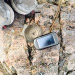
So, my Oregon 400t came - and I love it. Some weird things to get used to, but so much nicer than my previous ridiculous setup.
Yes, the screen is dim, but I'm holding it in my hand so I don't care

I was surprised to find it was not rechargeable and didn't include batteries, but it's not a big deal. It seems very very accurate.
I love being able to send caches to it straight from the site, and ALL the info is there!
I can log caches as found or not found, but this doesn't seem to feed back into geocaching.com - and then, I don't know how it would without some kind of conduit. So, I am finding them, and manually logging my finds when I get home, using the 400t as reference. Does anyone know of a way to automate this?
My Account>Access My Fieldnotes>Upload Field Notes From Your Garmin Colorado (Works for Oregon, too).
Once the field notes are uploaded and displayed, click on the log option. Any notes that you entered on the cache in your Oregon will show up, which you can modify. Once you submit the log, the cache will be removed from your field notes on the site, but will remain on your Oregon unless you delete the text file.
-
Hmm. Interesting. I don't know anyone with an Oregon 400t, but I can kind of see how that works. I would still prefer a licensed copy, so perhaps I'll wait to see if a v.2 gets released for sales.
I tried to edit my post last night, but the site wouldn't load: I meant to add that part of the reason I would like all of the maps is that I am an applied anthropologist and I travel frequently (cross-country and internationally) with very little to no notice. In this sense, it is very difficult for me to pick and choose what areas I should have pre-loaded, or to take the time to load additional maps on the fly.
This has me thinking that I should exchange REI my 300 for a 400t; however, seems as though the segment issue will come into play? Since I have some more fieldwork in Europe coming up, as well, I was hoping to set up one 4-8GB card for US with TOPO and CityNav, and another similar card for Europe. Would like one setup for Central America, as well, if there's software to support it. In this case, having pre-loaded US maps will not always be an advantage for me - though, capacity afforded by deleted sections may.
So to be sure I understand correctly from Cacheoholic's other thread and g-o-cachers' response above, when I install City Navigator, I need to install it at the same time as TOPO 2008, and when I do, they are entered together in a way that the segments are added and count further against the segment limit? In other words, there is not a segment limit for the maps individually, but it is instead applied to them together?
Thanks for your time! Sorry for being so dense!
-
Finally got my Oregon - decided to go with a 300, as I thought I needed to get the U.S. TOPO 2008 software anyhow, but didn't realize the 400t version was more compressed. Is it possible to get all of the maps onto a microSD card at once? I have a 2GB card, and have heard larger cards aren't as stable? I'd also like to put CityNav (?) on at some point, so just wondering what others do/have done?
Additionally, I was out caching tonight (first time out caching on my own
 ) and had the 300 lockup on two caches in a row right after the approaching alert came on. Had to turn off and on the receiver in order to un-freeze it. Anyone else with this experience? - I didn't see that noted in the wiki.
Otherwise, the Oregon was awesome and ended up within 0-1 feet on two caches! I'm officially addicted.
I appreciate any thoughts! Thanks.
Keep in mind with Topo2008 even if you have enough storage space you'll run into 2 other limitations (I don't remember which you'll hit first, but I think its the later):
- Mapsource won't produce files larger than 4GB (probably because of the 4GB FAT file size limits)
- The Oregon has a map segment limit which is probably similar to the Colorado (4k-5k).
Topo 2008 has around 6600 segments so you'll need to decide which 2600 you don't want to load.
As for the freeze issue, can you reproduce it? My OR has always felt sluggish when moving slow near a cache -- and I've seen the distance decrement and the map not update, but I've never had to reset the unit, its just a matter of moving faster or getting a better view of the sky.
GO$Rs
Thanks for the replies everyone!
g-o-cashers,
I saw the discussion on the segment limitations and 4GB (3.8?) limits in your Wiki thread or another recent thread. Sounds like there might be a work-around if one gives up some DEM (not sure what that stands for, but I get the gist), so I might try that, or just be selective on what to store at once. I was hoping to install City Navigator, as well - perhaps I should have started with the 400t, but I wanted the DVD to sync with my Mac, thought the compression was the same, and thought I'd be wasting $$$ ... Seems as though I can run a partial TOPO 2008 and CityNav on a 4-8GB microSD (?), so I may experiment, but now I'm a bit emotionally attached to the 300 after 20 fun caches in two days:P
As for the freeze issue, I repeated the freeze on all 10 of my first 10 caches (7 of which were in wide open spaces), so on Sunday I tried a different approach: I adjusted the Geocaching profile's tracking to off-road and tracking at 10 or 30 seconds instead of auto. After doing that, ran 10 other caches and didn't experience any freezes, though did experience a short lag period (~30 seconds) on one cache. Of the second 10, several were in fairly/heavily dense cover areas. For the most part, I'm getting 3-7 foot readings at GZ, with an occasional <1ft! Had one fluke cache with 25' foot best, and that's been the worst I've seen so far!
This Oregon is a tack driver, and I'm loving it. Wish I could get the entire map system on it, but as long as the freezes stay gone (knock on wood), or limit themselves to short lag periods, I'm extremely happy. Beats the heck out of my old 1st gen Vista (that was loyal until it died[RIP]). I've read and re-read the wiki (thanks!), but will gladly take any additional tips or thoughts on this issue or any other. I will update if I run into the problem requiring power off/on again.
-
I posted this question/issue in another thread, but thought I'd add it here:
Received my Oregon 300 three days ago and have had this issue occur on 10 out of 10 caches since - As I approach the cache, the approach notification comes on. After hitting 'OK' and returning to the map or compass screen, the receiver's orientation locks up. Distance to the cache continues to count down (inaccurately due to the loss of orientation), however, the blue arrow and purple indicator on the map screen, and the azimuth on the compass are frozen. Each time this has occurred, I have had to power off/on the unit, locate the cache again, and 'Go,' which does the trick.
Has anyone else experienced this, or any thoughts on a solution?
-
kinda sounds like a memory issue...just really slowing down. Has a hard reset solved the problem in field?
I'm a bit of a newb, so I'm not sure what hard reset means. Turning off and on the unit has been effective each time in getting the receiver active again until the next time. I haven't tried using the 'Restore Defaults' feature in the Setup>Reset>Restore Defaults if that's a hard reset? Thanks!
ETA: Ok, I figured out how to do a master reset - I also posted this issue/question in g-o-cacher's Oregon Wiki thread. I'm going to try adjusting a few settings and test it on a few caches today. Thanks for the replies so far!
-
Thanks GeekBoy and grof. Looks like I'll try a larger card in that case. I went out and hit 6 more caches today, and had the lock-up issue occur on all six - each time I got close to the cache, the alert would signal and then the blue map direction arrow and compass would lock up. The distance to the cache/waypoint would continue to measure, but would be off. Almost as if the compass lost calibration and the GPSr suddenly was unable to orient itself - so, not a total freeze, but a functional freeze.
From what you're saying, grof, sounds like the problem isn't repeatable for other 300s... Anyone else with experience one way or another? Is it possible for me to turn off the alert in order to test whether the failure will occur regardless?
Thanks for reading and any thoughts!
-
Finally got my Oregon - decided to go with a 300, as I thought I needed to get the U.S. TOPO 2008 software anyhow, but didn't realize the 400t version was more compressed. Is it possible to get all of the maps onto a microSD card at once? I have a 2GB card, and have heard larger cards aren't as stable? I'd also like to put CityNav (?) on at some point, so just wondering what otuers do/have done?
Additionally, I was out caching tonight (first time out caching on my own
 ) and had the 300 lockup on two caches in a row right after the approaching alert came on. Had to turn off and on the receiver in order to un-freeze it. Anyone else with this experience? - I didn't see that noted in the wiki.
Otherwise, the Oregon was awesome and ended up within 0-1 feet on two caches! I'm officially addicted.
I appreciate any thoughts! Thanks.
I don't think you'll have any problem there. I have an Oregon 400t with a Transcend (Cheapo) 4 GB Micro SD card in it. Since the unit already had Topo installed, I've now loaded the entire City Nav NT disc, the entire Inland Lakes disc, and the entire Eastern 1:24,000 National Parks disc onto this card, and, by the way, it has functioned flawlessly. This card cost me all of $24.10 delivered to my door!
I think the whole Topo 2008 program only sits on about 1 GB.
That's what I thought, however, when I try to transfer the TOPO 2008 map to the Oregon (even just CONUS) the file far exceeds 1GB and the space on the card. Perhaps I should give a 4GB card a look. Thanks.
-
Finally got my Oregon - decided to go with a 300, as I thought I needed to get the U.S. TOPO 2008 software anyhow, but didn't realize the 400t version was more compressed. Is it possible to get all of the maps onto a microSD card at once? I have a 2GB card, and have heard larger cards aren't as stable? I'd also like to put CityNav (?) on at some point, so just wondering what others do/have done?
Additionally, I was out caching tonight (first time out caching on my own
) and had the 300 lockup on two caches in a row right after the approaching alert came on. Had to turn off and on the receiver in order to un-freeze it. Anyone else with this experience? - I didn't see that noted in the wiki.Otherwise, the Oregon was awesome and ended up within 0-1 feet on two caches! I'm officially addicted.
I appreciate any thoughts! Thanks.
-
bsatroop57, have you checked out the Orienteering merit badge book yet? You might also check out the Army IET 600-4 training manual, which has a section on navigation, map reading, and protractor use:
http://usmilitary.about.com/library/pdf/armyietguide.pdf
A few detailed maps would be a great start, but in the long run, a GPSr will go along way and even 1:100,000 TOPO map software will be more versatile and less expensive (considering coverage/cost of numerous USGS maps).
-
Does anyone know if the 2.5 firmware update takes care of the 2.4 issues regarding the barometer and tide tables?
Yes, I believe that 2.5 fixed the barometer and tide problems.
Thank you

-
Thanks for posting this thread Super-T. I am in exactly the same position as you are as far as needing to replace my Vista, which became terminally ill this summer.
I've had a chance to use the 60csx and have been planning on purchasing it; however, as mentioned above by Roaming Man, I'm also a bit leery of getting into a unit that is nearly three years dated... I understand that it is a benchmark of sorts, but I'm a gear junkie, and would prefer to take advantage of more recent tech if it's panning out.
Does anyone know if the 2.5 firmware update takes care of the 2.4 issues regarding the barometer and tide tables?
Help! Ned advise in buying a gps for caching
in How do I...?
Posted · Edited by Melack
REI has a sale on the 60csx bundle, including TOPO 2008 (which is $100 alone) this weekend... $334.99.