

davesterx
-
Posts
18 -
Joined
-
Last visited
Posts posted by davesterx
-
-
You might check into asking local geocachers in your area for help in running the event, borrowing their GPS devices for the duration of the event rather than having them donated permanently. You could probably get some of them to come out and help set up and run the event.
-
I did a scavenger hunt at an event in a local State Park recently. The hunters were given a list of coordinates with a list of questions to be answered at each location. There was a time limit and points were awarded for every correct answer and in a tie breaker for earliest time back to the start. You could work individually or get together with other cachers and work as a team (the time was very limited and the coordinates were spread out over 20 miles of trail). Examples of questions: What animal is depicted on the sign at these coordinates? How many "candy canes" are at this location (actually steam pipes in the same shape)? How many slides are there at this playground?
Two weeks ago, I set up a cub scout geocaching scavenger hunt for a friend that wanted to teach his scouts geocaching. I placed 14 caches in a wooded park ranging from micro to 50MM ammo can. I put different letters in each cache which the scouts collected as they found each cache. The scouts were split into four different teams each with a GPS and each scout having an opportunity to "drive" to a cache. After finding several caches and collecting several letters, each team converged on the final location where a box was locked with a word-combination lock (actually two locks). Given the letters collected from the caches, the scouts had to figure out the letters formed words to unlock the box revealing a "Yule Log" with a small gift for each of them to take home. Surprisingly, these fourth grade boys found the caches and solved the puzzle very easily.
For the scouting event, I scouted the site to get the different cache locations and then created "artificial" geocaches in a database of GSAK (Geocaching Swiss Army Knife). I was then able to upload these geocaches into two Colorado and two Oregon GPS that were used for the event. The morning of the event, I ran out to the site and placed each of the caches confirming that the uploads into the GPS were successful and the coordinates were correct.
Hope this helps! Have fun!
-
It sounds to me like those that were trying to access the web site while it was down for maintenance would experience these problems. Try again now that the site is back up and running.
 Went out caching today, and while the app gives me my gps current location, it won't find nearby geocaches, tells me I have a communication issuer, There was an issue connecting to Geocaching.com, please try again! I have been trying for 7 hours, wasted a day out as I couldn't get to anything. I re-booted my iphone, I have a solid 4 bars, everything else works, email, on line games, etc., but won't find caches!!!! What's up????
 -
The story behind the story is that according to the logs of the cache, geocachers finding this cache, had, for several finds, reported that they were confronted by neighbors. It appears as if nobody stood their ground and actually calmly explained that they were geocaching and the container was hidden as part of the game. I lay bets that the property owner did not give permission and even if they did, the cache owner should have recognized the signs.
I had a situation once where I accidentally stepped onto someones private property because the coordinates I had were wrong and they came out and irrationally threatened to kill me without even giving me a chance to apologize and explain my error. But even in the face of such threats, I didn't run (he didn't have his gun!). I repeatedly apologized and got back onto public property as quickly and calmly as I could.
The point here is that a serious negative exposure of the geocaching community could have been defused without calling in the bomb squad. It really is a lesson for all of us to learn from.
COLORADO SPRINGS, COLO. -- The Colorado Springs Police Department's bomb squad investigated a suspicious package Monday morning, causing a road to close and four schools to go on lockdown.
According to a neighbor, a man was walking behind homes in the 8900 block of Estebury Circle when a homeowner sitting on his deck questioned the man. When the homeowner started questioning him, the man dropped a mason-type jar from his hand and fled the scene. The homeowner thought the jar, which had tape around it, was suspicious and called police. A bomb squad robot destroyed the package, which was found in a ditch between homes.
Nobody was injured, and police said the package turned out to be part of an online geocaching game.
Police shut down Research Parkway in both directions west of Austin Bluffs Parkway as the bomb squad investigated the package. The road is now open.
Timberview Middle School, Liberty High School, Prarie View Elementary School and Explorer Elementary School were on lockdown until about 9:40 a.m. as a precaution, according to police.
-
It isn't clear to me what you are trying to do.
If you want to change "found" geocaches to "unattempted" you can do this one-by-one on your GPS. The instructions are at the wiki page. (I needed to do this yesterday)
If you just want to remove all of the "found" geocaches from your device, then you need to do this by connecting your GPS to a computer by deleting the GPX files (again, there are instructions available about which files to delete).
The Garmin software does not provide a solution for removing/deleting GPX files or individual geocaches directly from the screen/interface.
i only just got my oregon 450 and i want to delete all the geocaches that i have found,so when i go on holiday i can have a clean sheet
-
"Photograph requests in which the CO requires specific content (must include the visitor's face, for example) should be made optional..."
What is meant by the words "specific content" other than the example provided (can't require a photo of the visitor's face)? If I require specific content: I.E. You log must include a photo of the rock face that you measured..." is this not allowed? I fear the lack of specificity to the requirement will get you nothing and for what is worth will lose its utility.
I recently did a GREAT earthcache where I had to identify, measure and photograph dinosaur tracks and calculate how fast they were moving at the time the tracks were left. There were a lot of tracks so there were a lot of possible answers. It was a 6 mile hike to the site where I had to cross an ice-cold river to accomplish the task. I would consider the requirement to photograph "specific content" was in place at this site primarily so that the CO could verify my answer against the particular track set that I measured.
I would like to make my own EC sometime soon but am being scared away by what appear to be ambiguous rule sets.
What is the issue with photos? If the issue is personal privacy, why not just say something like this then in the guidelines:.."Requirements for an earthcache logger to post a photo of THEMSELVES at the cache site must be optional. Earthcaches may require a photo as a logging requirement (in addition to the other learning tasks) if it clearly supports the learning process and/or validates that the cache location was physically visited."

You are absolutely right.
This whole thing is as clear as mud! Just what the heck is specific content? Can you require a picture but not say what ya want in the picture? This is a example of the right hand not talkin to the left hand. For those of us who have done a lota earthcaching, we need some clear water.
Please, would the reviewers, Groundspeak and geoaware put out a clear statement about pic requirements and what can be required in the photo?
The term 'specific content' refers to content that is not related to the site or educational logging tasks. For example, asking for the face of a cacher, a picture of their vehicle, the picture of their dog......are not related to the site or the logging task. These photo requests MUST be optional.
Thanks for the clarification.

-
"Photograph requests in which the CO requires specific content (must include the visitor's face, for example) should be made optional..."
What is meant by the words "specific content" other than the example provided (can't require a photo of the visitor's face)? If I require specific content: I.E. You log must include a photo of the rock face that you measured..." is this not allowed? I fear the lack of specificity to the requirement will get you nothing and for what is worth will lose its utility.
I recently did a GREAT earthcache where I had to identify, measure and photograph dinosaur tracks and calculate how fast they were moving at the time the tracks were left. There were a lot of tracks so there were a lot of possible answers. It was a 6 mile hike to the site where I had to cross an ice-cold river to accomplish the task. I would consider the requirement to photograph "specific content" was in place at this site primarily so that the CO could verify my answer against the particular track set that I measured.
I would like to make my own EC sometime soon but am being scared away by what appear to be ambiguous rule sets.
What is the issue with photos? If the issue is personal privacy, why not just say something like this then in the guidelines:.."Requirements for an earthcache logger to post a photo of THEMSELVES at the cache site must be optional. Earthcaches may require a photo as a logging requirement (in addition to the other learning tasks) if it clearly supports the learning process and/or validates that the cache location was physically visited."
-
Tried the pocket queries to the gpx file, does not load to colorado _ step 3 on link - any suggestions?
How far from your current location are the geocaches in that PQ?
Have you tried searching by Name, rather than the default Distance?
Less than 10 miles from home - when search by name not found
You did get the PQ via e-mail and unzip the two GPX files, right? Sometimes folks think they can download it directly from the website by previewing the results and all you get are LOC files.
When you connect your Colorado to your computer via USB, what files are currently in your d:\Garmin\GPX folder?
They are unzipped GPX files, and when the colorado folder comes up - the gpx files are dragged in the GPX folder - show up as in the GPX folder. Did this with a local Wherigo cartridge and it loaded onto the colorado but the caches do not.
We are on our way to a local event and hope to get some help there. Thanks for your suggestions here and any new ones would be appreciated. Is there a folder or shortcut you can put on the desktop to see the garmin colorado and files associated with it?
I use a program called GSAK to manage and upload all my caches but I've seen a similar situation happen before. Delete the GPX file in this directory (don't delete anything else!), disconnect the GPS from your computer, remove the GPS batteries, wait 10 seconds and then put the batteries in and reconnect everything. Re-install the GPX file. I have found that sometimes when I load a GPX files it "doesn't take" even when it appears to be there. Deleting and re-installing the file as described seems to fix the problem.
-
I just started doing this and it works great: I set up a pocket query for "New Caches placed in the last week" but leave it unchecked so it won't go to my e-mail. Then, since I like to use the map function, I can go to the map and look at where they are and decide whether I want to individually download these new caches or have the query sent to my mail box or none of the above. I also have notifications set up but I keep those limited to my immediate area so I don't get inundated with mail.
On a related note, I set up a query for "caches not found" in the same way. This way, I can go to geocaching.com and see on a map where there are caches that have not yet been found (because they are new or whatever the case).
-
While I understand that the real issue with the virtual caches was the armchair loggers that never visited the site, I find it profound that Earthcaches that are "educational" are allowed, but that virtual caches that are "educational" are not. What I've seen is that some cachers are making Earthcaches out of virtual caches by finding some geological aspect that they can attribute and yet still provide the educational tool that a virtual cache provides (Gettysburg has a number of "Earthcaches" that tell about how the terrain aided/hindered the fight). Obviously, I like virtual caches in the cases where physical caches are not allowed (The National Mall for example), and appreciate even more those physical caches that bring the cacher to learn something. Maybe what is needed is an alliance with some historical organization like Geocaching.com has with the Geological Society of America to review and post historically meaningful virtual caches. While I could care less to waymark the local loaf and jug, virtual caches to historical places are something I like to do.
-
Are others having trouble with the pictures that are part of the listing not showing. Makes unknowns based on the pictures just a little tough to do.
I'm seeing pictures not loading on the main page, the forum sites and on any listings. Came here to see what was going on. Glad it's not just me!
-
Not to worry, the poles don't hold the satellites in position, that would be gravity. However, your compass will be all messed up.
But don't they need a compass to stay on course? If the pols reverse, compasses will no no point north.
If you are referring the satellites, "they" stay in the proper orbits in a number of ways (including controllers who monitor and maintain their performance on the ground - this is called station-keeping) but none of them have to do with the Earth's magnetic poles. For the folks on the ground it is another story, but I know a lot of people that don't use their GPSr compass anyway. For those still using a Map and compass to navigate, we've got a BIG problem if we don't know where the pole is!
Now a little science...the Earth's poles flip about every 700,000 years (give or take a few thousand years) and it last happened about that long ago. Nobody knows if the flip occurs instantaneously or over a period of 10s, 100's or even 1000s of years because we've never experienced one before. And the likelihood that we'll experience one in our lifetime is pretty small (but not zero!).
Dave
-
I'd be more worried about Dec. 21st 2012 when the earhs magnetic poles are going to rotae and all the satalites will either come crashing down or float away.
Not to worry, the poles don't hold the satellites in position, that would be gravity. However, your compass will be all messed up.
Dinosaurs? Anyone else thinking about difficulty-5 travelling caches? Ha ha...
The stuff about the GPS satellites is just fear-mongering... But a necessary part of making sure we get the funding we need to keep those babies up there and running!
The folks that hold the money to keep these satellites up and running don't listen as effectively if the program is not "bleeding" or without public outcry.

Anyway...back to your regularly scheduled program...
-
As a fairly new cacher, just my two cents:
I love virtuals in cases where cache placers have been unable to put a physical cache because of rules.
Waymarking would be an acceptable replacement in my view, if I could download a pocket query for a visit area and then manage them for uploading into my GPS like other cache types.
As it stands now, I'm not interested in logging visits to all the McDonald's or the Ethiopian markets in my area.
If you were to make me choose between a virtual and a micro cache, I'd rather do the virtual in a second.
To round this out, and I understand I'm in a minority here, I'd like to see a "history cache" category where virtuals would be allowed in those circumstances where a physical cache logging requirement is not possible (such as a visit to the Air Force Academy Cathedral).
I should note too that there are SOME cachers that don't want to root around under a tree in an urban setting to find a micro cache but enjoy what they get out of visiting a site and proving they've been there by answering some questions, taking a photo and learning a little about the subject matter.
-
I was just wondering what all you geocachers carry with you. Thanks
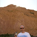
I usually carry a travel shoulder bag (like you'd get for going on an airplane) and wear a camelback full of water. In the bag, I carry my GPS, a small digital camera and gorilla pod, gloves, tissues, a small first aid kit, a gerber tool, an extraction tool for micro caches, and any TBs or coins that need to be dropped off. I also carry extra batteries for the GPS and a head-lamp just in case I get caught out after sunset.
For tougher terrain or for longer hikes, I carry the above items in a backpack (with camelback installed) instead and add walking sticks to aid in getting up steep elevation gains at high altitude (I'm in Colorado). In this case, I also add a snack or two (candy bar, trail mix or jerky) to my list of things to bring.
One of those small rolls of TP isn't a bad idea for the longer hikes. I have them in my geocaching tool box, but haven't ever had a reason to take one along (yet).
Dave
-
No business, no family vacations, no visiting just farthest ever specifically to geo cache.
A couple of weeks ago, I went just over 300 miles from home to find caches in New Mexico, Texas and Oklahoma...just to color those states "red". A week later, I went around 200 miles to get caches in Kansas and Nebraska. I am planning a 400 mile trip in a few weeks to get to the Four Corners virtual cache (I have a thing for virtuals at state corners!). After that, that's about as far as I plan to go in a single trip just for geo-caching.
Davesterx
-
My hiking goal in 2009 is to get to at least four caches above 14,000 feet and five above 12,000 feet. I'd like to get to a total of 100 above 10,000 feet but that may be a little too lofty of a goal but there are plenty of high altitude caches near my home in Colorado!


How do you handle all your stuff
in How do I...?
Posted
For car-caching, I usually only need a pen, a set of tweezers and a note pad to go along with my GPSr. I stuff them in my jacket pockets as needed. I keep everything else I might need in a trunk organizer.
For long backpacking trail hikes and biking, I use a camel-bak backpack to carry water and whatever else I need. You can find these just about anywhere.
For shorter trail hikes and urban caching, I have a shoulder sling bag similar to what was pictured previously but smaller. It has a pocket designed for a cell phone on the strap that I keep a Gerber tool and an outside pocket that I keep a pen, small tick tweezers, and a notepad. It has a small outside pocket on the top that holds my GPSr perfectly (when I'm not using it). The large interior pocket holds gloves, headlamp, point-and-shoot camera, gorilla tripod for camera, swag, travel bugs, travel first aid kit, and anything else I'd like to carry (such as munchies for the trail). The sling bag also allows me to wear a camel-bak or backpack if I want or need it.
For most situations, I prefer the sling bag because then I don't need to take the bag off to access whatever I need to reach and not having my pockets stuffed with junk. I should note that I was using one of those bags you clip around your waist, but then saw this bag at REI and knew it was perfect for geocaching.