

IVxIV
-
Posts
987 -
Joined
-
Last visited
Everything posted by IVxIV
-
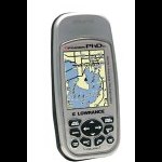
While I'm sure the Sirf III chip is an appreciated enhancement in GPS technology, I'd caution giving it any more credit than it is due. I bought my Lowrance iFinder Pro back in March 2004 and, it would get an equally reliable position lock while sitting in my livingroom too, about 15 feet in from the nearest window And it's ability to retain signal lock under amazon-like treecover is flat out amazing! Seems nowdays everyone is praising Surf technology for bringing GPS out of the dark ages, but personally I don't think it's as revolutionary as some may think.
-
Does Bad Batteries Affect The Reception Quality?
IVxIV replied to bengtb's topic in GPS technology and devices
Yep batteries on the verge of death can affect signal reception quality. But "bad batteries" meaning a pair of cheapo discount batteries should (fully charged) provide just as good GPSr performance as would top-of-the-line mega $ batteries. It's just the cheapos will likely die sooner -
Not sure if the transducer portion of your unit would get upset if used out of the water or not.. isn't there any mention or warning in the owners manual about it's use while the boat is trailered? If there is no warning then I would suggest you go ahead & give it a try. If that makes you nervous, just disconnect that sensor from the receiver. Re: contacting Lowrance for support. I find they are very helpful & friendly if you PHONE them. If you send an e-mail query though, you might be waiting a while for a response.
-
Sadly the old original black&white Etrex's have built a reputation for poor signal lock performance under tree cover. All GPSr's will eventually lose their lock but the early Etrexes will usually lose theirs first If your friend can afford to upgrade to a color etrex then he will likely be pleased with the improved signal reception in the woods. Or, try another model. Just make sure it is a newer model & things should improve. Also, it really isn't an issue which sort of antenna the GPSr has. A modern GPSr with a patch antenna will work as-good-if-not-better than a unit with a quad helix antenna
-
So... I Have A Garmin Vista Cx And Was Wondering...
IVxIV replied to Hobo Joe's topic in GPS technology and devices
Mapsource will open .gpx/.loc files directly, make sure you have the latest version of the software (6.11). The version that came with my Cx would NOT open gpx/loc files but the upgraded version will -
Guys, Google Earth is free. Enjoy it
-
Or how about Lowrance?
-
Just Ordered Garmin Cn V.8 And Have Questions
IVxIV replied to planewood's topic in GPS technology and devices
Just a quick question of you don't mind.. I have a Vista Cx & have ordered CN8, but it hasn't arrived yet.. In the meantime I'm just using the Mapsoure software to load Geocaches into (what I thought!) the 32mb card that came with the GPSr. Well, after loading 500 Geocaches into it, the thing starts saying "memory full!" Umm,,, huh? That piddly bit of data couldn't have filled 32 mb.. What I'm realizing now is that the Geocache locations loaded directly into internal memory and NOT into the MicroSD card(?) I look all over the manual etc & can not figure out what I did wrong.. Help! -
Cheapest Price For City Navigator, V8?
IVxIV replied to planewood's topic in GPS technology and devices
I ordered mine from www.GPScity.ca (Canadian site) for $143, which is the best price I could find. But, yup it's currently on backorder.. -
Do You Have To Have A Gps To Be Able To Find A Cache
IVxIV replied to sasha.p's topic in How do I...?
im confised already whats a topo? Oh, just to clear up any remaining confusion, TOPO is short for topography, which basically means terrain details like rivers, shorelines, elevation changes etc. Quite often the terrains TOPO will be very helpful to isolate a precise location of a cache especially if it's a fair ways off the beaten path. Good luck! -
Do You Have To Have A Gps To Be Able To Find A Cache
IVxIV replied to sasha.p's topic in How do I...?
Sure. Just find a map with a nicely detailed TOPO & coordinates resolution & figure it out the "old fashioned way" lol There are a few here that do it that way. -
Here's the owners manual for starters, hope it helps! => Click <=
-
Wether or not a GPSr has the Sirf III chip is not going to "guarantee improved performance" all the time. Yes as far as I know all the color Lowrance iFinders have the Sirf chip. The Garmin is using a Quad helix antenna whereas the Lowrance is using a Patch antenna. That too is not to imply one is better than the other, but that both do work a bit differently. Modern patch antennas are as-good-if-not-better than modern quad helix ones.
-
Thanks stevesisti that helps relax my concerns quite a bit. Yes the roads & river/lake contours depicted in the basemap are quite crude & "blocky" in their shape, I suppose they're just ment for general reference more than an accurate track, and GOOD TO HEAR the enhance maps are more detailed. Garmin really should make a bigger effort to tell new customers that the basemap details are only general representations and not an indication of what the GPSr is capable of. I'd wonder if more than a few new customers got scared off (like I almost did!) when eagerly fireing up their new GPSr toy & see how "wrong" it's ability to track a road appears to be. Maybe they did write that warning somewhere in the manual but I just missed it? Anyway thanks. Guess I'll go buy City Navigator now like I planned to do!
-
... add some info to my previous post... Now that I've made a couple round trips to/from work, I notice something interesting. While the Vista Cx doesn't seem to stay anywhere near the basemap roads at all (from 60' away & up to 300' off!) I notice that it follows it's OWN tracks extremely well. Meaning, going back against a plotted trail and the Vista Cx lines up with it's own track perfectly, just not the basemap road. Makes me wonder.. are the basemap roads that badly orientated? I am actually eager to get the City Navigator V8 software for this GPSr because I am mostly very impressed with it. BUT, I hesitate shelling out another $150 (Canadian) for the software because of how poorly the thing works against the basemaps... maybe (hopefully!) the Vista tracks the enhanced roads with more precision. Anyone have any insight on this?
-
Doesn't the Vista Cx also use the Sirf III chip?
-
This thread topic is well timed I'm trying out a Vista Cx that I just purchased today. So far all I've done was pop in some new batteries & was watching its performance as I was driving home. I haven't yet bought any enhanced maps for it, so am only watching the basemap... Well, I'm travelling North along a road that happens to be on the basemap and, just like the OP was mentioning as well, my plot trail is showing me travelling along at 60' west of the road for the whole duration of the trip (about 30 miles). Umm,, should I be nervous about this? I'm going to try some more tests before getting really upset about it, but am a bit disillusioned about the performance of Garmin's flagship eTrex...
-
Which eTrex model are you referring to, there are soo many.. If you can afford it, pop for one of the color display models. Not because of the prettier display, but because they're newer models and have more modern components. The earlier B&W models have difficulty maintaining a satellite signal while under tree cover etc, as compared to the color models
-
Just go to the Cache seek page & select "Hong Kong" in the country field http://www.geocaching.com/seek/ Narrow down the search area even more if you have more specific details.
-
Thanks for posting your review it is excellent, and perfectly timed! I just picked up an Asus MyPal A636 PPC, and am also going through the process of determining the *best* software to use on it for GeoCaching purposes. If possible I would LOVE to use a MINIMUM number of seperate applications to achieve a goal of "caching in harmony with technology" The A636 has a builtin GPS receiver, and one reason I bought it was that it's battery life is phenominal as compared with other PDA's with onboard GPS receviers, it claims to be good for around 7 hours continual use, which combined with the included car kit (windshield mount & charger) just seemed perfect to me. It also came with "Destinator PN" voice navigation software which so far I am very impressed with! Currently I am trying out the BeelineGPS trial software and, so far so good, except as you mentioned, the cycle time seems pretty relaxed on it. It seems like I can walk forever before it updates my position(!), you say GPSdash2 is better for that? I have read about GPSdash2, but haven't tried it yet because I don't think it holds all the GeoCaching info (description, past logs, etc) within it? I guess I could use something like Cachemate as a seperate software for that purpose, which I do like, as I've been using cachemate for a long time on my previous PDA, a Sony Clie Palm based unit that didn't have a GPS receiver interface.
-
I'm looking into this stuff too now. GPS Tuner apparently won the 2005 award (BeelineGPS was also a contender), but from what I can see.. GPS Tuner itself doesn't store the cache page info, like the description hints etc.. umm, or does it?
-
Sure thing the Magellan 315 was my last GPSr & I still have it. Found many caches with it! It should be more than sufficient to get your feet wet with, and decide later if you want to upgrade & what enhanced features might be good for you!
-
==> You can try this <==
-
Probably easier to adjust your GPS to match that of Google Earth than visa versa. What brand/model GPSr do you have?
-
Welcome to the sport/hobby/obsession! Sounds like you should have bought a "His & Hers" pair of GPSr's