

ftscgb
-
Posts
22 -
Joined
-
Last visited
Everything posted by ftscgb
-
My beloved Colorado 400t finally bit the dust after many years and many miles of dirt/mountain bike mapping. The usb connection broke and Garmin will only replace not repair the unit. If I'm going to replace the thing I wanted to see what others are using, any thoughts on the new gpsmap 62 for biking?
-
Garmin Colorado 2.54 Beta Firmware release
ftscgb replied to Gob-ler's topic in GPS technology and devices
I installed 2.54 this morning, it was very quick to download and install. If anyone is keeping track: 1. No problems installing or running with a 4g sandisk sd card in. 2. Prompts for "usb mass storage Y/N" when conneted to pc, or 12v usb adapter in car whether on or off. 3. Prompts for "power off Y/N" when disconnected from 12v power in automotive profile. 4. Compass might be a little more stable than 2.51, hard to tell because I never really used it much due to the jumping around issue. It still jumped from "6 feet to cache" to "14 feet to cache" while I stood still, but I think that's the epe changing. 5. Entering field notes on the device is pretty slick. 6. Seems to take the same amount of time/distance to recalculate as it did before. Basically it seems to work the same as it did before. To me it seems like Garmin did not hurt it with this release and actually made some improvements. I did verify I'm running v2.54. -
Everyone vote for the airplane please, it's currently tied for first with a slice of pizza.
-
Canada...gone. Alaska...gone. I'm sorry to have to tell you, but west of the Mississippi didn't fare too well. Mostly GONE. Hey I did keep Idaho though, my parents live in Boise. Seriously though if I really need anything I knocked off I have a bunch of sd cards laying around that I use in an mp3 player. Plenty of storage if required.
-
Oh wooow maaan. You're right. Well, I'm not taking it back I bought it clear up in Atlanta. I guess it's time to put together the list of states that have angered me lately!
-
When I select all the North America maps in Mapsource excluding Canada and Puerto Rica, it lists 318 maps at about 1.6 gig. Free space on the CO is 1.08 gig. Any advice? I'm just trying to set the CO up for auto routing.
-
Colorado 400t not showing caches
ftscgb replied to Tru3 Blu3 AL's topic in GPS technology and devices
They came from geocaching.com. I limited my pocket query to 100 caches, those will take me a while to work through. Other posts mention "shortcuts>geocaches", but mine is "shortcuts>where to>geocaches". I'll download and install the 2.51, until I do that almost nobody will know what I should be seeing. Was 2.30 the original (January 08) version? I also have gsak installed on my pc, but not the communication plug-in. Do you recommend using that? -
Colorado 400t not showing caches
ftscgb replied to Tru3 Blu3 AL's topic in GPS technology and devices
Hey g-o-$ers. I'm having a similar issue, I downloaded my 100 closest caches and moved them to the CO by dragging and dropping both (gpx and wpt) from their location to [drive] garmin>gpx. They show up under where to>geocaches, but when selected appear as a blue pin instaed of the treasure chest. Any advice? BTW, my unit arrived today with ver 2.30 on it. Could that be part of my problem? -
I received my 400t this afternoon, has version 2.30 on it. So far I've run a first pocket query, moved the 100 closest caches to the device, and used it to make my first find. The users manual is still in the bag! Great site, great FAQ from g-o-$ers. I'm in the same spot as Delthius though, I know I need to apply the new firmware but am really not looking forward to it. Serial # is 18z0064nn. Any thoughts on this?
-
I'm with you on that one bro, this site/forum is the best.
-
I bought a nuvi 350 three years ago and the only problem I've ever had with it was the suction cup came apart on my windshield. Garmin replaced the mount for free. I bought an Edge 305 one year ago and have never had a single problem with it, it does exactly what it says it will do. I asked questions and read answers for about a week and ordered the CO 400t this morning. I've decided to give Garmin time to hear what consumers want and respond. As far as I'm concerned they've earned it.
-
I took a little ride (200 miles round trip) this morning to see the CO in real life. The guy at Bass Pro Shop let me take the thing out in the parking lot to see the display in actual daylight. Users going from the 60csx are rightly disappointed with the visibility difference. I'm going from the black-on-gray Edge 305 display, the Colorado looked like Vegas at night to me no matter what angle I held it. I ordered a 400t 10 minutes ago, should be in on Wednesday. Thanks for all your help and advice everyone, this has been the most informed purchase I've made in a long time.
-
Hey Red90. Can you walk me through making a trail map please? If I understand what you've said, several trails CAN be displayed at once as long as they're all part of the same map. Correct? They'd all be the same color (cyan) but really all I need to know is what are my choices when I get to an intersection. where does it take me if I turn right or left. Zooming out in map view should answer that question. You said you edit the tracks once and they become routeable trails...etc. What edit do you make to the tracks? Sounds like it comes down to; does the device tell me what turn to make (track/nav mode), or do I decide what turn to take based on the map I'm looking at (map mode). Am I right or am I not even close?
-
Hey guys I really appreciate your time on this. Toddm great pics, thanks now I know what the visibility discussion is all about. Red90, how do you get around the no trackback, and no multiple track issues? I recently had a few tense minutes due to what turned out to be a missed turn. What do you do if you miss a turn, or the trail doesn't go where you expect it to go? My worries are less about rough trails and more about looong trails.
-
XopherN71, I wanna believe bro. But if you can't see it how can you use it?
-
Seems like they both display the same number of points, CO shows 1 track w/10,000 60csx shows 20 tracks w/500. It's shaping up to be the 60csx; it does geocaching better than the Colorado does mountain biking. Last question: is there a mount that allows the 60csx to be placed on the stem instead of the handlebar?
-
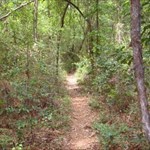
Ah, now I see what you're getting at thanks. A screen shot really is worth a thousand words. Lack of trackback, unable to display multiple tracks...those are a couple of pretty big whiffs man. I dunno, it's obvious the way things are today the 60csx is the best choice for what I KNOW I like to do; mountain biking. The CO is the best choice for what I MIGHT like to do; geocaching (now I know what it is). Do you guys believe Garmin will listen to the consumer and make some changes? If so the future of the CO is definately brighter than the 60csx. By the way, Timpat your screen shots are beige while redwoods mtn biker's are green. Am I seeing mountain vs forest terrain?
-
Excellent, thanks that screen shot is a big help. Just a couple follow up's please; based on the scale that's an area about 1.5 mi accross. If you were within 1.5 miles of a highway would it display on this exact screen using the basemap (I understand the accuracy issue from one of g-o-cachers posts on another thread)? If you have city navigator installed, would it show surface streets on that screen as well? Also, can that level of zoom be used to navigate the track you show? If you were standing on that cyan line when you took the screen shot would it show your position? Thanks for your time.
-
Problem is you still can not view it the way we're used to on the map screen. The only way would be to select that track and it is then highlighted cyan. Rather useless at the moment I think. As others have said perhaps viewing multiple tracks will appear in a future firmware update. I've emailed Garmin and have spoken directly to tech support asking for this. Maybe if more users bug them it will happen, it can't be that hard to implement viewing multiple tracks, all the other mapping units can do this. Useless because of the visibility issue? If I ride some random trail and save the data as a track for future use, does the device treat it any differently than the one I move from the pc?
-
BOOO...viewing multiple tracks makes a difference alright. I'm using an app called "expertgps" which allows multiple tracks to be displayed and edited on a map, and saved as a GPX file. Is it possible to move a custom track from a pc to the Colorado? That might be a way around the issue for me. Lol...I keep trying to find a way for the 400t to be the right one because it's so dadgum COOL!
-
-
Hello. I've recently started mountain biking and have been trying to use my Garmin Edge 305 for that purpose. Great fitness device but a bit of a letdown for navigating, basically it will get you out if you've ALREADY gotten out. Plus I can't seem to get the Training Center software to work properly with Windows Vista. Looking for a different device has led me here where I discovered the discussion about the 400t vs 60csx. Both list a bike mount as an available accessory. I'd welcome any opinions on the subject please. I also have a nuvi 350, so the new device will be used just for handheld applications; biking, hiking, find my car in Lowes Motor Speedway parking lot, etc. By the way...geocaching. What an awesome idea! You guys rock!