

mikey_b
-
Posts
32 -
Joined
-
Last visited
Everything posted by mikey_b
-
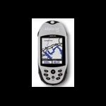
Well, I currently have in my possession 2 Garmins and 2 Magellans. One of them is the eXplorist 500LE. It's one of the easiest to use units I've handled so far. This is a 0118-serialized unit that has been flashed with the 2.57 firmware to enable WAAS. It compares favorably to the Legend HCx I have in my possession, average time to aquire satelites is quicker, average accuracy is higher, real world accuracy is better, it works better under heavy tree cover, and it seems to track better for driving or cycling. That being said, they are discontinued so getting any help from Magellan is like pulling teeth, not all models will accept the 2.57 firmware, and the map software (DirectRoute and topo) both appear to be discontinued, which means you need to buy old version and likely means they won't be updated anytime soon. On the other hand, I also have access to a Magellan Triton 400 and Garmin GPSMap 60Cx. Both are very accurate and quicker to aquire lock. The Triton does not yet support WAAS (beta firmware seems to support it) so it isn't quite where it needs to be (there are some other stability and functionality issues as well), while the 60Cx has been on the market for a while, has a mature and stable firmware, lots of map software options, and is backed by great customer service. Honestly, I'd say the 60Cx is the best choice for the money. It's usually found at or slightly above $250, but is well worth the money in my opinion.
-
Geocaching for childhood health
mikey_b replied to BlindEagleEyes's topic in General geocaching topics
I'm speaking as a parent of a 5-month old little guy and I can honestly say I will not allow my child to be raised by TV and video games and satiated with potato chips and chocolate bars. That's a recipe for disaster. Anything outdoors and active is better than being cooped up inside. I plan on using my sons curiosity to it's fullest potential to get him out of the house! Geocaching is great for teaching children a variety of skills, and more important, values. Things like Leave No Trace and the importance of caring for the environment and conservation of wildlife and habitat are just as important as being able to hike, read maps, and use a compass and GPS. Those skills and values will serve children well in life. Geocaching is really a gateway, as I see it. It's great to get young children involved and outside. It teaches great basic skills. Then as they get older, they can take part in different outdoor activities, like camping and fishing, then as they approach adolesence they are ready for backcountry hiking/camping and hunting, learning valuable skills along the way. Even if they don't have interest in taking part in those other activities, keeping them involved with geocaching is a great way to get the whole family out of the house and participating in a low-cost and educational experience and build some useful skills for later in life and hopefully pass them on to their own children. -
Do you have another battery to try? It seems as though either the battery is not holding a charge any more or there may be a problem with the charging circuit.
-
I think that's what most people have problems with, those instructions are referencing two different maps which are being used for the topo and POI information. I was scratching my head for a while until I finally broke it down in a spreadsheet to determine what was being one with which file. I'm still just looking at a bunch of *.shp files myself, I find my time is a little monopolized at the moment but hopefully will have a chance to work on this more on the weekend.
-
If I had some time to burn I'd love to record some tracks on my bike for some of the nice nearby trails, there's a lot of good ones from urban footpaths to rural nature walks. Plus, if I can bike them, then most people should be able to do them on foot (terrain-wise).
-
Were can i find Cache equipment in Winnipeg area?
mikey_b replied to Me and My 4 Girls's topic in Canada
I haven't really found anything local for geocoins and such, I used to have a supply of things like surplus ammo cans and items like carabiner clips and ball compasses. I bet United Army Surplus Sales would have had tons of sweet stuff for geocaching Good luck and let me know if you find anything. -
Honestly, I haven't had a chance to read through the POI process on the walkthrough, much less give it a try! Did you figure it out? I found the walkthrough to be in need of a bit of a clarification.
-
Have you tried the newest Vista drivers? What firmware version are you running on your eXplorist?
-
Try using Ptxt2shp instead of TXT2SHP, all you need to do is select your *.mp source and it will create the shape files based on the name you enter, and it's really quick.
-
I personally would stay away from the Garmin Colorado and Magellan Triton models, they are in my opinion "works in progress". Very impressive units to say the least, but not totally stable, and have some other quirky behaviour that needs to be addressed. That being said, the other choices you mentioned are great. The 60CSx and 530HCx are both based on the SiRFstar-III chipset/receiver and are excellent for hunting in thick brush. I can't say for certain that the 530 is the 60 with a radio, but they do seem to be identical otherwise. The 60CSx is considered to be one of the premier models on the market. The only thing I can think of with respect to a larger screen would be a Magellan eXplorist XL, but the eXplorist series has been discontinued and there are some issues with respect to customer service on the part of Magellan. I don't think you can go wrong with the 60CSx personally. If you get value out of the 2-way radio in the Rhino, then that would likewise be a good choice (especially for deep wilderness hunting/backpacking, the NOAA weather broadcasts could save your life!).
-
It appears to have been a problem with my source file, something must have happened when I saved the file as Polish Text. I was able to recreate my map segment and save it in Polish Text fomat again, and this time ptxt2shp coughed up the required *.shp files. Now to work out POI.
-
Except Magic Maps has not done any 1:50000 maps. The Ibycus maps are all 1:50000. Huge difference. Yes, it is unfair to compare a 1:250000 map to a 1:50000 map. Which map sheet are we talking about? I can try to convince Magic Maps to make a 1:50000 map for comparison purposes. Hmm yes... I just checked their site again. For some reason I thought the Magic Maps team were done 250K and wanted to finish 50K by mid-'08, appears as though 250K isn't slated to be finished until mid-'08. That's alright, I'll try and either dig up some 250K topo for the Garmin or see if I can convert the Ibycus 50K to *.imi format.
-
I will be doing a direct comparison between the eXplorist 500LE and the Legend HCx shortly, I will be using the Ibycus topo maps on the Garmin and using the Magic Maps topo maps on the Magellan. Since both maps are free and compiled from the same data source, it should be a fair comparison between the two units. I just need to find some time to go do some hiking in the outdoors to test tracking, accuracy (long/lat compared to known reference points), and functionality in the field. Anyone care to start a betting pool as to which works better?
-
Okay, now I have a Legend HCx to test on, is 063 available? Any problems using on this model? Need to determine if i want to keep the Maggie or not...
-
Hmm... seem to be having some issues doing the conversion to Polish Text format from the Garmin *.IMG files using MapEdit, I must be missing something here. PTxt2shp gives me some errors trying to convert to *.shp, I'll have to try the conversion using the TXT2SHP app and see if the txt file will convert properly.
-
Which GPS should I buy...GeoCaching Noob question sorry
mikey_b replied to thankukorea's topic in GPS technology and devices
I mentioned in another thread that the eXplorist 400 is a good unit, but it's discontinued. Magellan has an odd distinction between "discontinued" and "unsupported" as there are still some outstanding issues with the eXplorists that need to be resolved (such as lack of WAAS corrections) and the maps are quite out-of-date, but Mother Maggie isn't interested in fixing them. That being said, my eXplorist 500 is about the easiest thing to use, excellent interface and features. The Triton 200 I wouldn't really recommend, I prefer the more expandable units (SD card compatible) which means the Triton 400 would be my "low end". Problem is, Magellan is relying on folks buying the National Geographic maps for the Tritons. They are awesome maps! But they only cover the US. Tritons are compatible with the older, discontinued MapSend DirectRoute and Topo packages, but while they are compatible, they are not supported, and there are some issues that need to be resolved there as well with respect to the firmware. From the Garmin camp, my recommendation would be the Legend HCx for first time. It has a lot of features and is well-supported by Garmin. If you have a real need for the electronic compass (as opposed to the GPS compass in the Legend) and a barometric altimeter, then there is the Vista HCx, but I would probably jump from the Legend HCx to the 60CSx, myself. Garmin has a better track record with customer service and their devices are much better supported. -
Is this GPS unit a good way to get started?
mikey_b replied to thankukorea's topic in GPS technology and devices
Well, the eXplorist series is discontinued so you might not be able to get it. I don't know what kind of unit you would be able to buy in South Korea or what basemap you would get with it, to be honest. I have seen instances where dead eXplorist units are simply being replaced with their Triton equivalents. Magellan doesn't seem to be interested in supporting them anymore, as there is a known issue with WAAS corrections that was fixed for European models but not the North American models, and no one knows if there will be any new firmware released to fix those problems or updated map software released that will be compatible, so it's a toos-up. FWIW, I only bought my eXplorist 500 because it was cheap, came with a free case, and I had a workaround to fix the WAAS problem. Otherwise, I would have probably looked at a Triton 400 or Garmin Legend HCx. They are a good unit and really easy to use in my experience, nice and straighforward. Apparently the Tritons aren't so user-friendly. -
I walked in to Home Depot and got a 5 foot length of 1.5" hardwood dowel. Then I drilled out a hole in the bottom, placed a little glass tape and epoxy in the hole for strength, and drove in a large bolt with a 1" head. It's extremely tough and has been a useful tool while hiking!
-
How good are you at scripting downloads? All the individual IMG files are available via HTTP from http://www.ibycus.com/ibycustopo/download The list of IMG files available is at http://www.ibycus.com/ibycustopo/download/filelist.lst You should be able to cook up a script pretty quick if you use wget (or something similar). If you need a copy of just wget by itself, e-mail me, and I'll send it to you (otherwise you can get it through cygwin). HTH Dale **edit to add, my next area for update is 052, so you may want to hold off until I've done that one** No problems pulling the files down here, I'll script the download to run off prime hours to my storage box. I'll start with the *.img files for 062 as that is most of southern Manitoba, I should be able to merge them together and run them through some of the conversion utilities (possibly even script this) and see if they work properly on the newer Maggies. Thanks! edit: The maps for 062 were only 60-odd MB, so I'll play around with these and see what I can put together.
-
Is it possible to get the *.img files for 052 - 054 and 062 - 064? I'd like to experiment with converting them to *.imi format using some of the freeware tools out there and see if I can get them into an eXplorist/Triton-compatible format.
-
No, it is MUCH harder that way. The shape files from the Government come in a whole bunch of files to represent each entity. Mobilemapper wants a single shape file for lines, polygons and points, which the method I have shown creates. In addition, the method I have shown merges the maps together so that you only do this once. The government data is by individual 1:50000 tiles. There is no way to merge within Mobilmapper, so this must be done in advance. Regardless, you must do step 3 first. Now possibly Magicmaps has custom utilities to automate the process, but I have not looked into it. Excellent! Magic maps indicates they are not adding any more developers right now so I don't have access to any of their tools or documents but will give it a shot this weekend - hopefully with some free topo and DirectRoute my mapping needs will be cared for
-
I'm not really a fan of firearms for people who don't know how to use them. Even casual pistol shooters may not be experienced enough to hit a moving target reliably. People frequently underestimate the speed and fury of a bear attack, and do not realize that they may not even get a chance to unholster their firearm and train it on their aggressor before they are attacked. I am a longtime hunter, and have done much bear hunting in my area. I have seen a poorly hit animal get nothing but a surge of adrenalin - not something you want in an already dangerous situation. Leaving the pistols to experienced shooters is typically best. It's important to remember that most bear encounters never even happen really, the bear can hear or smell you coming and they make tracks because they don't know what's headed their way. Some bears are more curious than others and may stick around, if you run in to a bear that stands up on it's hind legs and sniffs the air and growls, it's not threatening you, it's trying to figure out what you are based on what it knows and how you react. Backing away slowly is best. If a bear approaches, you can learn a few things from how it approaches. If it saunters over, sniffing away at the air moving from side to side occasionally, it's most likely just coming in for a closer look. I say most likely because there have been times where they've become aggressive, even after a non-aggressive approach, due to various circumstances. Best thing to do is stand still and stay calm. Very hard to stay calm when there's a 400 pound bear sniffing your butt! Trying to run or back away can provoke an attack. If you DO have a firearm, bear spray, knife, air horn, flare gun or whatever, now is the time to prepare yourself. Do not crouch though, many animals seem to be able to pick up on body language and will take this action as preparation to strike. Some bears will turn away or veer off as they get close and make their own retreat to the forest, others may sniff around and leave if they've determined that you are neither a threat or a meal. Others may take a swing at you and it's decision time. Many books will say now is the time to assume the fetal position and play dead while covering your neck and head, and they may go away. I'm not too partial to that, so now would be the time for action in my estimation. You can also prepare yourself in advance if they come directly at you with their head low and ears up and pointed towards you - that is never a good sign and likely the bear has decided that you would make a tasty meal - the head down low is to improve balance and lower center of gravity for striking/mauling and is commonly seen before a bear attack. There are some good choices out there as far as bear defence. Ultimately, nothing will put them down as quickly and as reliably as, say, and .458 Winchester Magnum, but not many people will carry such a cumbersome weapon on a hike. Large caliber handguns are also a good idea, again, the bigger the better. A compact personal defense 9mm is a poor choice compared to a .44 Magnum, but better than nothing, especially if you are experienced with it. Bear/pepper sprays have varying degrees of effectiveness, some have dimishined effects if a followup it required, and some take a precious few seconds to reach full intensity, but it is better than having a fist fight with a bear. Since I do my hiking in deep wilderness I commonly carry a very large knife used for clearing foliage, it makes a comforting backup (I normally carry a rifle and do my deep hiking while hunting). Others may carry a backpack axe, a flare gun, an air horn, a pocket knife, there are a lot of options, even picking up a fist-sized rock is an option. Walking sticks too, especially if they are thick in diameter and about 4 feet long or more (protip: much like humans, bears noses are sensitive to touch and even a minor whack can make them tear up). Even travelling in pairs is an effective deterrent (especially if your partner doesn't run off!), but that makes firearms slightly less desirable in my opinion, you never know where the other is in a panic. Long story short, guns are good in the right hands but not required in most situations. It really is a case of different strokes for different folks.
-
What are your favorite trail recipes?
mikey_b replied to ScoutingWV's topic in General geocaching topics
Well I have some different recipies I like to use while on the trail. I kind of split them into two categories, one is "normal" camping and the other is deep wilderness hiking. For camping I'll pack out a small cooler and fill it with meats, fruit, and vegetables, and usually it's more of a family-friendly experience (tents, sleeping bags and sleeping mats, chairs, things like that). I normally also drag a "firepit" with me, consisting of a 45-gallon drum cut in half with a grill on the top so I can do such favorites as foil-wrapped chicken with a garlic butter sauce, slow cooked smoked hickory ribs, hamburgers, hot dogs, grilled steaks, turkey sausage, and baked potatoes and bring a pot for soups and a pan for bacon and eggs and things like that - eating well is very important to me when camping with friends and family! I normally take the other "half" of the drum and cut it down to a quarter for my non-cooking firepit. Here's a sampler for those who bring a cooler for their meat: 4 whole chicken legs, back attached 1 tsp each garlic powder (not salt), paprika, seasoning salt 1/4 cup unsalted butter or margarine Season the chicken then place individually on foil wrap, put 1 tsp of butter or marg on top then fold the foil over the top. Poke a small hole in the bottoms then place over a small fire for slow cooking. When the butter starts dripping out the holes, unwrap them and place on the grill until complete for a nice grilled flavor. Alternately, leave them wrapped up with no holes and they will cook a little slower and have less "campfire" taste but turn out fall-off-the-bone tender. Ribs can be done the same way - I like to season with hickory BBQ sauce top and bottom and wrap in foil. LOW HEAT! Very important. Alternately, if you have a campfire going and a rock nearby, place the wrapped package on the rock and move near the fire to slow cook. The slower the better! I had a slab of ribs take 4 hours to cook fully before they were ready, you could slide the bones out of the meat with ease and the flavor is remarkable. For real deep wilderness hiking (where trails do not exist and I carry everything I have on my back) I carry as little as possible for weight savings. Since I have to carry a small tent and sleeping bag, typically a rifle, first aid kit, knife, flashlight, compass, maps, GPS, bear spray, whistle, clothing layers and socks, lighter and matches, etc etc, I have little room for food, especially since I pack out for deep woods alone. GORP is a big thing for me, here is my usual mix: raisins dried banana chips dried apple pieces walnuts peanuts cashews almonds Cheerios pretzel sticks All the nuts are unsalted of course. Equal parts of each ingerdient is thrown in a large Ziplock and that's about it! Aside from that I pack a fairly large amount of jerky and pepperoni sticks, energy bars, granola bars, and anything else that doesn't need to be cooked and weighs very little! -
I think it might be a little bit easier than that. Instead of downloading the Garmin maps that Ibycus created and converting them to *.shp files, the NTDB has the data available for download in *.shp format from this location. Using those, I should be able to go straight to step 4 to convert the *.shp files into eXplorist format (I hope!). We'll see if this works out or if I "whoops" something up
-
Well, I asked the Magic Maps folks if I can help out doing some Manitoba stuff, should be good for making some maps and playing around with some custom stuff. We'll see how that goes!