

Rubberhead
-
Posts
776 -
Joined
-
Last visited
Everything posted by Rubberhead
-
Are There Any Problems With My New 60cs?
Rubberhead replied to primwolf's topic in GPS technology and devices
I'd load or re-load the newest software. Here's a link: http://www.garmin.com/support/download_details.jsp?id=549 -
Garmin has had card slots, albiet propritary, in their marine units for years. Why this hasn't been carried over to their handheld line is beyond me. That being said, 56 MB and a USB interface is all I need for my travel patterns and mapping needs.
-
I have Region US007 in Blue Charts V5.0 which covers from below Charleston SC to the southern half of Chesapeake Bay VA. All 90 very detailed NOAA charts only take up 9.21 MB total which is only 16.5% of the GPSmap 60C's total map capacity. The entire NC coast which includes the Outer Banks is only 4.10 MB. In other words - Blue Charts don't take up much. It's autorouting software like City Select and Topo maps that take the most memory per unit of surface area.
-
What programs are you trying to use to transfer data?
-
Of the two you mentioned the GPS V is the only one that will work for you. However, the 19 MB memory capacity is rather small for an autorouting unit. You will be disappointed with the small amount of maps that you can upload and in the time it will take to upload them. That being said, if you do get a GPS V that includes City Select, you will be able to use the second City Select unlock code in the GPSmap 60C(S) that you will be purchasing in about 8 months.
-
New To Caching, Debating Over Which Gps To Buy
Rubberhead replied to freddie9's topic in GPS technology and devices
Six months ago I would have told you that the eTrex Legend was the GPS receiver responsbile for finding the most caches. Now I'd say that distinction goes to the GPSmap 60C(S). My suggestion would be to go with a unit with a color screen and a USB interface - the eTrex Legend has neither. -
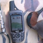
I have found the compass on my GPSmap 60CS to be very useful when geocaching. However, the real reason I got it was because I like to fish some offshore reefs. The "delta position" compass of the 60C gets real confused when the combination of wind, current, and motor push a boat in a direction other than straight forward. The e-compass is a real plus in these situations. I also use the e-compass to triangulate areas in the salt marshes were I might want to duck hunt. Basically I can sight-and-go on an area were I see ducks flying around in the distance even several miles away. The sight-and-go will draw a straight line to where the birds are. I then move some distance away and take another sight-and-go and mark the intersection of the two lines. It works like a champ. One more thing, I do hike in the Blueridge Mountains several times a year and have found the barometric altimeter useful, but it's when I'm home in the lowcountry with an elevation from 0 to 27 feet amsl, that the barometer becomes a fairly good weather forecaster. The worse case scenario is that I'd rather spend $50 and have the compass and barometer and never use them than to waste the $50 on hamburgers and CDs and wish I had an e-compass.
-
I always use www.chartedwaters.com They have solid prices and no gimicks.
-
I've had a GPSmap 60CS for a little over a year. It has left me for want of nothing. I'd suggest paying a little extra for the Compass and Altimeter.
-
Cig. Adapter...will It Work?
Rubberhead replied to tnfishdaddy's topic in GPS technology and devices
I agree - Yes it will work. -
Mapsource Poi Or City Select Or City Navigator
Rubberhead replied to jeejt's topic in GPS technology and devices
I stand corrected - I tried to get my unit (running 3.90 code) to display then overwrite low priority maps and it wouldn't do it. Either I'm crazy or Garmin fixed this problem somewhere in the updates. I'm not crazy - I promise. I'm not crazy. Neither am I. Wait an minute. Never mind. I'm not crazy. I promise. -
Same Units - Side By Side In Real World
Rubberhead replied to jackbear's topic in GPS technology and devices
I have been able to compare an eTrex Vista vs. an eTrex Legend, and an eTrex Legend vs. an eTrex Venture. There were noticable difference in satellite reception. I could be just coincidence but it seemed like the more advanced the unit the weaker the signal. The Venture was stronger than the Legend and the Legend seemed stronger than the Vista. -
Mapsource Poi Or City Select Or City Navigator
Rubberhead replied to jeejt's topic in GPS technology and devices
Team DEMP, I can actually see mine draw the lower priority maps first, then replace them with the higher priority maps until the highest priority maps are displayed. It is most noticable with very dissimilar maps such as Bluecharts and Metroguide, or Recreational Lakes and Metroguide. -
Mapsource Poi Or City Select Or City Navigator
Rubberhead replied to jeejt's topic in GPS technology and devices
Points of Interest was designed for non-mapping units like the eTrex Venture, GPS 76, GPS 72 and RINO 110. It would be a waste to get it for a GPSmap 60C(S). Like Team DEMP said, you can load both Topo and City Select maps. I would recommend turning on only the map set that you need. It you have them both turned on your unit will display the City Select maps over the Topo maps but it draws the Topos first so it ends up taking twice as long to refresh the screen if you have both sets turned on. Good Luck. -
Need Gps For All-around Use.
Rubberhead replied to nicholaicheck's topic in GPS technology and devices
I can only speak to Garmin's Bluecharts. Bluecharts are exact replications of the government's NOAA's marine navigational charts. These charts have been used my marine navigators for years. I have a GPSmap 60CS but I don't think it's any less rugged than the GPSmap 76C(S). It might be that the 76 series is more rugged due to the hard plastic covering for the antenna vs. the rubber covering in the GPSmap 60C(S) series. I'd say you would want to get a GPS with both a compass and barometric pressure altimeter. The altimeter can be used with the GPS functions turned off to save batteries. It can also be used as a barometer once you are camped. The electronic compass will let you mark a course line to an object in the distance. I use this feature to triangulate feeding areas used by ducks in flat coastal areas. It has saved me a lot of time and gas versus doing it the old way. Definately get a GPS with a USB interface and AA or AAA batteries that can be replaced in the field. -
The WAAS satellites are geostationary which by definition means they have to be roughly located over the Equator. These satellites have to orbit too, it is that their orbit speed exactly equals the rotational speed and direction of the Earth's rotation. Assuming from your screen name that you are, in fact, in Alaska, it could be that you are too far north to see a satellite over the Equator.
-
I don't know what NZ Roads V5 is but I'll make a guess that it is not autorouting software. If this is the case, your 60CS is going to use the basemap to autoroute from. Which, I'll continue to guess that, it doesn't have a road near where you are. Try turning off the NZ Roads and only looking at the basemap to verify that it doesn't have a road near you.
-
Beef1337, I don't have the Legend C but I did have a Legend for a while. I do believe that the Legend C does tidal predictions even though Garmin's website doesn't say it does. This alone would make it worth the extra money. Garmin's website doesn't mention tidal predictions on the GPSmap 60C(S) either, but these units certainly do have tidal predictions. Here's two screen shots from my GPSmap 60CS showing a tide station and the prediction graphs. I do a lot of boating in tidal areas and this feature is very handy.
-
Thales Repair - Customer Satiisfaction - None
Rubberhead replied to Dirtnapper's topic in GPS technology and devices
I've owned a lot of Garmin units and have only had two problems with two different units. The first was covered under warranty. I got the unit (a GPSmap 162) back in less than a week. When the screen on my Vista quit working it was about 2 years old, but since I had already had a problem with a previous Garmin they repaired the Vista for free and send it back overnight. I call the repair tech to thank him and he offered to send me an accessory for free just because I bothered to thank him. A week later I got a second mounting station for my GPSmap 162 in the mail. It's great to be a Garmin Guy. -
I, too, have an iPAQ that gets washed out in bright light. However, the screens on the Garmin GPSmap color units is a different technology. They are best in bright sunlight with no backlight needed. It is hard to describe how brilliant the colors are in bright natural or bright artificial light and in low light with the backlight turn on. The only time I have trouble with the display is when I'm wearing polarized sunglasses. Of course, this affects LDC screens too.
-
One more thing about USB: Almost every modern computer has a USB interface, but almost none come with a serial interface anymore. So you end up spending another $25 to $50 dollars for a serial card or a USB to serial interface. You should figure the cost of the USB-serial interface into the cost of a serial unit when comparing prices with a USB unit.
-
My only thought is to reconsider your initial choices, save a little more money and get you a color unit with a USB interface. Basically, the USB interface is about 50 times faster than the serial connection on the older units. It takes about 45 minutes to load 24 MB of memory in my Vista, but my GPSmap 60CS with a USB interface loads 56 MB in about 2 minutes. Imagine that you decided to go on an adventure on the spur of the moment but you need to load new maps into a GPS. If you've got a USB unit, you'll be ready to go in the time it takes to find and put on your boot. If you have a serial unit, you might was well go out and get a bite to eat while you wait for your GPS to load. As far as color screens go, God gave you color vision for a reason - use it. Just one man's opinion.
-
Additional Gps Unlock Price?
Rubberhead replied to wickedsprint's topic in GPS technology and devices
I've got a 60CS that I use mainly for fishing but I started to get interested in Autorouting. When I started looking at City Select, I considered doing the same thing you did, but found that Metroguide 4.0 (originally designed for the V) would autoroute on the GPSmap 60CS so I went that route since I had two other Garmin mapping units that I could use Metroguide with. So far, I've been pleased with Metroguide. -
Additional Gps Unlock Price?
Rubberhead replied to wickedsprint's topic in GPS technology and devices
I was just joking. I should have put a smilie on my first reply. -
Additional Gps Unlock Price?
Rubberhead replied to wickedsprint's topic in GPS technology and devices
I think your logic about the free unlock is sound, but your thinking about giving her the used V rather than the new V is seriously flawed.