

Rubberhead
-
Posts
776 -
Joined
-
Last visited
Posts posted by Rubberhead
-
-
One more thing, as GPS units get more accurate, the GPS altimeter's accuracy gets better. It's to the point, that the barometric altimeter is mostly useful as a barometer or to track altitude when the unit isn't reading satellites.
-
I've found humidity affects mine, especially at sea level. I'll set mine at the landing (sea level) and be, just like you said, 30-40 feet below sea level once I'm on the water. Of course, I am mainly interested in using it to forecast weather. When I'm offshore and the barometer drops, watch out...
But, I can set mine at the bottom of the Blueridge Parkway (3,200ish feet) and have it read only a few feet off at the top (6,054 feet). Of coure 30 feet is a lot smaller percentage at 3,200 feet than at 19ft.
-
As you've heard, it's not paperless on its own, but maybe with an app on your phone...
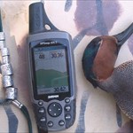
I'm still using a 2003 GPSmap 60CS as my handheld. I haven't replaced it because it's left me for want of nothing. Although, the NOAA warnings on the RINO 655t are looking very interesting...
-
GPSmap 60CS (still in love)
eTrex Vista
Nuvi 760 x 2 (Mine and the Mrs.)
Nuvi 650 (Daughter)
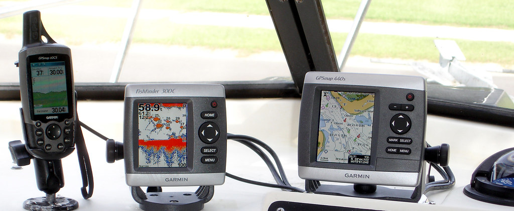
GPSMap 440s (Duck Boat)
GPSMap 545s (Fishing Boat)
-
I would think Garmin's Old Yeller' would be perfect with it's great big fat arrow on the compass page. Once he or she moves up, it would make a good back-up GPS or one for a guest. I'd bet you can find a used one for $50 or less.
-
I think I'd get a 60CSx and a copy of Topo 2008.
-
I'm a huge Garmin fan, so much that I bought the company. Well, I've been buying Garmin stock hoping to get enough that the dividends will support my GPS habit with at least one new GPS each year.
That being said, I bought a Nuvi 660 about six weeks ago. Well, it wouldn't read a high capacity SD card so I had to send it back. After calling Garmin, I got mixed news - it was going to be two weeks before a replacement could be shipped, but since the 660 had recently been discontinued the replacement was going to be a Nuvi 760.
Well, the first 760 I got was defective because the speaker wouldn't work so I had to send it back. The second 760 and third Nuvi overall lasted for about 3 weeks before the left channel and the speaker quit working so I sent it back. For my trouble they offer to send a brand new Nuvi instead of a refurbished 760. Silly me, I thought that's what I bought in the first place, anyway...
Now, the forth Nuvi shows up and I plug it in. The screen is beautiful with great colors based in a deep, rich black.
I spent a lot of time just to say that it really does seem that the screen on the newer Nuvi's are much improved but I'll have to do a side-by-side comparison with my wife's 650 to know for sure.
-
I have a 60CS, not a 60CSx, but I've always said that the 60CS has left me for want of nothing.
I use blue-charts and tidal predictions since I hunt and fish saltwater. I put tidal points on the calendar to predict future tides to plan hunting and fishing trips.
I use Topo 2008 along with the barometer when hiking the mountains.
I use an old copy of Metroguide 4.0 since it autoroutes on the 60CS and doesn't need to be unlocked.
I have it hardwired directly into the 12VDC systems in both of my boats and my Ford Explorer.
I connect it directly to my GPSmap 440s, FF250C and FF350C where it displays and records depth and temperature along with my track information.
I use the alarm almost every day.
The barometer at sea level does a great job of predicting whether a "pop-up" thunderstorm is going to hit me or not.
Did mention that I am for want of nothing?
(sorry for rambling but I really like my 60CS)
-
I can't help much, but I'm a dinosaur still in love with my 60CS too. I'd love to have a newer (x) model but I use that alarm clock all the time and the "x" models don't have the alarm.
My only suggestion is to upgrade the software to 4.20. I've been running it since it came out and haven't had a problem. The routing isn't as slick as my nuvi 760 but it doesn't do back considering it's a general purpose device.
https://buy.garmin.com/shop/store/downloads...67&pID=6447
I keep Metroguide 4.0, Bluecharts, Topo 2008 and Inland Lakes loaded in my 60CS all the time.
-
I'm still clining to God, my guns and my GPSmap 60CS and it's not even the "x' version. It is the most useful gadget I've every owned.
You sound bitter!


-
I'm still clining to God, my guns and my GPSmap 60CS and it's not even the "x' version. It is the most useful gadget I've every owned.
-
The larger segments usually have a larger scale (less detail). I usually download only the smaller (higher resolution) segments.
-
I have a Nuvi 650 and 760 and I like both.
But, I adore my GPSmap 60CS. It is the most useful GPS unit I've ever used or owned...
-
Get a new harddrive - they're cheap...
-
I have the 440s and it loads Topo 2008, and Recreational Lakes with no problems.
-
I've got a GPSmap 60CS with detailed autorouting maps, Bluecharts, Topo 2008, and Recreational Lakes. I also have a Nuvi 760 and a GPSmap 440s.
Because of the reflective TFT display, I still believe that the 60CS(x) or better a 76CS(x) is the most versatile unit Garmin makes. Unlike the Colorados and Oregons, the 60C(S) and 76C(S) look great in the direct sun without a backlight, autoroute, provide tide tables, and take 12VDC without a converter. Does the Nuvi 760 have features that I appreciate when driving – yeap. Does the GPSmap 440s work wonders when I’m on the boat – totally. If I have to use one unit for driving, hiking, on the boat – it would still be a 60CS or 76CS.
-
 Like a child the Night Before Christmas (next b-day 62), I got an e-mail saying Amazon had shipped my 60CSx today.
Man I can not wait to get out and start Caching. I walk 7 - 12 miles a day after work, in a wooded-park in town and I have found excellent spots to plant new caches.
See you out there!
Congrats - I adore my 60CS.
-
Garmin South Carolina
1) Comes only in Deer Hunter Orange
2) Waypoint database consists only of Wal-Marts and Bar-B-Que joints
3) The United States is a single waypoint to help
find the US on the world map.4) Comes with a miniature concrete block as a dash mount
5) Automatically reminds the owner when it's time to re-apply for workman's comp.
6) Used to be called the Garmin New York or the Garmin Ohio
-
can I upload the whole mapsource at once? I have a 2GB mem chip in it.
Look at the bottom of the "Maps" tab in Mapsource. It will give you a running total of space required at you select the various maps segments.
-
Garmin Alaska. Keeps freezing on you.
Sorry, got nothing.
Don't apologize - that's the best one yet...
-
I'm an outdoor generalist too including hunting, photography, freshwater and saltwater boating. A GPSmap 60CS is a constant companion for all these activities.
For mapping programs I have Metroguide 4.0, Bluecharts, Inland Lakes, Topo 2008, and 24k Topo for the east.
I've found that Topo 2008 is all I need for my hikes. I always have a layer of Metroguide 4.0 since it autoroutes. If I'm fishing I either use Inland Lakes for freshwater and Bluecharts for saltwater.
Since neither Topo 2008 or the 24k Topos are locked, I'd get them on CD/DVD not SD cards. This will let you plan and review trips on the computer and load maps on your next GPS.
If I were you, I'd get City Navigator NT and Topo 2008 since not all Appalachian trails are on the 24k Topos. You will love the autorouting of your GPS unit. You might want to get a RAM mount so you can use it in the car.
-
I just had another idea - Amazon sells the Garmin Colorado 400c for $481. Subtracting the $102 that would be wasted if you unlock the Bluechart for that one GPS unit and roughly $250 that you can sell your 60Cx for on ebay and you'd have a new Colorado for about $130. You can add Topo 2008 later and you've have a find GPS with good coverage just about everywhere.
I used checked my GPSmap 440s and it has wonderful detail around the Bahamas. I'm almost positive that the 440s and the 400c have the same mapset. You can call or e-mail Garmin to verify.
-
Your best, and maybe only, bet might be the Garmin's Bluechart coverage of the area:
http://www8.garmin.com/cartography/bluecha...amp;cd=Americas
I think you can get the DVD and the unlock code for that region, US010R, off of Amazon for about $102.
-
I use a GPSmap 60CS and a new GPSmap 440s on my fishing and duck hunting boats.
The 60CS is great for coastal areas when loaded with Bluecharts. Unfortunately, each region of Bluecharts costs roughly $120. I pretty much stay in US007 so it's not a problem but if I traveled south of Charleston SC or north of Williamsburg VA, I'd be out of luck.
However the 440s has all of US coastal areas pre-programmed. This is the same mapset loaded in the 400c. In my opinion, this map set is worth the price of entry.
Believe me, the Topo maps of the coastal areas don't hold a candle to the Bluecharts.
If it were me, I'd get a 400c and purchase inland lakes DVD and a RAM Mount to go with it.


 Like a child the Night Before Christmas (next b-day 62), I got an e-mail saying Amazon had shipped my 60CSx today.
Considering buying a Garmin GPSMAP 62S
in GPS technology and devices
Posted
When Geocaching first started there were no such things are basemaps...