


68-eldo
-
Posts
355 -
Joined
-
Last visited
Posts posted by 68-eldo
-
-
Disregard, error.
-
Oh, okay...will definitely try that this evening. So I'm assuming it won't have a formal benchmark designation (like FC1109 or something like that)? Excellent...thank you, again!
Correct. The PID used in the Geocaching website is exclusive to the NGS database and not used by any other organization.
-
As mentioned above it is best to use scaled coordinates with caution. Use the directions in the data sheet.
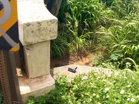
Using Google Earth I measured off 3.2 miles from the driveway of Kula Elementary School along highway 37 and arrived at 20° 48.341'N 156° 19.651'W. That puts me at the south end of the second bridge in your post.
Using street view I could not see any evidence of a benchmark. But it is most likely still there. Look below the steel guard rail. It was likely installed after the benchmark was put in. If it is not there then look on the far side of the concrete wall and down. It could be on the wing wall like TU0509.
-
-
I don’t know how much the transit of Venus on June 5th was talked about in the “lower 48” but there was a bit of a buzz here because it was one of the few places that it could be seen from start to finish. It was a great sight to see.
But I remembered there was a benchmark with that same name. I found it TU1283.
In the publicity about the transit of Venus Bob Sigall a columnist for the Star Advertiser ran a history column on the British party that arrived here to observe the transit of Venus in 1874. They set up in three locations in the islands Kailua-Kona on Hawaii; Waimea Kauai and Honolulu Oahu. The purpose of the expedition was to help determine the length of the astronomical unit.
Bob also pointed out the book Hokuloa: The British 1874 Transit of Venus Expedition to Hawai'i by Michael Chauvin. I was able to grab a copy at the library. Odd thing was the book was published in 2004 and I was the first to check it out. I recommend the book. Among the interesting facts is that the expedition brought with them 20 chronometers.
In looking at the data sheet for TU1283 I see the 1932 and the 2009 recoveries are of the wrong. Looking at location for TU1283 on Google Earth it looks like the station is gone because it is in a parking structure. But I’ll go look for it and make a found/not found recovery depending on what I find.
-
When this thread first appeared I put the book on my Amazon wish list. Early this year I got a gift certificate for Amazon so I bought it and put it in the books to read cue.
I just finished the book. It is very well written and I really liked the details like how they connected the clocks to the telegraph.
Thanks to Holograph for the recommendation.
-
If you have an android phone and Gmail account you can upload your finds to Google maps on your My Maps account (using your PC). Then when you open the Maps app on your phone you can turn on the My Maps layer, select the file you want to open and your finds will appear on your phone. Great for those impromptu hunts.
-
There are a number of stations around here that can be used as both an intersection station and a triangulation station. A couple of examples are TU1455 Ewa Church and TU0625 Gilbert. Gilbert is missing the signal on top but you can see in the pictures on GC that there is a disc under the bench that holds the marker. And you can see Gilbert occupied by a GPS receiver. Gilbert also had two reference marks but I could only find RM2. I think RM2 is now gone.
Ewa Church shows the flag that was found on all the stations with a permanent “A type territorial red and white survey signal” over the mark.
I don’t see that they are designated as both.
HTH
-
Thanks for the links. I’ve updated my info.
-
Unless I can find a section corner on publicly accessible land that actually has something there, I won't actually be seeing what is inside those monument boxes. And I don't know if PLSS section corners that aren't at a road would have anything there. (The monument boxes I have seen in the road all seem to correspond to PLSS section corners, I haven't seen any others. Though I could have missed some, they're not always easy to see.
 )
)This thread, and the research I've done as a result of it, has incidentally cleared up a little mystery about where the name "Baseline road" came from. And kinda makes me want to try to arrange a visit to Meridian-Baseline Historical State Park.
When you go you should find the Michigan Meridian. Looks like it is in the woods. Check this website:
http://www.pmproject.org/MIPM.htm
The coordinates I have for that is:
42°25'28.00"N
84°21'53.00"W
If you get better coordinates please share them here.
Thanks
-
Important to remember that the NGS datasheet that appears when you click on the "View Original Datasheet" link on a Geocaching page is actually an approximately 10-year-old version of the datasheet. To see the current datasheet, it's best to get it directly from NGS. Probably the easiest way is via a URL that looks like this — — (obviously with the last six characters replaced by the PID you are interested in.Before posting coordinates in a NGS recovery report, it might be a good idea to double check the NGS copy of the datasheet. ....
-ArtMan-
Or you can go to this web site and put the PID in the input box.
Scanning my avatar works too.
-
In my neighborhood we have street survey markers. These are markers on the center line that designate the beginning and end of tangent sections, center of intersections and maybe more. They are located under a hand hole to protect them during resurfacing etc.
I have seen surveyors use these when locating property corners on my street. This maybe what you are seeing.
Check to see if the ones you see are at the point where the road transitions from a straightaway to a curve and in the center of intersections.
-
For more information on the PLSS check out these web sites:
http://geology.isu.edu/geostac/Field_Exercise/topomaps/plss.htm
-
With KY3483, all 4 disks had a portion of the date stamped in that way.
I guess they lost the 5 and 9 number stamps and had to resort to a center punch.
-
I tried searching for Benchmap in the market but could not find it. Who is it made by?
Foxtrot-Xray. I think it is still in Beta testing. I'm looking forward to seeing it on the market.
-
The only down side I can see to the cheap one is the handle. If you are metal detecting a 5 mile stretch of beach you may want a more comfortable handle that contacts your forearm, but if you are only looking in one small area the cheap one would be fine.
-
I was under the impression that the meaning of CQ in HAM radio was “seek you” which sounds like CQ. It could be also used to look for a single operator, for example “CQ CQ KH6HCW”.
But then I’ve been wrong before.

I've heard it used in that meaning too, as a couple of my railroad coworkers are Ham operators. I'm thinking tho, that this may be a 'new' development, as opposed to telegraph work.
Agreed as HAM radio is newer than telegraph.
I was going to ask the HAM guy at my volunteer job (railroad) but he did not come in today.
-
I was under the impression that the meaning of CQ in HAM radio was “seek you” which sounds like CQ. It could be also used to look for a single operator, for example “CQ CQ KH6HCW”.
But then I’ve been wrong before.
-
Another MAGNETIC STATION strike out.
The stock pens in Loa, Utah have been removed but the call from the loading chute didn't help previous loggers; and the 87 feet from the T road east intersection has to be wrong.
Viewing the west face of the snow covered Henry Mountains made the extra miles from Salt Lake City to Green River well worth it. kayakbird
For what it’s worth, using Google Earth and throwing out the 87 foot measurement I get a lat/lon of 38°24'15.60"N 111°38'58.19"W.
-
dadgum, I haven't done one of these in a long time, and my brain is insisting on reversing the levels so that the water tower appears to be a well, and the houses are all sunken alongside the elevated streets! Anyone got a tip for popping into 3D the right way?
Patty
Try putting blinders on. Looking at the photo put a hand or something else to use as a blinder so that the left eye can not see the left image but can see the right one. Then put a blinder over the right eye so it can not see the right photo but can see the left one.
Then view the image with slightly crossed eyes. It should soon pop out at you. It is pretty amazing.
Glen
-
I wonder why two of the edges are so clean and straight, and two of them aren't.
I believe all four sides are straight. The unevenness of the surface makes an uneven shadow on the bottom. It is really hard to see this as a carved depression and not a raised square.
-
Corrected URL for BM 103 is
http://img.geocaching.com/user/31945b47-34db-4072-9ef0-97d79befe03c.jpg
Too many http://'s in the other link.
-
The local Friends of the Library had their book sale last month and one of the books I picked up was this one. Second edition fourth printing August 2000. Cost me $2. This book is a major plug for the manufacturer, but it does explain some things.
The new metal detectors like I have are very complex, micro processor controled, and are specialized. Most of the ones found in stores like Radio Schlock are coin hunters. Mine will even tell you what coin it finds like a quarter, dime, or what ever.
There are others made special to detect gold nuggets and others to find coin caches (cans of coins hidden by someone long gone) in ghost towns.
While the coin finders will also detect steel, brass and any other metal they are optimized to find coins near the surface.
The book also goes into metal detectors for wanding passenger at the airport and detecting nails in wood before sawing ect. Also mentioned the two box deep seeking model. Interesting but long winded and always plugging their products. But well worth the $2.
I considered building my own BFO (beat frequency oscillator) type also, but maybe it is easier to buy the right one.
-
I don’t think so but the Naval Observatory is a about a half mile away.
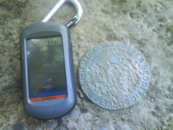
Did you notice the degree markings around the outer ring? 180 degrees is at the top of the picture.
Sandy
in Benchmarking
Posted
I hope all our friends in the path of Sandy are OK.
Wishing them well.