

seldom_sn
-
Posts
778 -
Joined
-
Last visited
Posts posted by seldom_sn
-
-
The only thing which stands out for me is GLONASS, and LED backlight (less worries about battery life).
Landscape view looks handy too.
All depends on price........
What do older devices use for backlights?
-
Weirder and Weirder.
If the Idaho Topo isn't transparent, and you can see it with both maps enabled, it must have a draw order higher than CN. I've done that for a map I posted to GPSFileDepot, but it stops south of Idaho, in central Utah.
Don't know anybody except one other guy at GPSFileDepot who sets the draw order that high, and he only does local maps of his local area back east. If the ID topo was "transparent" and the roads you were interested in were in an 8 sq. mi. area like a park that was defined by a polygon, that could obscure roads on CN depending on how the polygon was TYPed.
-
splashy was right. GPSBabel doesn't do IMG files.
-
I have a sudden, rather weird problem. GPS is a Dakota 20 with CN North America NT 2011.10 maps and Idaho top map (from GPS File Depot), both enabled. I live in an area with a lot of subdivisions, and today while out caching, I noticed that all the roads (except for the major ones) have disappeared in an area 2 miles wide (north/south) and maybe 4 miles long (to the west). Outside of that area, all the roads are showing. I disabled the topo map, and the roads that were missing came back. Enabled the topo and they disappeared again.
Anyone have an idea what's causing that? I've always had the topo on with no problems.
Thanks, and Merry Christmas!
Sounds like a draw order problem, but:
1) It's unlikely that any map would have a draworder that's higher than CN.
2) It's odd that the problem only occurs in an 8 sq. mile area. Normally it would cover the whole map.
Is the Idaho topo a transparent overlay?
Do you have any other maps on the GPSr that cover just the problem area?
Have you asked about this on the GPSFileDepot forum?
-
Instead of the expensive 60CSx, maybe look for a 60Cx or a 60CS?
60CX is a 60CSX without the electronic compass and altimeter. A good buy if you don't want those features. The 60CS had the same form factor, but much poorer electronics; something to avoid.
-
Internet cafe might not have had the correct USB drivers. Do you have access to your own computer?
Bad GPX files can mess you up bad, so deleting them's a good place to start.
Describe the hang. If you can't connect to a computer and it's hung how do you expect to delete the GPX?
-
Brilliant.
Millions of perfectly good GPSr will be made obsolete over night. I suppose that will be really good for the GPS manufacturers, though, eh? Everyone has no choice but to buy upgraded equipment?
I expect that the FAA and the military may not want to make those expenditures, though. And Grover Norquist certainly won't want to pay for them.
-
Does the last paragraph in Jim's link mean that the FCC is going to subsidize replacement of all my GPSrs with ones that play nicely with LightSquared, like they did with analog TV?
-
Are you using a PC or a Mac?
What is the name+extension of what you downloaded? (The extension is the three letters after the dot.)
Where did you download it from?
-

That map's a Garmin product (or compiled with Garmin's compiler) isn't it? AFAIK nobody else knows how to incorporate 3D DEM hillshade in their maps.
-
The GPSFileDepot tutorial has not been updated in some time, and is showing it's age with those outdated versions of MapInstall and BaseCamp. If a more recent, modern tutorial is desired, for both PC and MAC, try these.
The maps used in Atlas Cached's tutorial look really familiar. I must have a fan.
-
Most maps at GPSfileDepot have high quality topo, but aren't routable. AFAIK maps from garmin.openstreetmap.nl are routable, but have no topo.
-
Normally the map is installed in BaseCamp using a self extracting installer. Then when you have your GPSr connected to your PC you can use BaseCamp's MapInstall application to send maps to the device. See this tutorial.
-
No problem like that with my 30 either. I'd talk to Garmin.
-
Also, if I request individual OSMs, eg. Illinois, California, Australia, won't they overwrite each other? If I just rename them, will it work?
Renaming won't work unless you use an application to do it like JavaWa GMTK. If you are getting your OSM maps from garmin.openstreetmap.nl, the download script may cause each mapset you download to have the same name and overwrite the registry settings for the prior mapset. The fix for this is to use JavaWa GMTK (extras) to change the mapset ID and name once you have installed the OSM map, prior to subsequent OSM mapset installs.
-
Unless you are a geocacher, or want to use raster imagery like Birdseye, or want to wirelessly swap caches, or want your GPSr to talk to your heart rate monitor, you'll be swapping apples for more expensive apples. The newer units add a lot of features, but a 60csx will tell you where you are as well as the newer models.
-
One way would be to use mapping software to draw four lines connecting the points (making a four sided polygon) then save it to the gpx and tell it to show on the map as a track. Then you could look at the GPS" and stay within the boundaries.
For mapping software read: MapSource, BaseCamp, Google Earth + GPSBabel. I don't know the mapping programs for other than Garmin products.
For GE+GPSBabel save the track as KMZ, unzip it to KML, and use GPSBabel to convert KML to GPX.
-
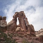
If you mean Manhattan, don't expect too much, reception can be bad or lost completely in urban canyons.
Will your bride be happy caching while in NY?
I understand there are some great hides at Saks Fifth Avenue.
 The topo leaves a lot to be desired though.
 -
What part of NY? You don't need maps to cache, but they help you find your way around. Quality free non-routable US topo from GPSfileDepot. Pretty Good routable maps for free from garmin.openstreetmap.nl without topo. Routable topo from Garmin (24k Northeast), about 120 USD. Probably the best routable roads (no trails) is City Navigator North America NT, about 50 USD for lower 48 states and 70 for to include Canada, and Alaska.
-
Thank you for explanation. I am finally seeing the picture. Maybe the recommended maps aren't the right ones for me.
It might help if you said a little more about your map needs. I assume you are somewhere in the southwest US, or planning to go there.
If you are interested in Southwest National Parks, there is a map called Desert Southwest at GPSfileDepot that is a contiguous routable map that extends from Death Valley to Mesa Verde and Arches to Petrified Forest. It also includes Grand Canyon, Zion, Bryce, Capitol Reef and Canyonlands. Data on the map are topo, roads and trails, land ownership, wooded areas, and hydro.
-
The maps "recommended" from gpsfiledepot I downloaded for AZ and UT were the same as CA...all topo and pretty useless. I wonder if I am getting the wrong ones? All I see are topo lines. I can't even find my street where I am.
Most maps from GPSfiledepot are not routable, so you won't be able to do much "searching" on your GPSr with those maps. Some maps from GPSfiledepot are "transparent". This means that they have a limited amount of detail, and are meant to overlay (show their data on) other maps. I posted some transparent topos there, Northern AZ and Southern UT. They only had topo, hydro, and trees, and were meant to overlay a routable map like City Navigator. Generally, the map download page will provide this type of information.
-
Before this post scrolls down and off the page for lack of any other answers, I'll add what little I know:
Garmin maps are pretty much interchangeable - any map designed for Garmin units should work on *any* Garmin unit. An older unit like the 60CSx won't be able to display newer features like DEM shading, but it'll just ignore 'em and work with the features it was designed for.
I've never heard of a Garmin-format map being incompatible with the 60CSx. This is the unit I use, and I'm a cartophile who collects maps from all over.
You might want to fire off an email to the maker of those maps, just to be sure.
I don't own any, but the GB Discoverer maps look like they combine vector maps with raster graphics. If that's the case, Oregons and later GPSrs would be the only ones that support them.
-
Wouldn't the velocity also mess up any altimeter? Some sort of high speed anemometer? Maybe something like a venturi?
-
Is it possible to add custom maps to my 60CSx? I'm looking to add images like from google earth to aid in looking for caches is this possible and if it is how do I do it. Thanks.
There's a program called Moagu that will format raster images in a way they can be viewed on a 60CSX. It's slow, and not nearly as efficient as vector maps. Keep in mind that Garmin uses the term "CustomMaps" to refer to raster maps. Others use "custom maps" to refer to homebrew vector maps.
 The topo leaves a lot to be desired though.
Totally Lost ... Help!
in GPS technology and devices
Posted · Edited by seldom_sn
When a GPSr has moved a great distance (say 500 or 1000 miles) it may take 10 or 20 minutes with a clear view of the sky to figure out its new location. After that it should locate itself pretty quickly (say 30 seconds).
Garmin has a free utility called MapConverter that will convert vector maps on your PC to Mac format.