


user13371
-
Posts
4331 -
Joined
-
Last visited
Posts posted by user13371
-
-
If the Magellan supports copying GPX files directly to it, see also http://forums.Groundspeak.com/GC/index.php?showtopic=311111.
-
And then there's this:
http://www.amazon.com/dp/B00AQUMZRA/
Battery power and a wifi connection for your GPS to net book, tablet, or smartphone. I usually tout this as a good thing for iOS users, but it's applicable here also.
Edit to add.... Well, shucks. Not available on amazon at this time. Guess I'd check newegg for similar... http://www.newegg.com/Product/Product.aspx?Item=9SIA1HD0HM8076
-
... the OP links to data obtained at coordinates ... may provide a decent view of the source of the OP's bicycle.
 Not quite, but thanks for pointing out the goof. You can enter your own location on that page, but I meant to post the more generic link:
ANYHOW... Put in your own coordinates, leave the GLONASS box unchecked, and see how many sats you have in view and what the PDOP number is. Then repeat with the GLONASS box checked. More satellites, lower PDOP numbers. It ain't rocket science.
Oh wait, yes it is!
-
-
GPSTrackLog mentioned an online GPS prediction, planning tool at CalSky.
I'm delighted about this, not ony because I've been looking for a GPS planner but also because this one also lets you include GLONASS in it's calculations. If you want to see what a difference that makes, run the numbers with and without.
-
...I have to disagree here. Geocaching does not require a map. ...
You could of course geocache and navigate in many ways without a map -- or even GPS -- of any kind. But I was providing an opinion to a specific user who already indicated he WANTS a map and options for several different kinds of maps. When the question is framed that way, the base map provided on Garmin is but a small step above nothing.
-
... going with the eTrex 20 or 30. I'm deciding if the electronic compass is worth it. ...direction by stars and the sun are usually good enough for me...
I have an eTrex 20. I don't feel deprived for lack of a compass -- and from your background don't think you would either. But I'll echo some of the previous advise given here: go to a geocaching event or perhaps a retailer and gets some hands-on time. See what works for you personally.
Are the stock maps found in GPS devices suitable for a cacher or is it recommended that I purchase higher quality maps?The built in map is not suitable for geocaching. But you may not need to purchase additional; there are lots of good maps for free on http://www.gpsfiledepot.com and also http://garmin.openstreetmap.nl. And google is your friend, just search for "free garmin maps" and you'll be sifting through far more options than I've suggested here.
-
I had high hopes when Garmin created BaseCamp Mobile and put Bluetooth LE on new models. But I haven't seen any detailed write-ups on how to do it and my own (very limited) experience with the BaseCamp doesn't inspire me to run out to buy an Oregon 6x0 just to figure it out. If one lands on my desk at work though, I might give it a try.
For now, the only way I know to transfer geocaches from an Apple iThing to any Garmin device is described in the thread Walt pointed to -- which requires you have a router with a USB port and some file management software.
-
Your best bet to replace the copy-protected CD would be for another user here to b sell or donte one to you. You might also post a "Want To Buy" posting in the Garage Sale forum.
I vaguely recall there was a hack available to get the progress to bypass the "Insert CD" prompt. But it's been so long since I've had one of these that I ight not be remembering correctly, could have been for a different product.
-
That's interesting. And the specs don't show the ability to add an sdcard. Kind of strange to have more cache capacity than the memory can hold.
Not strange at all. Just a little obscure.
The eTrex 10 has no card slot.
The database engine built into it for holding geocaches has a limit of 2000 entires.
The memory available on the unit is (d'oh, I don't remember exactly) a few megabytes.
All of that IS documented. What they cannot document is how big any given GPX or collection of GPX fles may be, or what else you have on the device taking up space, That's why it's difficult difficult to say how many geocaches will fit a variable matter.
Upgrading to an eTrex 20 adds a microSD card slot, and expandable memory lifts all those limits out of the way for most practical uses. Simple product differentiation.
-
2,000 caches will almost certainly not fit on the Etrex 10 without using something like GSAK to reduce the size of the file.
Emphasis added

In practice it's hard to get more than a few hundred loaded. Even when I stripped logs, hints, and descriptions I ran into memory problems around the 500 mark. Rule of thumb, don't worry about how many caches are in it, just keep the GPX file size under 3 megabytes.
Wrote about that over a year ago, here:
http://forums.Groundspeak.com/GC/index.php?showtopic=288825&view=findpost&p=4952268
-
Going back to the OPs's original request, I don't think there's a way to load NG Topos onto an Explorist 500, nor will other maps available for that device give the kind of detail he (she?) is after.
Here's another way to do it though, using a smartphone or tablet instead of a dedicated GPS:
Even without a subscription, Gaia allows downloading and offline caching of a lot of different high quality maps and imagery (including Google's). You don't need to scan a paper map, find screen shots, or click opoints to align them; just select the map type and region you want, and download it.
-
Rec90, that's a good question - I don't know the answer, either. Lots of variables: You may just not have triggered the kind of conditions I have, or an external GPS might not have to same issue, or maybe it only happens on newer iPhone / iPad devices (not older ones upgraded to iOS 6). But I'm not makin it up and I'm not the first to observe this. Google IOS6 snap to road
There's an easy test. Run Apple Map while riding the train and watch the little blue dot. You could try that with both the 4S internal GPS and your GLO to see if there's a difference.
---
Edit to add: Another variable I thought after looking at your profile. Apple might not have snap-to-road data in UK.
-
With iOS 6 (which the OP's iPhone 5 has, and many older iPhone/iPads might have),Apple changed how positions are reported, in a way that will be really poor for geocaching.
If you are standing still and have a perfect signal and there are no roadways nearby, it will give you reasonable coordinates. If you have less than a perfect signal, or you're moving at any rate faster than a slow walk - the location services will access Apple's mapping database and try to snap your position to the nearest road. Absent any roads nearby, the position pointer will wander quite a bit more than it did in iOS 5. It will frequently do this even if the application you are using is NOT Apple's Map program.
Internally, this is default behaviour of Apple's location services. there are supposedly ways to program an app to not do this. But I haven't found any that reliably ignore Apple's road maps.
-
-
...max speed of 4.7 mph while an average speed of 7.5???
Hmm... I missed this the other day, but kinda glad to see I'm not alone. I mentioned a week or two back that I had noticed my max speed was not recorded correctly. 41 MPH noted in real time during my trip, but only 34 MPH max reported on the trip computer and in the track log. I wonder what they're doing wrong?
-
39_Steps:
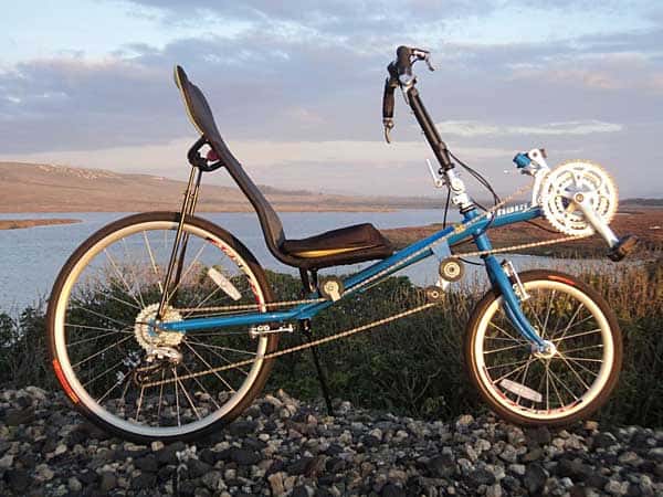
Off topic, The intriguing bike is a Lightning Phantom II, small frame. Front wheel is 16". You guessed correctly that I am not tall - but rather long-legged for my height and can get both feet flat on the ground at a stop. I really want a P-38-XT - someday - which I would probably order in the medium frame size.
On topic, I don't know if failing to capture max speed happened immediately or in post processing. Garmin eTrex keeps a default "current track" which I always assumed was raw data, and when you save that track I think it does some data reduction; track smoothing, throwing out spurious points, etc. I fouled up because by habit I clear the current track whenever I save to a named file, so I lost the raw data. I'll NOT clear the current track on my next ride.
-Lee
-
No fitness sensors. But when I get to the office on Monday I'll probably import the track to Google Earth for a more detailed analysis. Don't have anything comparable on iPad at home.
-
Grasscatcher: On both the "max speed" field on the GPS trip computer page as well as what showed up in recorded track. At least based on what Motion-X GPS shows on the imported track. I've seen this before - current speed in one field and max speed on another on the trip computer page: I'll see my current speed higher than the "maximum" - but this was the largest discrepancy I've noticed. I think you're probably right that there's some issue with how long I was at a given speed for it to "count" as the maximum -- probably some filtering buit in to ignore what might be erroneous data.
But still -- I was only at 41 for a second or two, but I know I was in the high 30's for a good stretch.
Re "pucker factor" - um, yeah. This bike is the most stable (and fastest) I've ever had, but there are times when riding the brakes seems prudent. A different model from the same company has disk brakes and that might be my NEXT bike.
-
Had a bike ride today that included some long, straight, smooth downhill stretches. A one point my eTrex 20 said i was going 41 MPH. But when I got home and saved the track, I checked the maximum speed for the trip and it said 34.. Way didn't it retain the higher speed?
-
The map kmz displayed properly on my iPad. Thank you, I didn't know you could do this and it will come in handy for more than just geocaching.
Regarding how to display geocaches - can't you add place marks/waypoints to the KMZ? I think you could just import a pocket query GPX into Google Earth and export as KMZ - don't know if that file would work in Google Maps they way you want though.
-
David1052: the iUSBhub (mentioned in post #11) is available on Amazon.co.uk...
http://www.amazon.co.uk/s/ref=nb_sb_noss?url=search-alias%3Daps&field-keywords=Iusbhub
...but it's fairly expensive compared to the RavPower WiFidisk -- which DOESN'T seem to be on Amazin.co.uk. What other vendors do you usually shop from?
-
Answered here: http://forums.Groundspeak.com/GC/index.php?showtopic=311111
I wrote that some time ago so Walt would stop volunteering me to help -- I thought he would just bookmark it
-
After thinking abut what I posted a little while ago, I decided to ask REI... And they answered within an hour:
Thank you for taking the time to contact REI about our return policy, and for the opportunity to respond.We know that our returns policy is an important reason why people shop at REI and most customers use it in a reasonable, fair manner. We have a well-deserved reputation for our friendly expertise, and for our willingness to take back things that don't meet expectations. We continue to have a great returns policy that lets people have confidence in everything they buy from REI.
The policy went into effect on June 4, 2013 and will be applied beginning June 5, 2014. All purchases before this date will be covered by the previous returns policy. Just to clarify, beginning June 4, items purchased at REI.com can be returned within a year of purchase, except REI-OUTLET.com items that must be returned within 30 days of purchase.
Updating our policy enables us to maintain our 100% Satisfaction Guarantee and, as always, we stand behind all purchases made at REI and REI Outlet. We hope you will give us the opportunity to prove this to you in the future.
Rest assured that we are sharing comments about this change with the co-op's leadership.
--REI Online Customer Service
Pretty fair, I think.
 Not quite, but thanks for pointing out the goof. You can enter your own location on that page, but I meant to post the more generic link:
Questions for owners of the Garmin GLO
in GPS technology and devices
Posted
WAAS (and GLONASS) are enabled by default, Garmin provides no way to set them on/off.