

robd0gg
-
Posts
153 -
Joined
-
Last visited
Posts posted by robd0gg
-
-
old thread, but always wondered why GC hq has hidden the pathing to their users.. must be out of fear of exploting, stalking etc... but heck, Facebook and every other online social site has an easy way for it's members to get a link to their own profile page..
-
- The Washington State Discover Pass is good for all state owned/managed lands, and the pass is required to park in these areas. Day/Annual passes available.
Technically the Discover pass, is an access pass, vs a parking pass.. meaning you need one regardless of whether you stop, or park.. Typical places where you'll need this are state parks, fish and wildlife preserves and the like.
- The National Forest Service requires a pass at any of their trailheads and picnic sites on either side of the river. Any of the interagency/national park passes would work, or I could get a Northwest Forest annual pass, or the national forest day pass before going.
I see the Northwest Forest Pass as more of a parking pass.. you don't need it when transitioning NFS land, but you do if you park.. it's also useable for some per-person sites, such as the Johnson Ridge Visitor Center at Mt St Helens. but only for a single person. If you camp in campgrounds within NFS land, the site fee suffices for the requirement and a pass is not required as long as your at the campground.
-Any BLM or BoR recreation areas would be covered by the interagency passes but do not have any passes of their own? I'm not sure if there even are any sites nearthe gorge, or if there are, if they would actually require passes.
Correct.. no fees or passes required at BLM sites that I am aware of.. also, both the state and feds, have a number of free days.. so check their respective websites.. maybe you could save some money by planning your trip on days they offer free access.
Here's a link to the Discover pass FAQ.. if you scroll down the page about a third of the way, you can see the free dates for 2014
-
Im so new a this . Zure years of looking but eight found. Can i find a droup here in klamath falls to hang with. I LOVE IT. please. Let me joi. You a little
Noxamanda11@yahoo.com im a nice fat married lady and i need excwrcise and new people, chatty or not. Thank you.
Amanda

-
Check out the Lime Kiln trail near Granite Falls, and for that matter, there are a ton of great caches up along the Mountain Loop highway corridor.. the two most popular being the Big Four Ice Caves trail, and Monte Cristo.. dozens of awesome caches along those two trails.
-
I have the week of July 7-15 off and could be available for a road trip then..
-
where's that? down in the Gifford?
-
Capital Forest near Olympia has miles of trails to dirt bike on.
Here is a cache in the area: GC2EG90
Capitol is a great place to ride, but pretty much only during dry weather in my opinion. The clay soil there is the slickest stuff on the planet when it gets wet.. literally as slippery as ice. The state also closes it down from November through April.
-
I'm a long time dirtbiker and cacher.. Tahuya does have quite a number of caches accessible via OHV trail (and a LOT of trails too by the way).. lots of caches up in the mountains too, in the Gifford Pinchot area, Manastash/Taneum has some, up in the Mad River area near Lake Wenatchee.. in the Green Dot road area around Coluckum Pass etc. I have placed a couple myself up in the Cascades that are accessible only by dirt bike.. or by foot :^) lots of options, but that season is about over, although Tahuya is open year round and is great riding in the winter months.. in fact, it's better then in my opinion.
and nice video quads.. I was just over in your area a couple of weeks ago (camped at Kamiah).. I was on a adventure bike, although we rode the Lolo trail and a few other local dirt/4x4 roads..
-
I did get an email reply from GPNF:
"Geocaching is a permissible activity on the Gifford Pinchot National Forest.
Geocaching is prohibited in Wilderness, Natural Areas, Research Areas, and
the restricted zones of the Mount St. Helens National Volcanic Monument.
The cache needs to be located so that user trails are not created. For example
along a trail or adjoining an existing site.
Here is a link to a map showing the restricted zones of the Monument.
http://www.fs.usda.gov/Internet/FSE_DOCUMENTS/fsbdev3_004860.pdf "
I take that means no permission needed - just need to follow their rules, along with the geocaching.com rules, of course.
good to know.. now if we could get the State Park managers to ease up on their requirements.. I have some favorite spots in some State Parks that would make ideal cache placements, but not worth going through the hassle of their red tape.. which is too bad because cachers = visitors = money. Especially now that they are charging for access again.
-
watching this thread as I was planning on placing a couple next week while down there camping and riding.. there are a few dozen caches already in the forest down there.. and there's no official national level policy on caching on NF land, but I would be interested in hearing what they say.
-
does anyone know of a Cache by Bike (bicycle) list? I've done the Iron Horse from the pass down to Rattlesnake Lake
-
http://o.seattletimes.nwsource.com/html/localnews/2015659592_twodead20m.html
makes one wonder if it's the same person(s) that killed the mother and daughter out there a few years ago
so sad.. stay on your toes out there folks
I've heard (from someone living in that area) that there are a lot of meth labs up there. I wonder if people are just getting to close to someone's private space up there (even though it may not be private land).
One set of killings seems personal. Two sets in the same area could be drug related (not saying the people hiking were involved in any way, but just may have walked unknowingly into bad territory). I'm sure the sheriff is investigating this possibility along with others.
But do be careful out there, just in case this may be the cause.
hmmm.. maybe.. but these are pretty popular trails and campgrounds, not remote back country locations.. drug producers and dealers are not (that) stupid and wouldn't place an operation close to campgrounds/trails that have high use, but your warning is valid.. I ride dirt bikes and dual sports a lot (and some hiking, but don't have the knees for much of that any more) in the Cascades and pot growing and meth operations are at an all time high (no pun intended).
-
http://o.seattletimes.nwsource.com/html/localnews/2015659592_twodead20m.html
makes one wonder if it's the same person(s) that killed the mother and daughter out there a few years ago
so sad.. stay on your toes out there folks
-
I can help with the HTML portion.. it's something I do for a living.. I've a fair hand with Photoshop and Illustrator too, although I'm not a great graphic designer, but it sounds like you pretty much want to use the design and content from the archived page?
-
-
-
I'm looking at a motorcycle on Saturday. If I can get some stuff done, I may be able to work up an Oly hike on Sunday. The freeze level went way up, so I don't know what it looks like up there.
what kind of motorcycle Criminal?
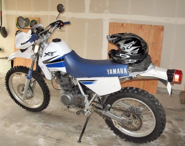
Nice.. I have a couple myself.. I enjoy dualsporting to get to some of the caches in the hills.. let me know if you want to take a ride some time
I placed this one last year via my dual sport..
you can drive up to it with just about any vehicle, but the fun way is to take the multi-use trail up from the Naches River area
Sounds like fun! I just need to get a motorcycle carrier for my receiver if I'm going to venture out that far. The bike has a top speed of ~65MPH so I don't really want to do much (if any) highway travel on it. Also, my butt-in-the-saddle time is pretty short.
I hear ya bout not wanting to do much highway travel.. we often stage up on FR 70 East of Greenwater and ride the Naches trail and/or forest roads down to hwy 410.. not a lot of geocaches along that route, but probably half a dozen or so that you can ride up to. The Southern end of GPNF is also a great destination for caching by dual sport.. tons of caches down there.
here's a carrier I have.. and a lot of people in our group have. We like it for relatively light weight (aluminum) and yet is quite strong and well built.
http://www.amazon.com/AMC400-Lightweight-Aluminum-Motorcycle-Carrier/dp/B000B8LIKM
-
I'm looking at a motorcycle on Saturday. If I can get some stuff done, I may be able to work up an Oly hike on Sunday. The freeze level went way up, so I don't know what it looks like up there.
what kind of motorcycle Criminal?
Nice.. I have a couple myself.. I enjoy dualsporting to get to some of the caches in the hills.. let me know if you want to take a ride some time
I placed this one last year via my dual sport..
you can drive up to it with just about any vehicle, but the fun way is to take the multi-use trail up from the Naches River area
-
I'm looking at a motorcycle on Saturday. If I can get some stuff done, I may be able to work up an Oly hike on Sunday. The freeze level went way up, so I don't know what it looks like up there.
what kind of motorcycle Criminal?
-
Alright, I just took some time and went through my caches and added attributes to them. Most of my older cache had attributes, my newer ones didn't.
I'm still not sure which attributes to use when, somewhat of a guess on my part. If anyone finds one of my caches and feels an attribute was needed and not there, or there and not needed, let me know.
yeah.. we have a convert! as for picking which attributes, it is somewhat of a guess.. who's to say what is fitting for a child, or what not, but more is better, just make sure they fit
-
No I do not use pocket queries. I have tried that feature once quite a while back. But for my kind of caching, I usually just load a bunch of caches in the area I'm going to.
Now that I have had my second knee replacement, I may be able to do a lot more caching this summer. Pocket queries may become a great help, but I haven't needed them yet.

Yeah, that explains. Just take a look at the page where you create them, you'll see that you can filter by attributes. And some cachers actually use this, for example to find caches where they can walk with their dog. That's why it makes sense to put the "dog" attribute even though someone looking at the listing or at the location would know that dogs are allowed anyway.
I use attributes for PQ's all the time
for example
to get a list of child friendly caches that involve a hike, but not to strenuous for when I go out with my grandson
or to get a list of jeep friendly or trail bike friendly caches (I often cache by jeep or motorcycle)
or to get a list of caches with a good view, or a waterfall
the list goes on and on.
-
I'll make a further assumption. A lot of caches are/were placed by inexperienced newbie cachers, that likely don't understand the value of attributes. The same can be said about caches that don't offer an additional way point for parking, or even any kind of help for parking or access to the cache etc. I do wish that reviewers would help suggest these things to cache placers, and I have always felt a person should have a set number of cache finds before being able to place one.
That's not necessarily asking for rules that allow the game to be played a specific way, but is more about educating cache hiders so we can all use the great tools that Groundspeak provides to improve the experience for everyone.
-
In addition, you can use the Favorites feature on geocaching.com to sort caches in an area by Favorite votes, which is very handy for finding local favorites.
you need to be a premium member for that
edit: oops.. only need premium to log favorites.. anyone can sort on them
-
I am very pleased to announce Heli-Caching in the Lewiston, Id area. We got together with Kiwi Air to offer something special for the 2011 WSGA Campout and it will be continuing with more trips added after the campout.
It starts August 5th and 6th for the registered Campout guests and will open up after that weekend for anyone to go Heli-Caching and earn a free coin (free
 )
)Check them out http://www.kiwiairhelicopters.com/geo-caching.html
Also on facebook http://www.facebook.com/pages/Kiwi-Air-Helicopters-Flight-Seeing-Tours/125024867511632
Here is the event page on facebook http://www.facebook.com/event.php?eid=193540233999734
wow.. thats pretty wild.

 )
)
Visiting August 8-9
in Northwest
Posted
My family and I will be out of town next week, but your best bet is to use the search feature, maybe sort it by favorites, then make a PQ out of it? there are some great caches in the area, but by and large, like any suburbia, lot's of duds too.. If your more adventurous, and can do a bit of hiking, well then this area is pretty special. Places like Cougar/Tiger Mountain have hundreds of caches, some great ones, a lot of not so great ones, but you'll get lots of good hiking in, some great views of Seattle etc. Venture out along I90, and you have the Iron Horse State Park, with miles of easy to walk/bike ride. If your more in to urban hunts, and want to do a little Seattle sightseeing as well, head on over to the Seattle Waterfront/Pike Place Market area.. some pretty wild, and interesting caches in that area. Then there's the Lime Kiln trail up near Granite Falls, and the caches along the Mountain Loop Highway with the Big Four Ice caves and Monte Cristo are spectacular hikes and have some fun caches. Snoqualmie Falls is a fantastic place to visit with some fun caches as well.
Another option.. if you're in to hiking, go to this website.. http://www.wta.org/go-hiking/hikes
and maybe pick a hike that sounds good, and there is bound to be one or more caches along the route.
let us know how it goes.