


Puppy Dawg
-
Posts
461 -
Joined
-
Last visited
Posts posted by Puppy Dawg
-
-
bump
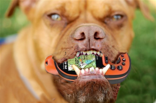
While we're at it, let's have some scratch marks and drool on the GPSr.
-
I don't think there is. Could be wrong though.
-
I'd muggle the prison.
-
The water part..this is a really tough hike, so I don't think many folks would be willing to do that! The fold feature...is it the "lake" he's talking about? (the part that's all sandstone) And for the other idea, I'll try to find Dry Lakes Ridge Summit. (There is no summit in the road near the ridge, the road just keeps going up) Thanks!take vertical and horizontal measurements of the fold feature if possible. Ask the number of visible layers in the anticline. If there is a suitable exposure, time how long it takes a pint/quart or other suitable amount of water to be absorbed by the Eocene Juncal Formation sandstone, that would probably vary depending on conditions but the visitors would be taking a measurement and making an observation.
-
So here's a description of the area I found on a website:
I'm just stuck on how to make good questions to get it approved. If anyone has help with that, please either PM me or reply here. Thanks!Dry Lakes Ridge was created primarily during the orogeny (mountain building) of the western Transverse Ranges, likely during the middle Pliocene (1 to 5 million years ago), and major deformation as middle Pleistocene (20,000 to 1 million years ago). Geologically, Dry Lakes Ridge is composed of Oligocene nonmarine and Miocene and Eocene marine sedimentary formations. The ridge represents a large anticline trending east-west. The youngest rock, of the Coldwater and Cozy Dell Formations, only remain on the flanks of the ridge, mostly on the south side. The oldest rock, the Juncal Formation of Eocene Era, is exposed on the ridgetop, primarily on the northwest part. Most of the ridgetop finds exposed Matilija Formation of late-Miocene Era. The anticline is clearly exposed in the roadcut at Dry Lakes Ridge Summit on State Route 33, but is not marked on the road. A small spring surfaces here seasonally, and the Forest Service tried drilling for a reliable source of water here, but failed, as this spring is not supported by the deep aquifer like that supplying Bellyache Falls.The ridgetop "lakes" have never held water. I have hiked up to the top many times, and specifically went up there the morning after a heavy rainstorm to see for myself; no standing water. I did find a flotsum and jetsum rack line along the southern edge of what I call Basin 3, the largest, nearly westernmost basin, pictured above; however, no standing water at all. The soil and bedrock are very pourous, Eocene Juncal Formation sandstone, which absorbs water very quickly. In addition, the sedimentary strata are nearly vertical at the ridgetop, as Dry Lakes Ridge is an anticline with the top eroded away.
-
Don't do anything until they need maintenance. THEN find someone to adopt them.
-
I have one called Pining for a Cache. Based on your description, the difficulty rating would be unaffected and the terrain would be 3-4 stars.
-
It would be useful because trail cache often go the full two weeks. Around here, the FTF hounds are everybody, so if the caches are on a trail, most would only get it if it was a FTF oportunity. And when the notes get changed to smileys, it looks as though the cache has already been found. Caches would get found quicker, then reccomended to other cachers. It would mean more people ultimately go find the cache.<snip>
I just don't get it either. What really is the point and who (specifically) would use it? for what purpose?
-
I try to make the finals of my puzzles regular or large, but don't mind if their micros. And regarding ^^this post^^, you will eventually get used to rating pyuzzles. Maybe base it on the ones you've found??
-
Altoid tins are actual smalls. Film cans and bison tubes are micros.It never ceases to amaze me at how many "small" containers there are out there that are the approximate size of a film can. ...
AGREED!!!
About 20% of smalls I have found this year fall into that category. Film cans, altoid tins and even 2 bision tubes.
-
Lots of multis are just, yeah, many finds for one smiley. linky How do you think I could've done that without making it a multi?? Also, why do people care about their smiley count anyway?
-
Animated, please.A graphic that's pretty much just bacon falling from the sky. That make more sense?
Animated or non animated?
-
Yes, but I didn't have more than one feature request! This also shows what I still want, as well.If you had four new feature requests, then it would mean something to post them all "in one topic". But this is only one new feature request and a rehash of three old ones.
I know of one guy who has over 200 ECs. Another who has over 100. There are lots around here. I want it so when you click on the cachepage you know exactly what to expect.
This might make sense if there were so many EarthCaches around that people were having difficulty identifying the single-stage ECs from the multi-stage ECs. But as it is, I don't see the point (other than adding another icon). ECs are rare enough that I don't think we need to subdivide the category any further.Multi-stage earthcaches - See this thread for more info.
This is mainly wanted (by me) for scoping out cache locations. So many puzzle ideas, CCC ideas, etc, too few spaces. It's good to be able to easily find spots that will work. If this gets implemented I'll elaborate.
You can already click on the "Google Maps" link on the cache page, zoom in all the way, and then zoom in one more click to get StreetView. Assuming that StreetView has data for the area near the cache, of course.Street view in google maps - See this thread for more info.
It's a waymark that's also a geocache, only hard to submit.
Like others who posted to the original (and now closed) thread, I don't get it.Waymarking Hybrids - See this thread for more info.
Around here, betafinds are extremely common. People post a note saying they're a beta and in 2 weeks (or after the FTF is claimed) they change their logs to smileys. This would help because peoiple can still see that its a possible FTF, and the betafinds don't have to worry about it any more.
Just log your "beta" find sometime after the first few logs are posted.Betafind log type - See Post #2 for more info.
Correct
Like others who posted to the original (and now closed) thread, I don't get it.Waymarking Hybrids - See this thread for more info.OMG! After reading that about 5 times, I think I'm the first one other than the OP to understand it!! After submitting a Waymark, if you can beat a little online game, involving clicking your cursor on fast moving objects, you will be allowed to post your Waymark on Geocaching.com as a "Waymarking Hybrid" Geocache.
I say bring it on!

Lots of people would use this. The log shows up on the cache, it just doden't alter the number of finds on the cache. It gives you a smiley though.Betafinds??
Let me get this straight - you want your "find" count to up by one but the total find count on the listing page stays the same?
I don't get it.......why? Would the log show on the listing page? who would use this?
-
Alright! Great work!
-
I'll take some. But I already said that elsewhere...
-
I think he meant seperate, not combined.
-
So how about a log type where it alters your smiley count, but does not count to the total smilies logged in a cache? eg, you can log one, the cache will still show up unfound.
-
By popular demand, all of my feature requests today will be in one topic.
Here is what I currently want:
- Multi-stage earthcaches - See this thread for more info.
- Street view in google maps - See this thread for more info.
- Waymarking Hybrids - See this thread for more info.
- Betafind log type - See Post #2 for more info.
OK, that's it for today.
Edited to fix BBcode.
Edited again to make it look less like release notes.
- Multi-stage earthcaches - See this thread for more info.
-
Yes, let's see it happen.
-
No to both questions. but there should be a way.
-
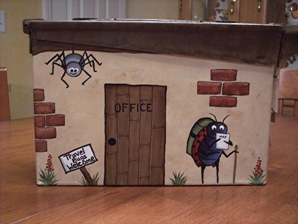
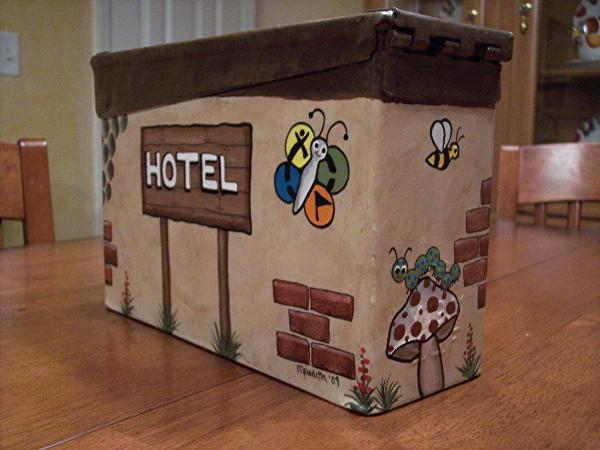
Man, that is great!!Here are a couple of pics of an ammo can that I painted recently for a friend.

-
While caching in the woods, wear long pants, gloves, and a jacket. Should work.
-
A graphic that's pretty much just bacon falling from the sky. That make more sense?
-
I have had no bad experiences while group caching. Favorite groups, well...random cachers really...

Southwest Trails mapset for Garmin GPSr's Available
in West and Southwest
Posted
California? Or just wishful thinking...