


DaveD
-
Posts
589 -
Joined
-
Last visited
Everything posted by DaveD
-
Groundspeak is removing Benchmarking and the logs/photos
DaveD replied to Michaelcycle's topic in Benchmarking
I am very sorry to see this go. Many thanks to so many who have posted great pictures and hand-held positions that I've been able to harvest and improve the quality of tens of thousands of stations in the National Spatial Reference System. I'd like to think that I've made some friends here along the way as well. This has been a great site to help the National Geodetic Survey do a bit of educating about the importance of these data to the country. If anyone has follow-up comments or questions about these marks just drop me a line -- base9geodesy@gmail.com. Peace to all and thanks again -- Dave Doyle owner Base 9 Geodetic Consulting Services NGS chief geodetic surveyor (retired)
-
It's always best if you owner contact info, but if that's not available for whatever reason than yes submit reports detailing mark conditions. Having an updated recovery does not in any way indicate general right of access on private lands.
-
Excellent Michaelcycle. I must admit to a certain level of frustration when I see a note posted by a geocacher that they found a bench mark with a scaled position and it was "way off" but then they don't provide the value they got.
-
I don't specifically remember PG0958, but in general yes that's probably me. In general, I review posts each day to see if someone has posted good quality pictures and/or hand-held values for scaled bench marks. I never post a recovery for a mark found by a geocacher since I did not recover the mark myself. I validate all hand-held positions to ensure that the match the station description. Assuming all of decent quality I can then upload them to the NGS Integrated Database. Having spent years on the NGS datasheet committee I still feel a commitment to do what I can to improve the quality of the reference frames.
-
These are not in error. All of those are USC&GS bench marks that have relatively accurate horizontal positions that were determined in 1942 by the U.S. Geological Survey. Their values are published on the North American Datum of 1927 (NAD 27). I harvested them and simply transformed the coordinates to NAD 83. They more than satisfy the requirement to be labeled as HD_HELD1. I have performed similar transformations for several thousand scaled marks that had been set by USC&GS and later positioned by USGS. Regrettably the vast majority of horizontal control established by USGS was never formatted and provided to the National Geodetic Survey for inclusion in the National Spatial Reference System.
-
If you're looking for a great holiday gift for your favorite bench mark hunter, take a look at "Lasting Impressions" from Bernsten International The author, Ronda Rushing is the daughter of the company's founder and until retirement was the company president. It's a great collection of pictures and stories about unique and interesting survey marks across the country.
-
USGS stream gage reference marks are not like reference marks for a triangulation station. There is no station mark only the stream gage. They don't typically measure the distance from the RM to the gage but rather perform leveling to determine the height difference. Like Wister6813 and Bill93, I think the coordinates are a typo. USGS has set thousands of these marks across the country and only a very tiny fraction have ever been accurately connected to the National Spatial Reference System maintained by NGS. In some cases the gage has long since been removed but the RM remains.
-
Oddity: Where did "I" go, and how'd "M" show up?
DaveD replied to foxtrot_xray's topic in Benchmarking
While I can't speak directly to a line "371" in Indiana, it's highly likely there are more as Bill93 noted. It certainly wasn't normal but there were several instances during my tenure at NGS (72-13) where one or more level lines were set and for a variety of reasons never leveled to. -
Correction has been make.
-
Thanks for the sharp-eyed posting. Since this mark is less than a km from Montana I'm sure it was just a typo when someone entered the recovery. I've sent a note to one of my colleagues still at NGS to review and mark the appropriate correction. The MN DoT surveyors are a great hyper-active bunch but I'm pretty sure they didn't recovery this one.
-
That reply from NGS must be from someone relatively new who is doesn't yet know that USGS does not have a database - never will. We tried hard back in the '80s and '90s to work with USGS to automate their data for inclusion in the NGS Integrated Database - lots of talk but not much action. They submitted a bit of their horizontal data in some western states but that was about it - none of their leveling data ever came across.
-
Pipe marks were common largely because they were very easy to prepare and set. Concrete marks are heavier even if they are prefab and certainly require more time and resources when they were poured in place although they are way more stable. Pipe marks were also very popular with US Government Land Office (USGLO) and the Bureau of Land Management (BLM).
-
Without more specific information about the marks location my best guess is that the info below published by the U.S. Geological Survey in Bulletin 766-U is the mark you're looking for:
-
The marker you found is one of many set by the U.S. Geological Survey (USGS) in support of their great effort to create the national series of topographic maps. While the positions and heights they determined for these and their other marks were good enough to support that effort, they were seldom of the quality required by the U.S. Coast & Geodetic Survey (USG&GS), now the National Geodetic Survey (NGS) to be a part of the foundation horizontal and vertical national datums. The vast majority of USGS marks in the NGS database and listed for Benchmarking are individual marks that were observed by USC&GS/NGS as part of their later field efforts. So while PTS 1-5 and likely 7-?? were set only this particular mark was later observed to the highest national standards. Information on the other marks can be obtained by contacting the USGS field office in Rolla, Missouri.
-
Back in "the day" the U.S. Coast & Geodetic Survey had essential three different survey functions for control marks. 1) General geodesy, set and observed by horizontal and vertical field units at the highest levels of positional accuracy. They are the ones who set Triangulation, Traverse and Bench Mark disks. 2) Airport survey crews responsible for positioning major airports as the foundation for instrument approach procedures and aeronautical charting. In many cases these field teams were small and usually set marks labeled "Topographic" 3) Shoreline crews - generally worked off USC&GS nautical charting ships. The often set "Hydrographic" disks as the support for either shoreline plane table surveys and/or associated photogrammetry surveys. Most control information for these Topographic and Hydrographic marks was managed by the respective USC&GS offices that performed shoreline mapping and aeronautical charting. Since the majority of these stations were not observed to national geodetic standards they remained unpublished for the general public but often used for repeat mapping and charting work. Over the years, from time-to-time some of these marks were connected by the geodetic field teams and their positions upgraded to national standards and are now published by the National Geodetic Survey. Regrettably sometime back in the late '80s or early '90 the paper record of most of these marks were destroyed as they no longer served their original purpose with the advent of GPS.
-
Bill93 - send a note to Malcolm Archer-Shee -- malcolm.archer-schee@noaa.gov
-
NGS started automating all the positional, height and descriptive data for marks that they already had in paper form beginning in the mid-1970's. All of the original data that is now in the database was hand punched on 80 character cards. Over the years the database structure and data entry systems have changed and numerous automated checking routines that did not exist when the DB was first developed. These data, along with a similar cooperative effort by the Canadian Geodetic Survey formed the very first national geodetic control databases anywhere in the world. While the agency did extensive outreach to other federal and state agencies performing geodetic surveys (e.g. USGS, Bureau of Land Management, Corps of Engineers, TVA etc.) only a very modest amount of data was ever received from them.
-
Both marks you found were set by the U.S. Geological Survey (USGS). The second one DOP 2 1959 is a standard marking they used which includes the initials of the survey team's chief of party. Regrettably the vast majority of the data for marks set by USGS was never submitted to the U.S. Coast & Geodetic Survey (USC&GS), now the National Geodetic Survey (NGS) for inclusion in the national reference systems. You may be able to find some information on these two marks by contacting the USGS office in Rolla, MO -- https://mcmcweb.er.usgs.gov/
-
The Florida Geospatial Users Group has recently posted several 1-hr videos that describe some of the fundamental concepts in geodesy including; reference surfaces, horizontal and vertical datums and the forthcoming 2022 datums planned by NGS -- https://www.youtube.com/channel/UCG69vYuN1Q61fWKiXffzo9A/videos These may help geocachers better understand the importance of what are generically referenced on this site as "bench marks"
-
I deeply regret to inform that my friend and colleague NOAA Commander George Leigh (NGS Surveyor) passed away on June 26. George was a well respected geodesist at the National Geodetic Survey and contributed to the development and implementation of our National Spatial Reference System serving on NOAA hydrographic charting ships, geodetic field teams and performing critical administrative duties at NGS headquarters. George was passionate about the history of the agency we served and his efforts and outreach can be found in many different places on this site. He will be deeply missed by all of us who worked with him and those he helped along the way.
-
I suspect this is a magnetic station, actually one of a pair that would have been originally set. The inscription NM would stand for North Meridian. It's very typical of the type set by the US Coast & Geodetic Survey during the late 1890 to early 1900s. Regrettably some of the USC&GS Special Publications that described magnetic observations from the 19teens are not available on the NOAA library site.
-
It's not that marks with good coordinates aren't used in boundary surveys, it's that they don't control the boundary that comes from the description of the parcel. The coordinates from either traverse or GPS surveys are most often used to as an attribute to the boundary corners as an aid for future recovery
-
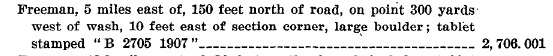
Marks with just a scaled horizontal position are true "bench marks," that is a mark for which a very accurate height was determined. These marks are an essential part of our national infrastructure as they provide the foundation for all forms of topographic mappings, water management, flood insurance mapping, storm evacuation route planning - the list goes on and on. The height for these marks were determined by the process of geodetic leveling - . This process does not have a horizontal component to it. Marks with accurate or "adjusted" heights were determined either by the surveying technique of triangulation, traverse or more recently GPS. Some marks have both adjusted vertical and horizontal values but they are a relatively small portion of the network. The scaled horizontal positions were as it states literally scaled from U.S. Geological Survey (USGS) 7.5 minute topographic maps. If the mark was shown right on the map it's generally possible to scale it's position to an accuracy of about 1-2 arc seconds (100-200 ft). Marks that were not shown on the maps required to cartographer to read the description and from that make a best guess estimate of the marks location - hence it is not uncommon to find their values in error by 200-600 ft and sometimes more. It should be noted that with the exception of property boundaries defined by coastal water lines (e.g. Mean Low Water etc) geodetic control marks, both vertical and horizontal are only used in boundary surveys to provide and attribute for future use. With the exception of some of the state boundaries virtually no property in the U.S. is defined by coordinates. This may change in the future but it will require considerable changes in property law. I should also note that GPS coordinates posted on this site for scaled bench marks have been harvested and updated nearly 70,000 marks in the NGS database which will contribute to improved recovery for others in the future.
-
Missing benchmark that may relate to the Kryptos mystery
DaveD replied to skintigh's topic in Benchmarking
There are three likely reasons that the artist identified a mark as being from the U.S. Geological Survey 1) Some people think that all marks were set by USGS 2) Most likely in my mind - USGS had set a witness post near station LOOMIS. Just like USC&GS/NGS, it was not at all uncommon for their field teams to set a witness post near an existing mark that they had used if one did not have one - also like the USC&GS/NGS metal witness posts of that theirs specifically said to contact USGS for information. The artist could easily have mistakenly said it was a USGS mark because of a sign. 3) USGS may have set another mark in the area. Less likely I think. You would need to contact their office in Rolla, MO to try and find any data. Unfortunately USGS doesn't provide much in the way of resources to support their old control information so it may be a bit of a chore. -
Missing benchmark that may relate to the Kryptos mystery
DaveD replied to skintigh's topic in Benchmarking
The data I was provided were the observed performed at station LOOMIS before it was destroyed. These included what's called the abstract of directions which allowed me to compute the orientation or azimuth of the line from LOOMIS to BOWEN, and the electronic distance measurement between the stations. That is sufficient detail to compute the position for BOWEN.

.png)
.png)

