


1setter
-
Posts
132 -
Joined
-
Last visited
Posts posted by 1setter
-
-
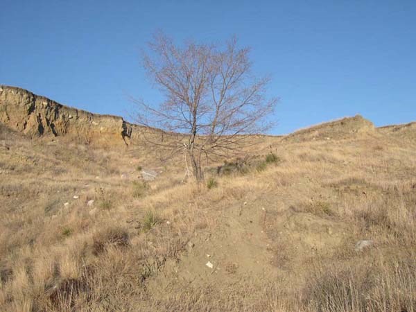
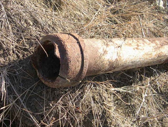
Here is what happens in South Dakota along the shore of Lake Oahe (Missouri River) with too much rain. The second picture is a pipe cap marker from 1889. It ended up uncovered at the base of a new cliff.
-
Leave me on. I love stats.

-
I see my user name on the list. I'm not sure how it got there. The only NGS reports that I have done have been a few destroyed marks. I started posting a few of my old ones with JDS initials so I might get something besides 0's behind my name.
-
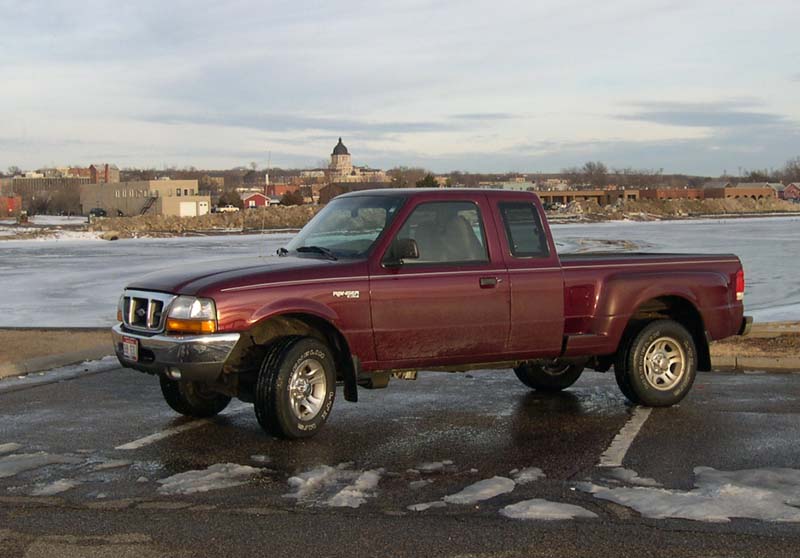
'00 Ford Ranger unless it's a long drive at high prices, then we take the Toyota Camry.
-
I've logging a few along Interstate, but I did them as you mentioned; from the outside. Most are right along the fence. Some I didn't even have to cross the fence, just reached through to clean it off and took the picture from the top. A couple were near an exit and were outside the fence or there was no fence.
-
Here's a natural way to avoid ticks of any kind. When out walking the trails, don't walk on the trails. The ticks don't move far from where they are born and they are born where they fall off the deer. If you inspect a heavily used deer trail closely, you will see them all over the grass on both sides of the trail. Very hard to find where it's harder to walk.
-
I'm in Pierre. I probably won't show up for a cache event. I'm a caching loner. I'm even trying to work up an article for Today's Cacher about the magic of caching alone.
-
This looking for 'unfound' caches can be a bit of a let down. Last summer I targeted Crystal Mountain in the Black Hills because it hadn't shown a log in almost a year. When we found it, we saw that the log book had been signed the previous fall, but apparently they weren't in to logging online.

-
Actually I did view your Post and that is why I thought it was written like a salesman would write. I guess I should have known it wasn't a pitch because a salesman wouldn't have made it so darned hard to find.
-
Sure sounds like a sale's pitch to me.
-
Mine is at 19.15 miles. I just upgraded the firmware. That pretty much takes care of it. It's been to England and France and back in the plane. That put some miles on it.
-
My daughter says she is going to school in Florida next year. I'm caching down and back.
-
It must be all big city folk here. I have to go 141.9 miles and I included virtuals and locationless. South Dakota is a bit sparse. If I pretend I am at my old home town in Montana, I would have to go 33 miles to get to the first cache, but about 110 to get 100 because it is closer to the cache laden Black Hills.

-
I noticed a couple of crazy errors by looking around local states. It says the lowest in Wyoming is the Sheridan Muni Standpipe at 3.28 ft. There is no place in Wyoming even close to 3 feet in elevation. And Sheridan is at the foot of the Bighorns which are the tallest range in Wyoming topping out at over 13000 ft. Montana's lowest is shown in Park Co. just north of Yellowstone Park. 631 ft. Any point on the Yellowstone river all the way to North Dakota would be lower, even though the lowest point in the state is in the NW corner on the Kootenai River. 1800 ft. In South Dakota here, the oldest is shown in Brookings Co. dated 1874 and oddly designated I29 138.85. It seems strange that they would have known at that early date exactly where I-29 would be built. I'm betting they were off by about 100 years when doing the entry. I see in the entry, the stamping on the disk says 1974.
-
Just the fact that the marker was at the exact coordinates tells me it isn't the right one. They never are on an adjusted mark. It may be 50 to 500 feet away. This is the description location you are looking for. TEMP. PT. NO. 3 IS A 1/4 INCH BRASS ROD DRIVEN BETWEEN THE EXPANSION JOINTS OF THE SIDEWALK ALONG THE SOUTH EDGE OF EAST 54TH. STREET SOUTH OF THE F.A. MC DONALD SCHOOL. IT IS 15.5 FEET EAST-SOUTHEAST OF THE SOUTHEAST CORNER OF A METAL METER BOX, 11.0 FEET WEST-SOUTHWEST OF THE SOUTHWEST CORNER OF A METAL METER BOX, 5.2 FEET SOUTH OF A POWERLINE POLE BETWEEN HOUSE NUMBERS 123 AND 125 AND 2.0 FEET NORTH OF THE SOUTH EDGE OF THE SIDEWALK. THE BRASS ROD HAS A MARKED CROSS THAT WAS HELD AS THE POINT.
-
Here is one near Philip, SD. PT1156 It's a bit blurry because the picture was taken while speeding by on the highway.
-
My favorite so far was Bloomin Heck a 7 part multi cache in London. Took a few days while sight-seeing with a group, but I got it done before we left.
-
The software to use in education along with a GPSr is mapping software such as ESRI's Arcview GIS. You can then use coordinates and points collected and compare with a wide variety of data that is available from most state's environmental departments.
-
I've had some trouble taking pictures of disks with my auto focus camera in the dark. Ended up with just a white blur. Mine needs at least some light to help with the focus.
-
Shape files are used with GIS software. I use them with ArcView GIS. Downloading the NGS shape files allows you to insert them into a map and gives a table of details about each PID downloaded.
-
Even with only 2 people, I like a 3 person tent. We use the REI Taj 3 tent. But I see it's not on sale this year.
-
Want to add some more? Around here they are called depots. Add that to your search.
-
That illegible word was probably 'beef jerky'.
-
It looks like there is something 1/2 mile or .9 mile S of the Pass KK2038 . Without a picture, nobody here will be much help.


Can I Borrow Any Gps
in Education Archives (Read-Only)
Posted
What a grand idea. I think we should all send our GPSr to someone unknown across the country. I'm sure it will be back in a week for sure.