


Mega Scooter
-
Posts
72 -
Joined
-
Last visited
Posts posted by Mega Scooter
-
-
-
Excellent find and excellent photo! This photo ties with a bench mark as the oldest photos of a USC&GS disk that I have seen.
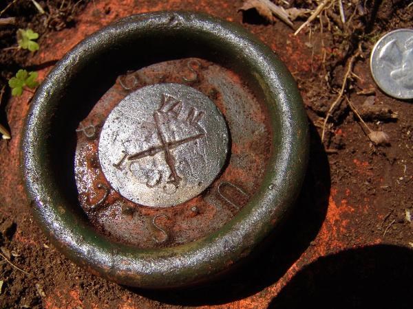
There are actually 4 variations of this old "cup" style of USC&GS disk. One had a large scribed "+" on the central flat area, one had a medium sized "+" in the central flat area (yours), one had a triangle on the central flat area, and the last had none of the above (the one found has a center-punched small hole near the center.
GeorgeL
NGS
Thank you,
I found one other like this in MAY RD1700
The photo isn't as good. I think that the "+" was put on when it was stamped.
Here is YAM 1903 I don't guess I'll ever see another. Nobody's THAT lucky.
Enyoy
-
I'm beginning to believe that triangulation stations are harder to find than plain old benchmarks....

Even with reference marks, they're difficult at times.
That being said, I'd like to say...
Fantastic Recovery!
~ Mitch ~
Thanks Difficult Run,
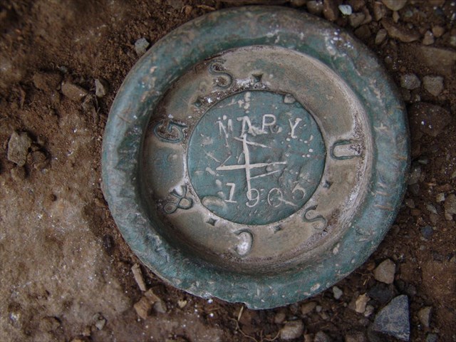
MARY was not an easy mark. But I have to say, the pure joy of brushing off the last of that dirt, followed by an almost sinful sense of pride, makes me think that this Benchmarking stuff might be addictive.
—M S
-
MegaScooter,
Mary is a very interesting looking benchmark. Thanks for sharing. Did you have to use your metal detector to find it?
Also, I see that people logged a find for Mary in 2006. Does that mean it was covered with 11 inches of dirt in 2 years?
-- TillaMurphs
I tried using a metal detector and a probe on the first attempt. But neither would penetrate the crushed stone. Also, there are a lot of metal artifacts and the ground was far too hard to dig up everything. So I took a lesson that I learned here in the Forums. (What a gold mine for Benchmarking knowledge.) I acquired the best compass I could afford, with an adjustment for declination and mounted it on an aluminum and plastic tripod. Malnut and I stretched string along the azimuths from the box score. We made all the measurements we could find to make and left a mark for each one. We ended up with an ellipsis shaped area about one by two feet. Then we started digging. The sod over the mark makes it clear that the ground hadn’t been disturbed in the last five or ten years or more.
MS
-
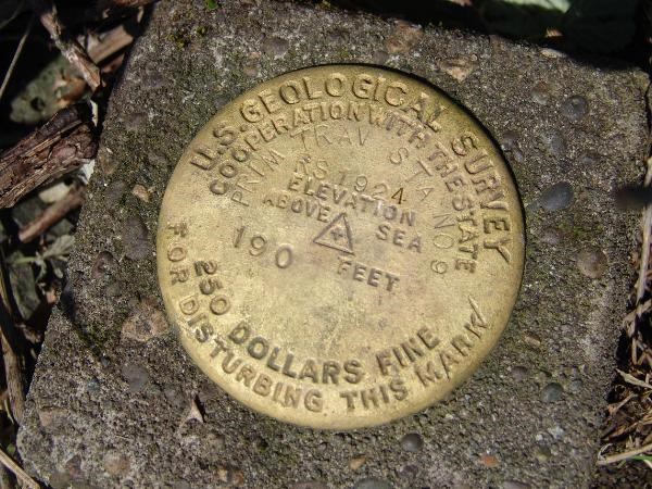
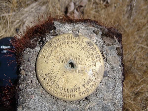
So I went up to Mary's Peak in Oregon today and unearthed this old style disk.
I thought some of you would enjoy it too.
Meet MARY 1903
-
Carry a whisk broom with you. A vigorous brushing will sometimes bring out detail and not change the patina.
-
A bump to keep this interesting thread alive. So here is my small contribution:
RD1700 (US) U.S. Coast & Geodetic Survey – Oldest - better photo
RD1752 (OR) Yamhill County - 2
RD1708 (OR) Polk County
-
-
Here is a photo of HOLD RM 2 and part of the quarry that is about to eat it.
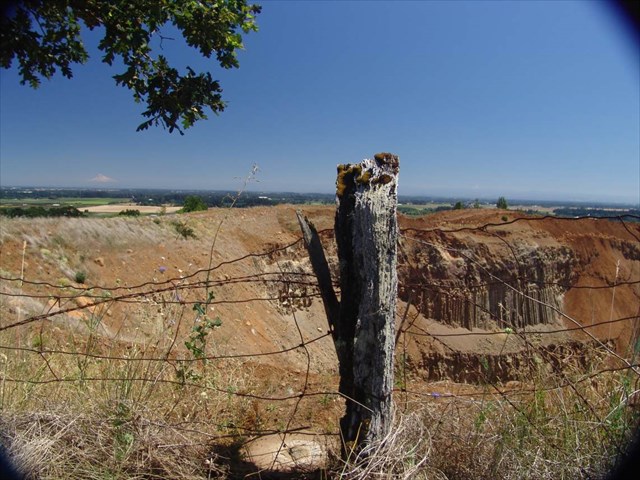
Here it is from the other side. Not very scenic I know, but may be worth seeing?
-
-
More photos please.

-
Offer them here first, please.
-
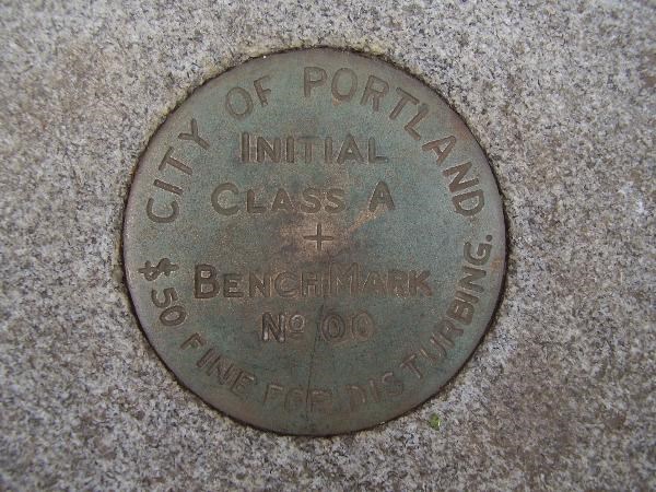
And I though this one looked a bit cluttered!
It would be hard to get that one right. The 24 is dominant.
-
I haven't guessed right yet. Here is one for you to consider.
Shirley~
Close.
 I was thinking BMU 137 1957 because of the previous ones. That is really busy.
 -
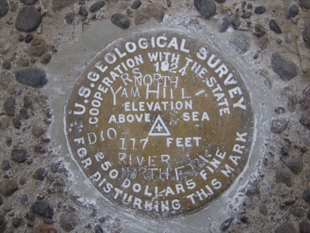
“RNYRNF”
So what’s with all the extra stampings? Are there a lot more like this out there? I can almost imagine them running out of room and adding another disk. Well ... almost.
-
Can you guess what the designation of this disk is by looking at the stamping?
Check your answer HERE
-
Here are two more. I wonder if they were Bright-Dipped or Anodized? Look how PTS 8 is starting to oxidize in the center where it's damaged.
PTS 9
PTS 8
Got the Titles mixed up.
-
double post darn it
-
I have my fingers crossed. Sure hope this works.
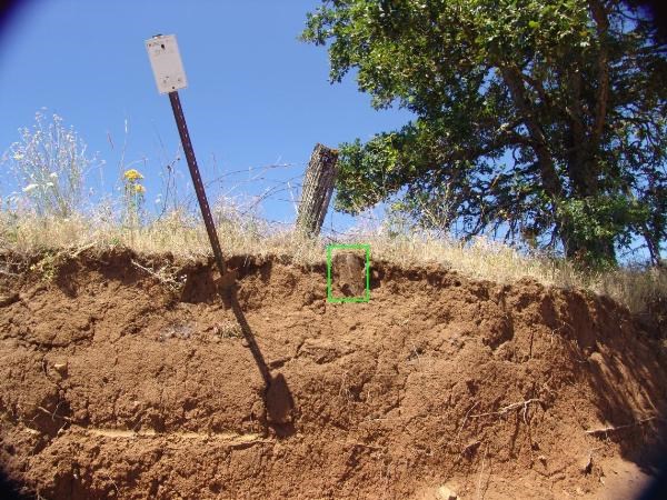
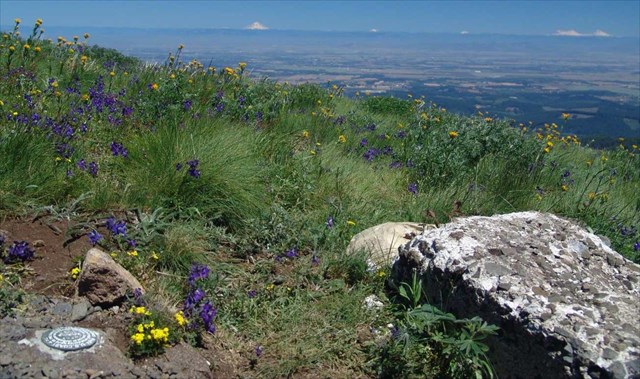
Mary's Peak RM 3 and the Oregon Cascades.
-
VERY nice!
And interesting to note that all eight notes on the mark are MONUMENTED, not RECOVERY.
Seems that everyone felt the need to upgrade the mark in some fashion.
Yes, the mark looks like it could very useful. To the East, it overlooks the Willamette Valley to the Cascade Range, and to the West, the Chehalem Valley to the Coast Range.
-
In Oregon, This must be one of the oldest Disks. It's an old style C&GS disk placed in 1903. RD1700 YAM 1903 I found it today and ... ok I'm very proud of it.


Disk Logo List
in Benchmarking
Posted
Sorry BuckBrooke, I just found out that the links in my last post didn't work. Don't know what I did wrong.
RD1700 (US) U.S.Coast & Geodetic Survey (oldest type)
QE2315
RD1752 (OR) Yamhill County (with logo)
RD1708 (OR) Polk County
M S