

Mega Scooter
-
Posts
72 -
Joined
-
Last visited
Posts posted by Mega Scooter
-
-
AZchachemeister, Your old gold Reference Mark is outstanding. Please excuse me while I blush with envy.
ArtMan,
The Data Sheet says that the Stamping for EY0879 is “REESTABLISHED 1923”. The Data Sheet for EY0880 says the Stamping is “145 RALEIGH” (It says it in two places). Wouldn’t the RESET stamping say “145 RALEIGH RESET”? I’m thinking EY0879 was originally stamped “145 RALEIGH” and the reset (EY0880) was stamped “REESTABLISHED 1932”. Of course for that to be true, both Data Sheets would have to be in error. I guess that puts me in PPF’s camp. Clearly something is in error. It would be nice to see the original 1923 Data Sheet.
—MS
-
The benchmark looked like this:
Flood Plain Reference Marker
Do Not Remove
(Triangle Marking)
#########
Est. 2006
- It was a copper colored circle/disc that was flat on the ground and was set into the cement porch on one side of a bridge.
Welcome Normand99,
When you've found a way to post your find, please let us know. I for one would love to see a photo of it.
MS
-
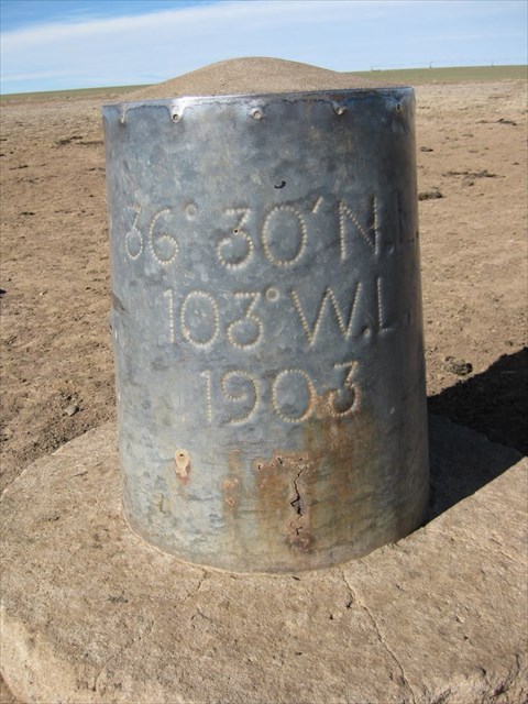
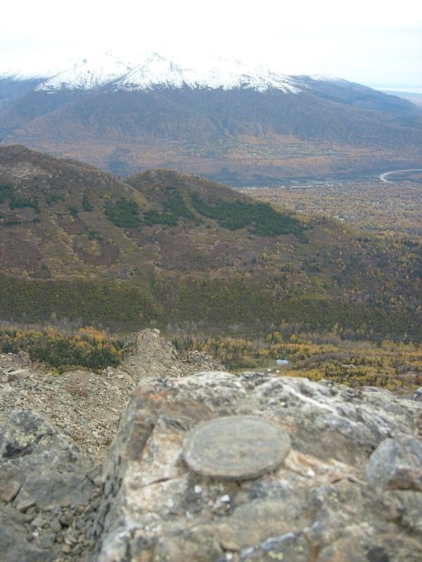
This is Kidder Astronomical Station near the Texas, Oklahoma, and New Mexico border. It’s a zinc cylinder filled with concrete. The cows use it for a back scratcher. GL1436
—MS
-
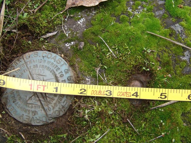
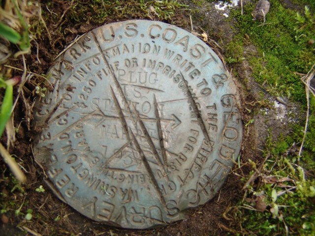
Notice the measurement is center to center. Sorry I was so sloppy with the tape photo. Not only is there a lot of slack in the tape but there is a parallax problem because the tape is so high above the Marks. I’m glad they didn’t replace the copper plug with a disk, but, why put a RM so close? RD4006
PLUG IS THE STATION
MS
-
And the Data Sheet says: 195.47 (feet) Adjusted
MS
-
-
Thank you 2oldfarts for starting this thread. This was a good day for me.
See: RD3836 MAPLE HILL 1878
The rough bushy terrain prevented me from getting closer than 200 feet to this leaded drill hole two weeks previous. But I recovered from my wounds and came back with a machete and literally whacked my way onto the site. Not much of a triumph to some of you but this mark predates my next oldest mark by 25 years. So, I’m happy.
MS
-
Here it is at Forestry Supply
"Ten-Hour Fuel Moisture Sticks"? Please tell me that doesn't mean you have to run out and change them 2.4 times a day...
Patty
Hi Patty,
I found the sticks on the scale at the unoccupied LOT. I think they put them into the environment for ten or so hours until they reach equilibrium and then weigh them.
MS
-
What is the PID for one in Hendricks Co?
Doh! I searched Indiana instead of Tennessee. Don't ask.
Benchmark not logged KA0228 S 77 IN survey disk
MS
-
Hi Nalarangka,
The Mark S 77 in HENDRICKS county was monumented in, and stamped 1946. Your Mark is stamped 1938. My guess is they are two different marks and that yours isn’t in our database.
MS
-
Thanks foxtrot xray and jwahl. You guys are two of the many reasons why I love this Forum. The problem I was having was; it hadn’t occurred to me that you could take the sticks off the scale and expose them to the environment.
 I guess the numbers indicate percent moisture. Mystery solved.
MS
-
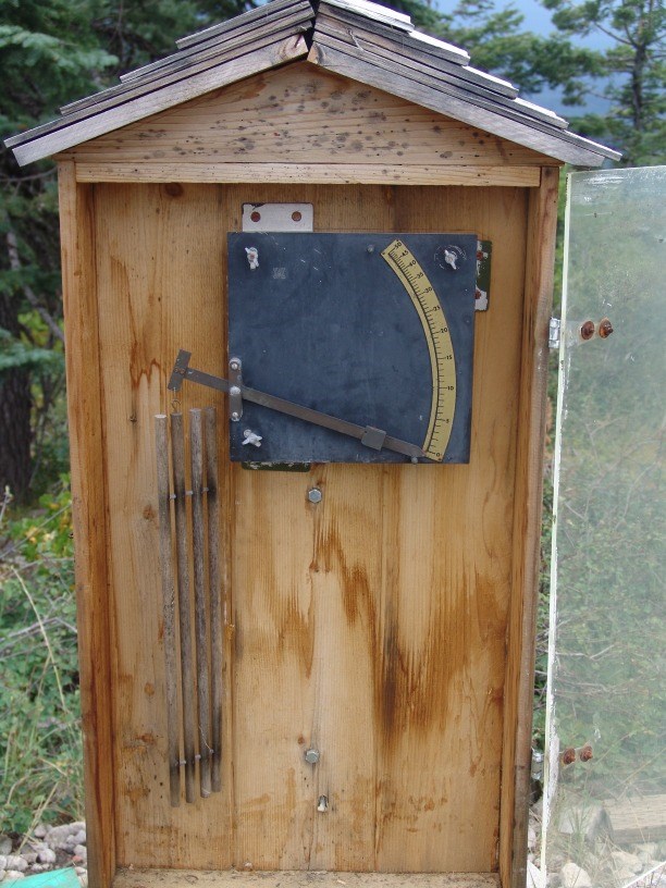
Does anyone know what this is? I found it near a rain gage at the Rustlers Peak Lookout Tower site. It has four sticks on a balance beam with a pointer. There are one unit graduations from one to fifty from bottom to top, and the units get closer together as the numbers get higher. I’m trying to convince myself that it measures humidity, the more humid the air the heavier the sticks get. No, I don’t believe that for a minute. What is this really and how does it work?
MS
-
-
 My pin arrived today too. I am delighted with it. Thank you George.
MS
-
-
-
The great and amazing and wonderful members of the TheBeanTeam found this 1956 station that is a Tidal Bench Mark: OA0708
Hi TillaMurphs,
I was just about to ask if you posted the wrong link, when I saw it. The very first line on the Data Sheet:

OA0708 ***********************************************************************
OA0708 TIDAL BM - This is a Tidal Bench Mark.
OA0708 DESIGNATION - FLORENCE
OA0708 PID - OA0708
OA0708 STATE/COUNTY- OR/LANE
OA0708 USGS QUAD - FLORENCE (1984)
OA0708
OA0708 *CURRENT SURVEY CONTROL
OA0708 ___________________________________________________________________
OA0708* NAD 83(1991)- 43 58 00.59399(N) 124 06 30.36401(W) ADJUSTED
OA0708* NAVD 88 - 10.494 (meters) 34.43 (feet) ADJUSTED
OA0708 ___________________________________________________________________
Both the Horizontal and Vertical are adjusted. I wonder if it was a Triangle Station that was adopted for a Tidal Station Mark?
MS
-
-
-
-
-
-
Bill93
That may be the tool used to make this mark.
MS
-
 My pin arrived today too. I am delighted with it. Thank you George.
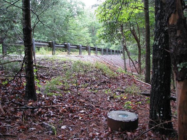

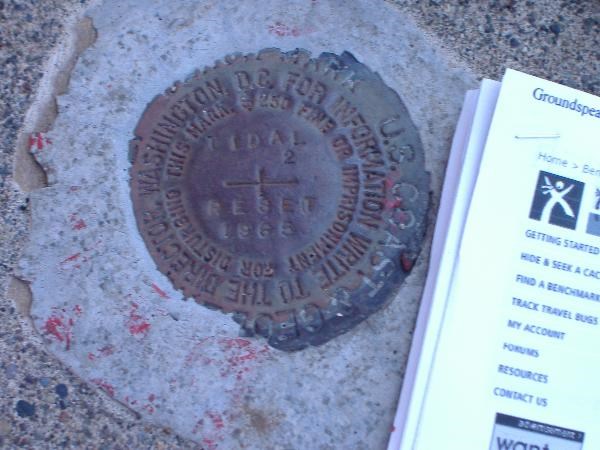
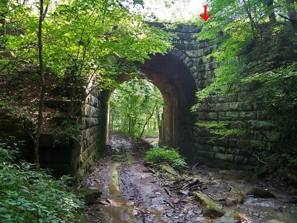
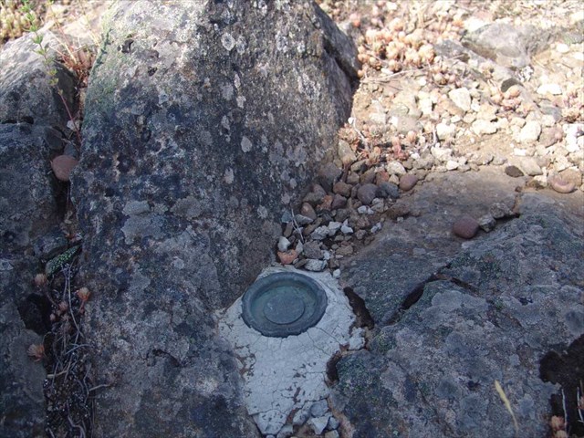
Photo Contest
in Benchmarking
Posted
This contest is in the tradition of Black Dog Tracker’s annual contest and has mostly the same parameters.
I am encouraging you to post the most interesting benchmark pictures you can find, either your own, but preferably someone else's.
Pictures that have previously been posted in other threads may be entered if you believe they have merit. There is no time parameter for this thread.
Entries must have a disk at least vaguely visible in them.
Entries should be accompanied with a link to the associated PID.
No intersection stations (towers, buildings, etc.) To quote BDT “They all look pretty good, but they're not really all that 'benchmarky'.”
A close up picture of a mark is OK only if it includes something interesting in the surrounding environment.
My thoughts on interesting include: beauty, color, composition, unusual, environment, landscape, flora, fauna ... But my interest is what you think is interesting.
I’ll start off with GN0437 a recent post by arrowheadroger. Care to play?