


Rich in NEPA
-
Posts
441 -
Joined
-
Last visited
Posts posted by Rich in NEPA
-
-
From Deb Brown's earlier post:
Good vs. Poor condition codes can be somewhat of a dilemma because there's some judgement call involved with some of them. If you find a station that has NGS control on it and the condition seems to be questionable then send me a photo via email and we'll work together to determine it's code. I hope I haven't made this confusing. If a setting is stable and the stamping is good enough to identify the station by name but the disk face is marked up I'd call it GOOD. If a disk is still in it's setting but the setting removed it's destroyed. If a disk is gone but the shank remains it's technically destroyed BUT the position might still be usable. I'm sure some of those are listed as destroyed in the database and if you find any let me know because I'd like to change that code to POOR and add an explanation in the text.In this case I believe it would be a good idea to send an e-mail to Deb Brown for a determination and include all the evidence (photos and description) found at the station site. Since it's a tri-station and at least one reference mark is still intact, there is a good chance that FZ1197 is still quite usable. I log these as Found in Poor Condition on GC.com because the station can be positively identified even without the station disk.
The trouble with GA1396, however, is that it is a vertical control with a scaled location and there's no way to be absolutely certain that you have positively identified the station (in spite of how certain you yourself may feel). Since there isn't adequate proof that the drill hole you found is from GA1396, NGS will most likely declare it as Not Found. This has been my experience so far, and I always log them as such.
Cheers ...
-

As long as we're endulging in a little wishful thinking here, how about a Leica Disto Lite5? I'd prefer the Classic5, but I'll restrain myself from being too greedy.

Cheers ...
-
I would limit any action to the removing of trash and clearing of overgrowth so that the mark is readable. If the page lists it as being under the ground, then it should be returned to the state it was found in.
I concur with this 100%. However, on one occasion in particular (see: LY2731) I decided to replace the missing witness post (no signage) because of the difficulty in locating and accessing the station and its reference marks. The station is right smack in the middle of a large woodlot with very thick undergrowth and briars. There are no track roads or footpaths in or out. All marks were covered over with soil and forest duff and will probably end up that way again in a short time. The original witness post was missing and I felt it was better in this situation to replace it with something quick and simple. Otherwise I prefer to leave things exactly as I found them. If there are significant changes from the historical description I will make an effort to update the directions and take measurements and bearing to new reference objects and include this information in the NGS recovery reports.
Cheers ...
-
Remember this: “Declination West, Turn Azimuth Ring West!”
When going from MAP to TERRAIN --> ADD (CCW).
When going from TERRAIN to MAP --> SUBTRACT (CW).
For example, if your declination is a negative value (meaning West), and you're converting from True North to Magnetic North, you ADD the declination to the bearing (turn your compass ring counter-clockwise).
Here in northeast PA my magnetic declination is roughly -12½°. If, for example, the True North bearing I get from the box score on the datasheet says 142°, I set the azimuth ring on my compass to 142, then continue to turn it counter-clockwise to 154½. Do the reverse if you take a compass bearing and want to know what the True North value is.
I made a little cheater card that I keep with my compass 'cuz I always get the directions confused no matter how many times I have to apply them! Hope this helps.
 Cheers ...
[Edit for typo.]
-
Zhanna takes very good care of reporting all of the stations that we recover either together or individually. So far she has submitted 46 official NGS recovery reports and all of the datasheets have been updated accordingly.
Cheers ...
-
It does tend to take away much of the challenge when a station has already been found and logged, but in those cases I try to give myself a new challenge by finding and adding some information to the recovery that the previous finder missed. For example, even though my photos may be similar to what's already posted, I will attempt to provide a different view or include different reference objects. You'll find that most benchmark hunters are not willing to spend a lot of time or effort at the station. Sometimes they'll post only a close-up of the mark and do not provide orientation views. Sometimes they will log a reference mark instead of locating and logging the station mark itself, or they fail to locate all of the reference marks. Also, I like to carefully check the older historical “to reach” directions and note any changes (for up-to-date directions, road names, highway numbers, the existence of witness posts, blazes on trees, fence lines, etc.) as necessary, and I try to provide measurements and bearings from any new reference objects. Believe it or not, things change significantly in an area over time and there's always something useful that you can discover and describe which makes your visit and your logs/photos unique. In this way even subsequent visitors to a benchmark can feel that they've made an important contribution.
Cheers ...
-
I can appreciate Jeremy's predicament regarding the transition of the existing logs to the new site, but I will continute to maintain that the confusion would be mostly eliminated if the benchmark logging options were simply changed to:
1. Found, with accompanying check boxes for the Condition—Good, Poor/Disturbed, and Destroyed (station was positively identified but mark/landmark no longer exists).
2. Not Found.
3. Post A Note.
The condition "Destroyed" can be checked by anyone who feels they have sufficient evidence to prove that the station itself has been positively identified, but it would be better used if NGS confirms it by declaring the station destroyed on their datasheet. A brief explanation about the various logging options ought to be added to the log entry page. The key difference between Found and Not Found with regard to missing and presumed destroyed marks will always be positive identification of the station, as required by NGS.
It's a shame that this sort of system can't be easily utilized on the new site.
Cheers ...
-
...<snip>...
2. Someone finds that the location of the benchmark (a bridge or building) is gone, or the actual cement mounting where the disk obviously had been is found, but the disk itself wasn't found. The benchmarker logs as 'destroyed'.
...<snip>...
I assume that changing 'destroyed' to a type of 'found' would increase the find counts of persons doing #1 and #3 appropriately and increase the find counts of persons logging as #2 inappropriately.
How people log on GC.com is going to depend on how much they are willing to understand about NGS benchmarks in general, and their own reasons for hunting them. This site is indeed about Find Counts. It is about rewarding people for their efforts and their successes. I agree that not everyone is interested in reporting to NGS, but we already have people logging inappropriate finds based on locating a single reference mark, for example. I feel that this sort of thing is a matter of education on the part of the benchmarking community and sincerity on the part of the benchmark hunter. Many Geocachers log finds inappropriately as well. There's not much anyone can do about this when all is said and done, but fortunately it's not a terribly common occurrence.
As for #2 above, NGS will not declare a station destroyed in this situation. There is simply not enough evidence for them to do so, and I make this statement from experience. I myself do not log it as a "find." It is reported to NGS and they, in turn, update their datasheet with a "Mark Not Found."
NGS standards for "destroyed" are fairly easy to interpret and follow. The serious benchmark hunter will attempt to maintain a high level of standards and integrity in his activities; the "hobbyist" will usually prefer to take the easier way and log whatever he feels like. Or so it seems to me.
Cheers ...
-
sometimes we find that they ARE destroyed, but we are not in official position to make the pronouncement. for instance, the spire of the cathedral here in burlington VT is a benchmark, but the whole church burned down thirty some odd years ago and the spire is not yet reported as destroyed.
the building was razed and there is no longer a spire, so i'm pretty sure this one is gone.
Flask, I think this is a good example where you do have adequate proof that the station is destroyed and I would suggest that you submit the evidence to NGS. Of course the final determination is theirs to make. In this particular case I think it is fitting for you to have logged the station as "Found in Destroyed Condition" and you could mention in your log that an official NGS recovery report has been submitted.
Here are a couple of destroyed landmark examples (Zhanna and I often work as a team for many BM recoveries and she will take care of submitting all of the NGS reports): LY2800, LY2802, LY2723.
Cheers ...
-
Does anyone see an issue with changing "destroyed" log type to "found as destroyed" as a conditional found? If this were the case all of the old logs would just convert to this new description.
There are essentially two issues involved with the concept of destroyed marks, and it's kind of difficult to explain them clearly.
Unlike Geocaching, where a logbook is typically required to be found and signed, recovering an NGS station can include finding the mark (or landmark) which identifies the station, finding the station in disturbed/mutilated condition whether the mark is there or not, or simply not finding the mark but being able to positively identify the station. (Usually, finding an empty hole where you believe the mark should have been is not adequate proof of the station's identity, and even NGS will not consider declaring the station as destroyed. More proof is needed.) It's easiest to think in terms of "stations" as opposed to the physical marks themselves. NGS refers to stations in their datasheets. The marks merely represent the stations.
Finding the mark intact is a no-brainer: it means the station was found and identified. If the mark is missing, then it's a whole new ballgame! The problem now is whether the station can be positively identified, and that's where NGS comes in. The evidence is submitted to them and they will determine if it's sufficient to identify the station and whether it should be declared destroyed. The "Destroyed" logging option is in a sense irrelevant to us, but credit should still be given for the more difficult task of identifying the station itself. That's why I feel "Destroyed" should be a condition relating to the "Find," but only used after NGS has officially declared the station destroyed. If the station can't be positively identified (as is usually the case with vertical control stations with scaled coordinates), the mark should be logged as Not Found. As another example, tri-stations with a missing mark can almost always be positively identified by locating the reference marks and working back from them to the spot where the station mark should have been. Landmark stations, as well, can sometimes be easily identified with a little extra research.
So, to answer Jeremy's question about a possible work-around, my own opinion is that his suggestion would be a reasonable alternative. I'd also like the suggest the wordings: Found in Good Condition, Found in Poor/Disturbed Condition, and Found in Destroyed Condition. Most often we'll be logging one of the first two options or a Not Found, and then going back to edit the log if NGS accepts a destroyed recovery report.
Cheers ...
-
Here are a just a few major problems and issues (I'm sure there are others):
1: What happened to the coordinates that were recorded with the original logs? It's understood that stations with adjusted coordinates probably don't need to have GPSr coordinates supplied with the logs. However, GPSr coordinates are important additions for stations with scaled coordinates. NGS is in the process of providing an official means for submitting differentially corrected and/or autonmous GPS coordinates for scaled stations. On-site GPSr coordinates can also help locate reference marks, which often don't have their own datasheets or adjusted coordinates.
2: Where are the coordinates that were recorded with the original photos that were uploaded with these logs? This usually relates to photos of reference marks (as noted above). Is all this data lost now?!
3: The dates shown for existing logs are the dates that the logs were entered and not the date the marks were recovered. Many of us log our recoveries days or weeks afterward. This is most definitely unacceptable.
4: Why on Earth is the "Destroyed" logging option still being offered? This issue has been discussed to death. An NGS station is either "Found" or "Not Found," otherwise a Note should be posted. NGS standards dictate whether a station is destroyed and they alone should make that determination. However, the "Found" option should contain a separate Condition Field: Good, Poor, Destroyed. The Destroyed condition can be checked when NGS declares a station destroyed and updates their datasheet based on evidence submitted to them from the recoverer. This implies that the station was positively identified, and therefore "found" for the purpose of recovery and logging.
I have no problem with any of the cosmetic changes or new search features, but for the life of me I can't understand why things that were never a problem always seem to get messed with, and things that should be changed are merely ignored, glossed over, or have some awkward new wording applied. Many of us work hard at making the best recoveries possible and providing accurate and up-to-date information. It's also very encouraging to see so many professionals visiting the benchmarking forum and following our activities through our benchmarking logs.
Cheers ...
-
How would Cary Mountain be for skiing?
Al, I'd say it's probably doable but it would be a challenging workout. It's a long hunt even during fair weather. There's considerable elevation gain involved, some of it on woods road and some along an old ATV trail (which is not very well established since motor vehicles have been banned from the SGLs). The first and last caches are at ground level and most likely covered with snow. I'd suggest backcountry skis because portions of the trek are along narrow footpaths through areas with heavy low brush and berry bushes. You'll be rewarded with a fabulous view, too. Good luck if you decide to attempt it. I'd be very impressed!

Cheers ...
-
I would love a five part multi on skis. I wonder how far Michigan is from here.
Hi there, Al! I know where you can find a really nice, snow-friendly, 4-part cache hunt on X-C skis ... and, it's a lot closer than Michigan.
Cheers ...
-
I like #1! We have a station not far from here supposedly established in 1885 with that very designation: KV3874. Anyone care to bet whether or not it still exists?! With some luck, and when the weather turns nicer, I'm hoping to satisfy my curiosity.
Cheers ...
-

It's easy to solve this problem graphically, and you don't even need a map to determine the coordinates of the unknown waypoint. Simply use a sheet of grid paper and scale the X and Y axes to include all the given points. In this example each UTM grid square is 1km by 1km with 100-meter subdivisions. You could also add 10-meter subdivisions if your scale is fine enough. Most GPS receivers will resolve UTM coordinates down to 1 meter. You could also solve this algebraically, but I think this is just as good considering the inherent inaccuracies. Hope this helps.
Cheers ...
-
But I think special honors go to Zhanna and Rich in NEPA, who do an exceptional job (often together) in and around Scranton, PA.
Art, thank you so much for noticing! Only now I feel a little guilty that I've been slacking off since the holidays and sitting on at least 8 benchmark logs (with related photos) that Zhanna and I had successfully recovered during December. One of them was so far off from the NGS coordinates, and the historical description was so misleading that it took two trips involving a significant hike each time, along with a good bit of detective work to finally locate it. But it was totally worth it!!!
Cheers, and happy hunting ...
-

I guess there are a few more of you out there like me who remember having to make double-sided floppy disks from single-sided ones! This write-protect notch punch is about 25 years old.
Cheers ...
-

How many of you "old timers" know what this is?
-
In order to claim that a station is destroyed it's essential to provide adequate evidence that the station was positively identified. So here's how I see it: if I can provide the evidence then it's exactly the same as a regular “Find,” and I do not use the Destroyed logging option.
Seeing that it's a fairly straight-forward task to verify the identity of this particular station, there's little doubt that I would be logging it as “Found.” However, since I don't know the entire situation and whether enough of the landmark exists to be useful, it would be a tougher call for me to claim whether it's in “Destroyed Condition” or merely “Poor/Disturbed/Mutilated/Needs Maintenance.” I might simply log it “Found—in Poor Condition” and explain why. Later, if a recovery report is submitted to NGS, I'd wait to see how they will declare it. If NGS updates their datasheet for this station as “Destroyed,” I can always go back and revise my log. Either way I would include at least a photo of the site with my log, as well as a good description of any other evidence I may have discovered (for example, an old photo from the library, or a conversation with someone who has local knowledge of the changes that were made).
[Edit] Some recent examples: MEHOOPANY, LZ0106, LY2800 and LY2802.
I have to agree with ArtMan that it's sometimes easier to just describe (or photograph) what you found than it is to categorize it's condition.
Cheers ...
-

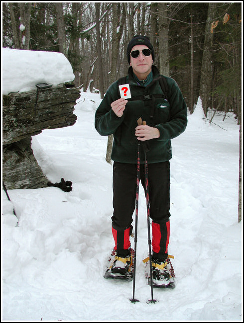
Mine are 9x30 Sherpa “Climbers” with hypalon decking, Lotus binding and adjustable pivot system. The photo above was taken last Winter at "Whitney Copse" cache near Binghamton, NY. There was a fragile crust covering 18-24 inches of snow.
Bear in mind that snowshoes are great for steep terrain but they will not provide the efficiency, convenience, speed and degree of flotation that X-C skis can. And that is especially true in deep powder. I own both and speak from years of experience. I rely on snowshoes whenever I've got a lot of climbing to do, when the trek to a cache is relatively short, and/or when I'm bushwhacking and there is an icy crust over the snow that won't support my weight. Otherwise I'm convinced that waxless X-C skis are nearly the most ideal way to travel in snow country!
Cheers ...
-
{Removed non-humurous commentary.}
-

I've found this setup to work extremely well for creating tracklogs while mountain biking. The Garmin GA27C antenna is attached with Velcro, and the GPS unit goes into my cycling jersey back pocket or in a fanny pack. In addition I installed a safety connection in the cabling so that if (when!) the antenna gets snagged by a branch it all comes apart easily with no damage. As for quad helix v. patch, they both seem to work fairly well in heavy tree cover but I'd have to give the edge to the patch design for maintaining signal lock better due to its overhead reception pattern. The main issue with the quad helix design is keeping the unit in a vertical orientation, especially when walking or riding. A handlebar mount might help, only I don't think I'd want to subject my receiver to the constant shock and jarring of riding rough trails.
The GA27C also comes in really handy when I'm taking benchmark photos with the GPSmap76 positioned flat on the ground next to the mark. Typically three out of four times at high-order horizontal control stations (such as triangulation stations) and with WAAS enabled I record coordinates that are an exact match to a thousandth of a minute with the NGS coordinates.
Cheers ...
-
Why count 'finds' that have no intrinsic value?
Well, because when I can reasonably prove that I've located the station and that the mark is missing or destroyed, my "recovery" does indeed have value. The difference between Found and Not Found is the proof. It relies on the same criteria that NGS requires and therefore they can use it to officially declare the station destroyed. In many cases this does not mean that the station has no value and that it can't be used. Often there is enough left of the setting to be useful to someone! It's just that it no longer meets NGS standards to remain in their database. If the proof is inadequate NGS will record it as Mark Not Found, and so will I.
If you want to get right down to it, of what real value is the GC.com benchmarking Website and benchmark hunting in general?! I'm involved with this activity for the simple reason that I sincerely desire to make a significant contribution to the profession and to the maintenance of a valuable heritage and resource. For me it's certainly a lot more "meaningful" than looking for hidden Tupperware but, of course, each activity has its own merits.
Cheers ...
-
Since it seems to me that the disc was the only representation of exactly where the "station" was, and now it's gone, I can't figure out how the "station" could still be there, or how it could be of any use to a surveyor because I can't find it without the disc.
First of all it's not a theory, let alone "my" theory. It's basic high school geometry. Survey points can be calculated to an extremely high precision and in many cases the figures can be exact. But they are still imaginary points that are referenced to an imaginary representation of the earth. Those points exist whether or not a disk or landmark is there to embody them.
In the case of the example you sited, the error in your logic is that you've assumed that the description is accurate. It may not be, as many of us have learned through experience. And since the coordinates are scaled, you're already missing your best means of locating the station. So, the description is basically all you have to go on. (I was just involved in the recovery of a vertical control on Sunday where the description said 6 feet from the centerline of a highway. Turns out we measured the station to be 16 feet from the centerline. A typo in the database? Probably. But it would have been easy to assume that the station was under asphalt if the mark wasn't actually located nearby.) {One other point in this regard: I think it's important to keep in mind that every situation is a little different. If the mark is buried, of course it's of no use to anyone, including a professional. But, as has been pointed out many times here, a station can still be quite useful even if it's condition would warrant its being declared destroyed by NGS.}
The problem with most vertical controls, it seems, is that horizontal precision is not a real concern, only the vertical distance from the geoid, but not having a reliable horizontal position can certainly make finding them a very real problem. I suppose that's the main reason why NGS will generally not declare them destroyed—lack of adequate proof that the station itself has been identified. Tri-stations, it seems also, are a whole other matter. They include reference marks to help pinpoint the horizontal location with about as much certainty as anyone could expect! If the station mark is missing there's adequate evidence that the station (that imaginary point, remember?) was positively identified. In this case NGS will almost certainly declare the station as destroyed (I have first hand experience with this in more than one instance).
My argument is not about destroying benchmarks per se, but simply trying to get across the concept of having adequate proof that a particular "station" was indeed located and identified. And I contend that for the purposes of GC.com benchmarking (and not NGS reporting!), if a station was adequately identified, and the mark/landmark was discovered to be missing, then you have made a "successful recovery" and it should be logged as "Found—in destroyed condition." Otherwise, as is the case with your mark (possibly being) under the sidewalk, I would simply log it as "Not Found." And the whole idea of this change in approach is to help prevent the indiscriminate reporting of destroyed marks to NGS!!!
Cheers ...

 Cheers ...
Waterboy With Wife Reaches 300!
in Northeast
Posted
Cheers, and happy caching ...