


jbuffethed
-
Posts
171 -
Joined
-
Last visited
Posts posted by jbuffethed
-
-
That is great. I have a Garmin Colorado & and a Nuvi. What do you use for routable maps? I see gpsfiledepot has maps, but they aren't routable.
Hasai (= Howdy! in Okinawan Japanese "Uchinaguchi") jbuffethed!
FREE routable maps for Garmins, try this.
Free maps for Garmin brand GPS devices from OpenStreetMap
Read the site and how tos.
I use it everywhere I've gone to, US & Japan.
If problems using them, give me a PM (Personal Message) from my Profile page.
I probably can help.
Good Luck & Cache On!
Thanks, I had forgotten about that site. I've got the City Navigator on my Colorado and Nuvi for the states, but couldn't find anything CN for Japan. I have downloaded all of Japan from that site. I'll load it up and see how it works.
I found one geocaching group on Facebook, but it's not really active and I cannot post on it. Is there a group on Okinawa? I'm sitting at 848 finds right now. I want to try and time my 1000th for Japan.
-
That is great. I have a Garmin Colorado & and a Nuvi. What do you use for routable maps? I see gpsfiledepot has maps, but they aren't routable.
-
I am moving to Kadena in May-June '14. I do not have any contacts over there that cache. Would love to have a caching buddy too.
Where do you work? I'll be at the 18th CS. You can message me too.
-
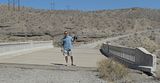
Finally went out backpacking a few weeks ago with 3 other friends. I always bring my 100oz bladder with ice/water from home. I was going to get one of the Kayadyn's, but we found the "Life Straw" at Bass Pro for $20. It's small, light, and filters up to 264gals of water.
-
Foxtrot,
I just got Jelly Bean 4.1.2 leaked to my HTC Rezound. Your latest v0.0.85 works like a champ.
Cool, thanks!
The next release will have some UI updates for JB.

0.0.85 is working on Jellybean 4.2.2
-
Foxtrot,
I just got Jelly Bean 4.1.2 leaked to my HTC Rezound. Your latest v0.0.85 works like a champ.
-
Is BenchMap to a point where you can put it on Google play? It does not need to be perfect or complete, just reasonably functional. You can always update it later.
Many of my apps are getting updates on a regular basis.
Actually, yes. I'm in the process now. I'm waiting on some required graphics and approval of upgrading my google account.
Foxtrot,
I love Benchmap. I've been testing from near the beginning I think when you first asked for testers. I use it all the time when I am out and cant load markings into my gps. I havent experienced any issues running it on my Rezound, Ice Cream Sandwich, on Verizon.
-
This last Friday, we were able to welcome back 4 Tusgkegee Airman to Alabama. They flew into Montgomery and headed out to Moton Air Field. It was their first time since their training during WWII. My family and I were out near Tuskegee Alabama and had to stop. I love visiting history like this.
Three marks are accessible to the public by visiting the museum. Great piece of history. Hanger #2 will be open soon with a real "Red Tail" inside.
-
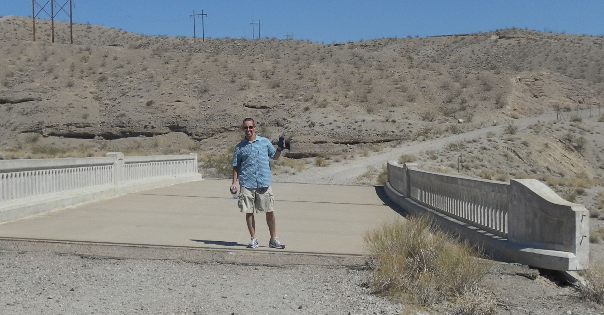
I've seen this bridge many times on this forum. I finally made it out to Vegas all the way from Alabama. I had to make the drive to Hoover Dam and into Arizona. I loved it out there.
-
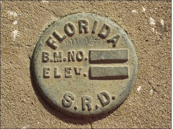
I found a similar mark in Apollo Beach, FL, but it is stamped and is in the database.
Not my photo. I could never find the one I took. Designator HIL 14 B FLDT
-
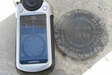
I am running Windows 7 x 64 with Firefox or Chrome pushing to my Colorado 300 without any problems. My GPS shuts off the seconds I remove the USB cable, but that is a Colorado issue.
-
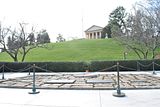
Recent trip to Arlington National Cemetery - HV3621
Designation:
ARLINGTON CEMETERY LEE MANSION
Marker Type:
flagpole
-
haha, That's funny.
-
I usually load both. If I am out and about and I am near one or the other, I will search for it.
-
Or if you cant help the bug/coin along, you can at least discover it. It will show in your history of trackables as it would had you actually moved it.
-
I am headed to DC after this deployment, it would be awesome to find one of these. Hoping for Numero Uno.
-
I do not have a Mac, but this is what I use to get benchmarks to my Colorado on the PC. I think I had the same issue with POI loader. Hope this helps.
Click on the state and select the county: http://www.holoscene...ds_archive.html
You will download a ".dat" file.
Download NGS->GPX http://ngs.tsqmadnes...GPX-210b317.exe
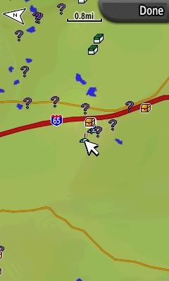
It will convert to a usable gpx file. It gives you all the full description and all. I just drag the new gpx file into my gpx folder. All location adjusted show as a gold treasurebox, location scaled shows as a "?" You get the full description as you would a cache. I use this all the time and works like a champ.
Green Box - Regular Cache
Gold Box - Adjusted Benchmark
? - Scaled Benchmark
Little antenna near cursor - towers/radio antennas
-
I dont use GSAK to load benchmarks, but this is how I load them directly into my Colorado 300.
Click on the state and select the county: http://www.holoscenes.com/special/geocac/ds_archive.html
You will download a ".dat" file.
Download NGS->GPX http://ngs.tsqmadness.com/ngsgpx/release/NGSGPX-210b317.exe
It will convert to a usable gpx file. All location adjusted show as a gold treasurebox, location scaled shows as a "?" You get the full description as you would a cache. I use this all the time and works like a champ.
I found a pic of how the above instructions show on my Garmin Colorado.
Green Box - Regular Cache
Gold Box - Adjusted Benchmark
? - Scaled Benchmark
Little antenna near cursor - towers/radio antennas

-
I dont use GSAK to load benchmarks, but this is how I load them directly into my Colorado 300.
Click on the state and select the county: http://www.holoscenes.com/special/geocac/ds_archive.html
You will download a ".dat" file.
Download NGS->GPX http://ngs.tsqmadness.com/ngsgpx/release/NGSGPX-210b317.exe
It will convert to a usable gpx file. All location adjusted show as a gold treasurebox, location scaled shows as a "?" You get the full description as you would a cache. I use this all the time and works like a champ.
-
If you did actually find the cache, you have to mark it as found separately from a "needs maintenance".
-
I like getting out and about to places I normally wouldn't go.
-
I'm not a big NASCAR fan, but that car looks awesome. You did a great job.
-
Hey Tuck, check out www.gpsfiledepot.com for free topo maps. They work great, but are not routable.
-
Because I am one day closer to the end of this deployment and one day closer to seeing my wife and kids.


Aloha Thread ( Hawaiian Islands )
in West and Southwest
Posted
Yoda, were you able to get your cache? I'm still stationed here for another 9 months. I might be able to head out that way and check it out.